Pennsville in Pennsville Township in Salem County, New Jersey — The American Northeast (Mid-Atlantic)
Finn's Point National Cemetery
Photographed by Devry Becker Jones (CC0), September 20, 2026
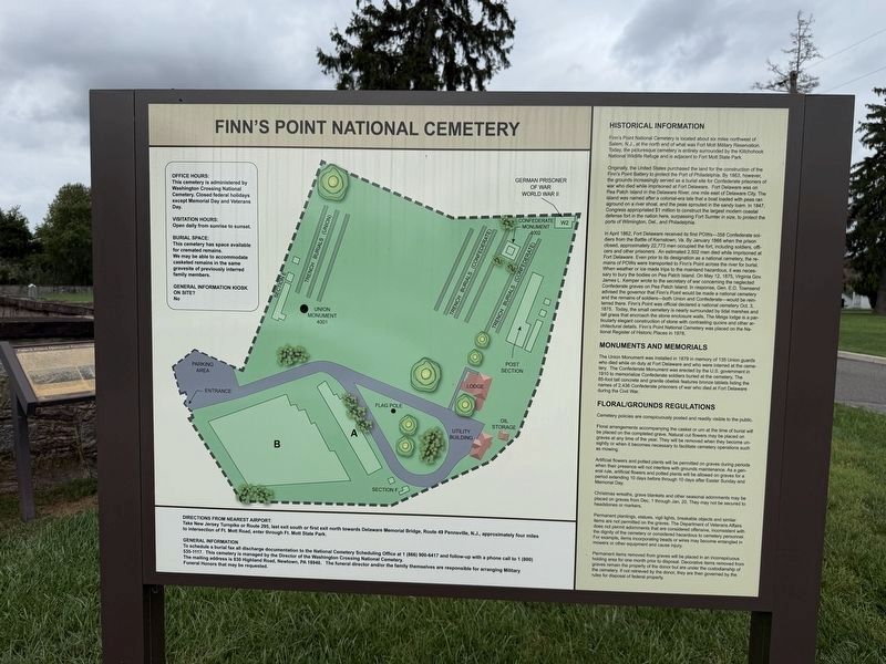
1. Finn's Point National Cemetery Marker
Historical Information
Finn's Point National Cemetery is located about six miles northwest of Salem, N.J., at the north end of what was Fort Mott Military Reservation. Today, the picturesque cemetery is entirely surrounded by the Killchohook National Wildlife Refuge and is adjacent to Fort Mott State Park.
Originally, the United States purchased the land for the construction of the Finn's Point Battery to protect the Port of Philadelphia. by 1863, however, the grounds increasingly served as a burial site for Confederate prisoners of war who died while imprisoned at Fort Delaware. Fort Delaware was on Pea Patch Island in the Delaware River, one mile east of Delaware City. The island was named after a colonial-era tale that a boat loaded with peas ran aground on a river shoal, and the peas sprouted in the sandy loam. In 1847, Congress appropriated $1 million to construct the largest modern coastal defense fort in the nation here, surpassing Fort Sumter in size, to protect the ports of Wilmington, Del., and Philadelphia.
In April 1862, Fort Delaware received its first POWs—358 Confederate soldiers from the Battle
this page online
Photographed by Devry Becker Jones (CC0), September 20, 2026
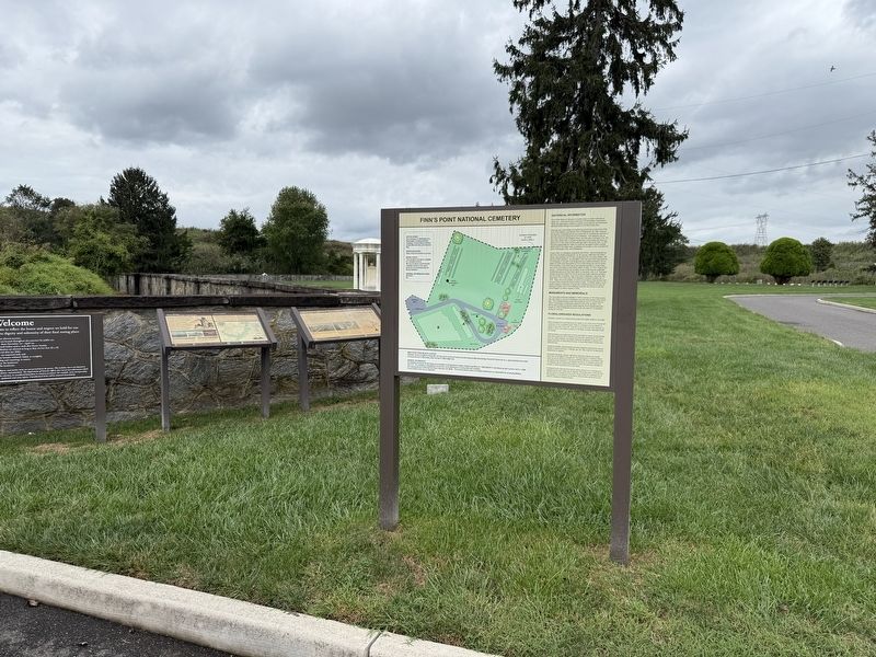
2. Finn's Point National Cemetery Marker
Monuments and Memorials
The Union Monument was installed in 1879 in memory of 1835 Union guards who died while on duty at Fort Delaware and who were interred at the cemetery. The Confederate Monument was erected by the U.S. government in 1910 to memorialize Confederate soldiers buried at the cemetery. The 85-foot tall concrete and granite obelisk features bronze tablets listing the names of 2,436 Confederate prisoners of war who died at Fort Delaware during the Civil War.
Topics and series. This historical marker is listed in these topic lists: Cemeteries & Burial Sites • Forts and Castles • War, US Civil. In addition, it is included in the National Cemeteries series list. A significant historical month for this entry is January 1866.
Location. 39° 36.633′ N, 75° 33.328′ W. Marker is in Pennsville Township, New Jersey, in Salem County. It is in Pennsville. It is on Cemetery Road 0.7 miles north of Fort Mott Road, on the left when traveling north. Touch for map. Marker is at or near this postal address: 456 Fort Mott Rd, Pennsville NJ 08070, United States of America. Touch for directions.

Regionally, this marker is in Greater Wilmington, in South Jersey, and in Greater Philadelphia. It is also in the American Northeast, in the Mid-Atlantic, and on the Eastern Seaboard. Globally, it is in the North Atlantic Region, North America, the Western Hemisphere, the Western World, and the Anglosphere. Historically, it finds itself in what was once New Netherland and also one of the original Thirteen Colonies.
Other nearby markers. At least 8 other markers are within walking distance of this marker: New Jersey Coastal Heritage Trail Route (here, next to this marker); a different marker also named Finn’s Point National Cemetery (here, next to this marker); Union Monument (within shouting distance of this marker); a different marker also named Finn’s Point National Cemetery (within shouting distance of this marker); Veterans Memorial (within shouting distance of this marker); Confederate Burials in the National Cemetery (about 300 feet away, measured in a direct line); Medal of Honor Tree Memorial (about 300 feet away); a different marker also named Finn's Point National Cemetery (about 300 feet away). Touch for a list and map of all markers in Pennsville Township.
Credits. This page was last revised on October 9, 2026. It was originally submitted on October 4, 2026, by Devry Becker Jones of Washington, District of Columbia. This page has been viewed 5 times since then. Photos: 1, 2. submitted on October 4, 2026, by Devry Becker Jones of Washington, District of Columbia.
