Hudson Yards in Manhattan in New York County, New York — The American Northeast (Mid-Atlantic)
Freight Rail on Manhattan’s West Side
| — | High Line | — |
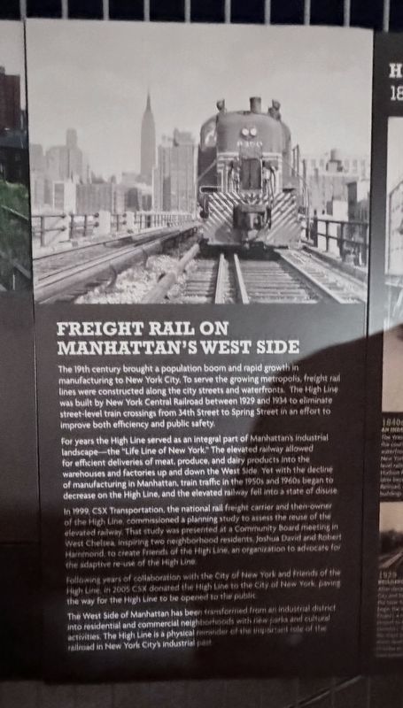
Photographed by Trudi Jacobson, September 30, 2026
1. Freight Rail on Manhattan’s West Side Marker
The 19th century brought a population boom and rapid growth in manufacturing to New York City. To serve the growing metropolis, freight rail lines were constructed along the city streets and waterfronts. The High Line was built by New York Central Railroad between 1929 and 1934 to eliminate street-level train crossings from 34th Street to Spring Street in an effort to improve both efficiency and public safety.
For years the High Line served as an integral part of Manhattan’s industrial landscape—the “Life Line of New York.” The elevated railway allowed for efficient deliveries of meat, produce, and dairy products into the warehouses and factories up and down the West Side. Yet with the decline of manufacturing in Manhattan, train traffic in the 1950s and 1960s began to decrease on the High Line, and the elevated railway fell into a state of disuse.
In 1999, CSX Transportation, the national rail freight carrier and then-owner of the High Line, commissioned a planning study to assess the reuse of the elevated railway. That study was presented at a Community Board meeting in West Chelsea, inspiring two neighborhood residents, Joshua David and Robert Hammond, to create Friends of the High Line, an organization to advocate for the adaptive re-use of the High Line.
Following years of collaboration with the City of New York and Friends of the High Line, in 2005 CSX donated the High Line to the City of New York, paving the way for the High Line to be opened to the public.
The West Side of Manhattan has been transformed from an industrial district into residential and commercial neighborhoods with new parks and cultural activities. The High Line is a physical reminder of the important role of the railroad in New York City’s industrial past.
Topics. This historical marker is listed in these topic lists:
this page online
Location. 40° 45.234′ N, 74° 0.228′ W. Marker is in Manhattan, New York, in New York County. It is in Hudson Yards. It can be reached from West 30th Street just west of 11th Avenue, on the left when traveling east. Touch for map. Marker is at or near this postal address: 605 W 30th Street, New York NY 10001, United States of America. Touch for directions.

Regionally, this marker is in New York City. It is also in the American Northeast, in the Mid-Atlantic, and on the Eastern Seaboard. Globally, it is in the North Atlantic Region, North America, the Western Hemisphere, the Western World, and the Anglosphere. Historically, it finds itself in what was once New Netherland and also one of the original Thirteen Colonies.
Other nearby markers. At least 8 other markers are within walking distance of this marker: Self-seeded & unfinished (within shouting distance of this marker); High Line 1840 - Today (within shouting distance of this marker); Interim Walkway (within shouting distance of this marker);
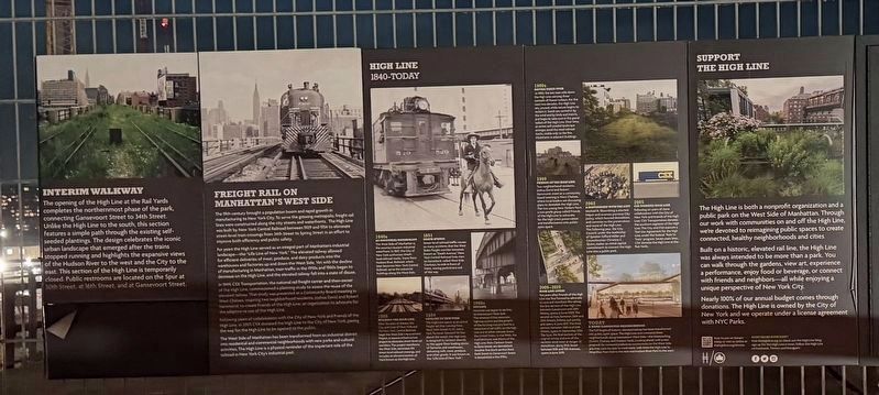
Photographed by Trudi Jacobson, September 30, 2026
2. Freight Rail on Manhattan’s West Side Marker
More about this marker. Located on the elevated High Line above W 30th Street.
Related markers. Click here for a list of markers that are related to this marker.
Also see . . .
1. Friends of the High Line.
The High Line is a public park on the West Side of Manhattan operated, maintained, and funded by the nonprofit conservancy Friends of the High Line. Through our work with communities on and off the High Line, Friends of the High Line is devoted to reimagining public spaces to create connected, healthy neighborhoods, and cities.(Submitted on October 18, 2026, by Michael Herrick of Southbury, Connecticut.)
2. High Line (Wikipedia). (Submitted on October 18, 2026, by Michael Herrick of Southbury, Connecticut.)
Credits. This page was last revised on October 18, 2026. It was originally submitted on October 5, 2026, by Trudi Jacobson of Slingerlands, New York. This page has been viewed 12 times since then. Photos: 1, 2. submitted on October 5, 2026, by Trudi Jacobson of Slingerlands, New York. • Michael Herrick was the editor who published this page.
