Custer in Custer County, South Dakota — The American Midwest (Upper Plains)
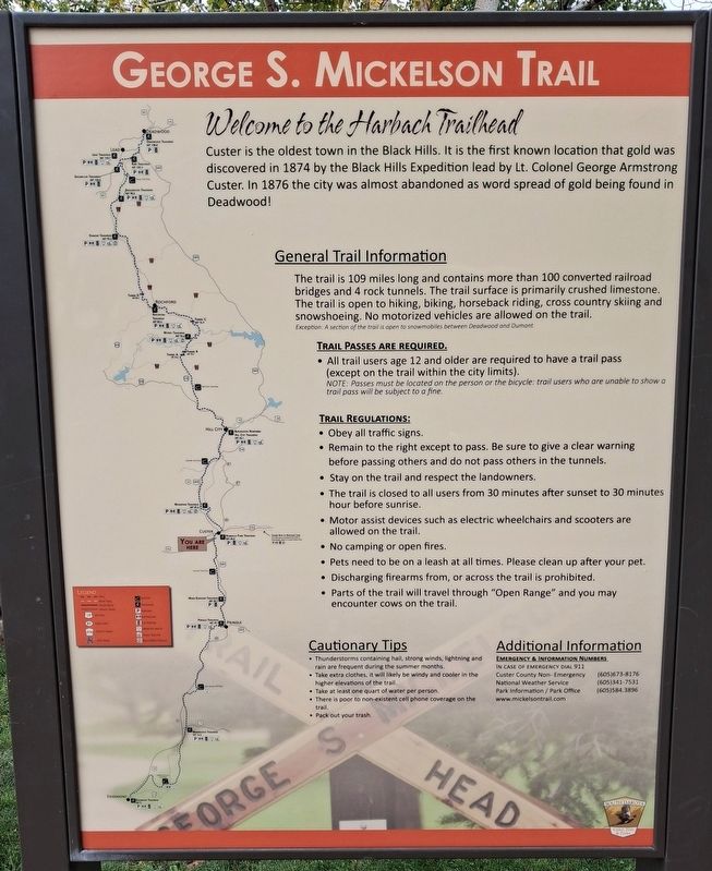
Welcome to the Harbach Trailhead
George S. Mickelson Trail
Photographed by William Fischer, Jr., September 22, 2026
1. Welcome to the Harbach Trailhead Marker
Custer is the oldest town in the Black Hills. It is the first known location that gold was discovered in 1874 by the Black Hills Expedition lead by Lt. Colonel George Armstrong Custer. In 1876 the city was almost abandoned as word spread of gold being found in Deadwood!
[Balance of marker is General Trail Information and not transcribed]
Erected by South Dakota Game, Fish & Parks.
Topics. This historical marker is listed in these topic lists: Environment • Exploration • Immigration • Settlements & Settlers. A significant historical year for this entry is 1874.
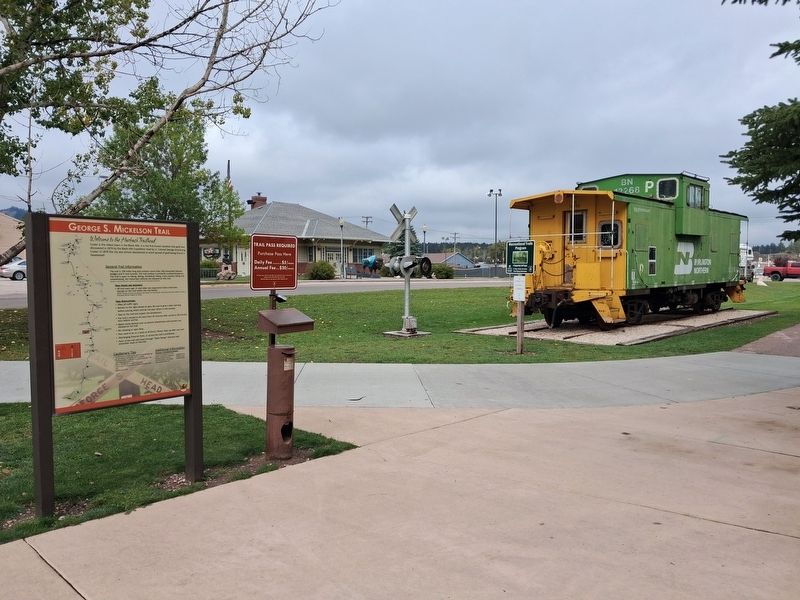
Location. 43° 45.927′ N, 103° 35.874′ W. Marker is in Custer, South Dakota, in Custer County. It is at the intersection of 6th Street and Washington Street, on the right when traveling north on 6th Street. Marker is in Harbach Centennial Park, near the Caboose. Touch for map. Marker is in this post office area: Custer SD 57730, United States of America. Touch for directions.

Regionally, this marker is in West River and in Greater Rapid City. It is also in the American Black Hills, in the Lewis & Clark Corridor, on the prairies, and on the
this page online
Other nearby markers. At least 8 other markers are within walking distance of this marker: General George A. Custer (within shouting distance of this marker); Big Rock Park & Pageant Hill (within shouting distance of this marker); Chief Sitting Bull (about 300 feet away, measured in a direct line); George Armstrong Custer (about 300 feet away); a different marker also named Big Rock Park & Pageant Hill (about 300 feet away); First National Bank of Dakota Territory (about 400 feet away); Custer Veterans Memorial (about 500 feet away); L. Cpl. Cody Glenn Engen (about 500 feet away). Touch for a list and map of all markers in Custer.
Photographed by William Fischer, Jr., September 22, 2026
2. Welcome to the Harbach Trailhead Marker
Credits. This page was last revised on October 5, 2026. It was originally submitted on October 5, 2026, by William Fischer, Jr. of Reynoldsburg, Ohio. This page has been viewed 4 times since then. Photos: 1, 2. submitted on October 5, 2026, by William Fischer, Jr. of Reynoldsburg, Ohio.
