North Springfield in Fairfax County, Virginia — The American South (Mid-Atlantic)
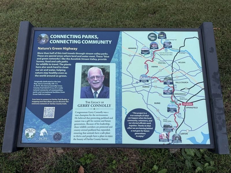
Connecting Parks, Connecting Community
| — | 🏞️ | — |
Photographed by Devry Becker Jones (CC0), October 1, 2026
1. Connecting Parks, Connecting Community Marker
Nature's Green Highway
More than half of this trail travels through stream valley parks. These are special areas where land and water meet. These "blue and green networks," like the Accotink Stream Valley, provide homes, food and safe paths for wildlife to travel. The plants here also work hard to clean out air and water, helping nature stay healthy even as the world around us grows.
Originally dedicated to the late Rep. Gerry Connolly Cross Country Trail (GCCCT) is a 41.5-mile natural connector of communities, park and recreational facilities from Great Falls to Lorton.
The Legacy of Gerry Connolly
Congressman Gerry Connolly was a true champion for the environment. He believed that protecting parkland and nature was a gift for current and future generations. Because of his leadership, these wildlife corridors are protected and county-owned parkland has expanded, ensuring that animals have a safe place to thrive and people have a place to enjoy the beauty of Fairfax County forever.
"This project is a true example of what can happen when the local community, volunteers, and our elected officials work together. Thanks to that effort we are leaving behind a real gem for future generations to enjoy."
Erected by Fairfax
this page online
Topics. This historical marker is listed in these topic lists: Government & Politics • Natural Resources • Parks & Recreational Areas • Roads & Vehicles.
Location. 38° 47.582′ N, 77° 13.071′ W. Marker is in North Springfield, Virginia, in Fairfax County. It is on Accotink Park Road 0.7 miles south of Southern Drive, on the left when traveling north. Touch for map. Marker is at or near this postal address: 7500 Lake Accotink Acc Rd, Springfield VA 22151, United States of America. Touch for directions.

Regionally, this marker is in the Washington Metropolitan Area and in Northern Virginia. It is also in the American South, specifically in the Upper South, in the Mid-Atlantic, and on the Eastern Seaboard. Globally, it is in the North Atlantic Region, North America, the Western Hemisphere, the Western World, and the Anglosphere. Historically, it finds itself in what was once the territory of the Mississippian Culture, one of the original Thirteen Colonies, one of the Confederate
Photographed by Devry Becker Jones (CC0), October 1, 2026
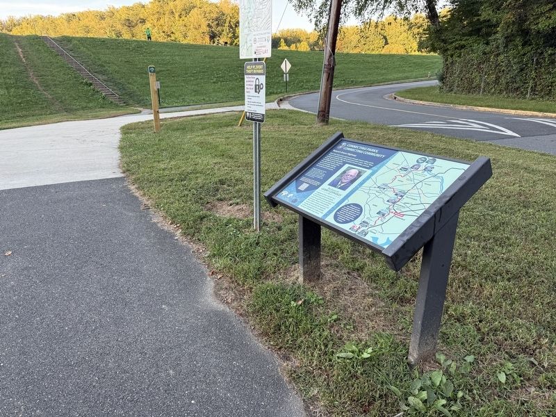
2. Connecting Parks, Connecting Community Marker
Other nearby markers. At least 8 other markers are within 2 miles of this marker, measured as the crow flies: Orange and Alexandria Railroad (within shouting distance of this marker); The Orange And Alexandria Railroad Trestle (within shouting distance of this marker); The Civilian Conservation Corps (approx. 0.4 miles away); a different marker also named Orange and Alexandria Railroad (approx. 0.7 miles away); Ravensworth (approx. 1.1 miles away); a different marker also named Ravensworth (approx. 1.2 miles away); Estate Inventory of 16 Enslaved, December 20, 1856 (approx. 1.2 miles away); Soldiers Memorial at Howrey Field Park (approx. 1½ miles away). Touch for a list and map of all markers in North Springfield.
Other markers no longer nearby. Connecting Communities and Parks (was here, next to this marker but has been replaced with another marker now near it); The Origins of Lake Accotink (was a few steps from this marker but has been confirmed missing); Orange and Alexandria RR (was within shouting distance of this marker but has been permanently removed).
Credits. This page was last revised on October 6, 2026. It was originally submitted on October 6, 2026, by Devry Becker Jones of Washington, District of Columbia. This page has been viewed 5 times since then. Photos: 1, 2. submitted on October 6, 2026, by Devry Becker Jones of Washington, District of Columbia.
