Rapid City in Pennington County, South Dakota — The American Midwest (Upper Plains)
The Great Race/Black Hills Geology
Photographed by William Fischer, Jr., September 20, 2026
1. The Great Race/Black Hills Geology Marker
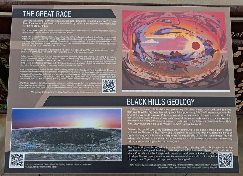
THE GREAT RACE
Lakotans explain the Red Valley circumnavigating the Black Hills through the story of The Great Race. There are multiple versions of the race told by Lakotans and many other similar stories by citizens of other tribes.
The following is excerpted from James LaPoint's account as told in "The Great Race," an exhibit and materials created by the Center for American Indian Research and Native Studies.
At one time there were no Black Hills as we see them now. Only a vast prairie land existed, and upon it there roamed huge animals. There were flying vultures that preyed on the land animals. There were insects as big as eagles, with long sharp stingers that paralyzed and killed. Since all sorts of animals appeared from every comer of the earth to take part in the race, heralders, in a common language, kept the newcomers informed of the rules. One rule established that once the race began, there was to be no stopping.
And then the fateful day arrived. A voice shouted: "Hokane! Your fate is at hand! The race was on. Instantly a mass of animals was on the move. The earth trembled under the impact of the stomping
this page online
Before the sun had set that first day, there were already groans of agony The squeals and wailing of the weaker animals filled the air. They were trampled and crushed under the heavy hooves of the giant animals. The damp earth lost its moisture under the constant beating of hooves. Pulverized dust rose skyward, choking and obliterating the flying hordes of birds above, as they circled with the animal racers down below. High above, a bird would screech and then fall to the ground, a victim of weariness, or of some accident in the air.
After many days of the race the endless stream of racing animals moved madly on. Then, to and behold! The path of the racers sank crazily under their combined weight. Within the circle of racing animals a bulge appeared, strangely rising out of the ground. At first it was only a small mound: But suddenly, the earth quivered and groaned like a huge animal in pain. The mound rose faster and faster, and higher and higher. Then, with a thunderous roar, it burst open. Flames and dense smoke rose skyward, carrying fire and debris. Rock and ashes pelted the racers.
After the air had cleared and there
Photographed by William Fischer, Jr., September 20, 2026
2. The Great Race/Black Hills Geology Marker
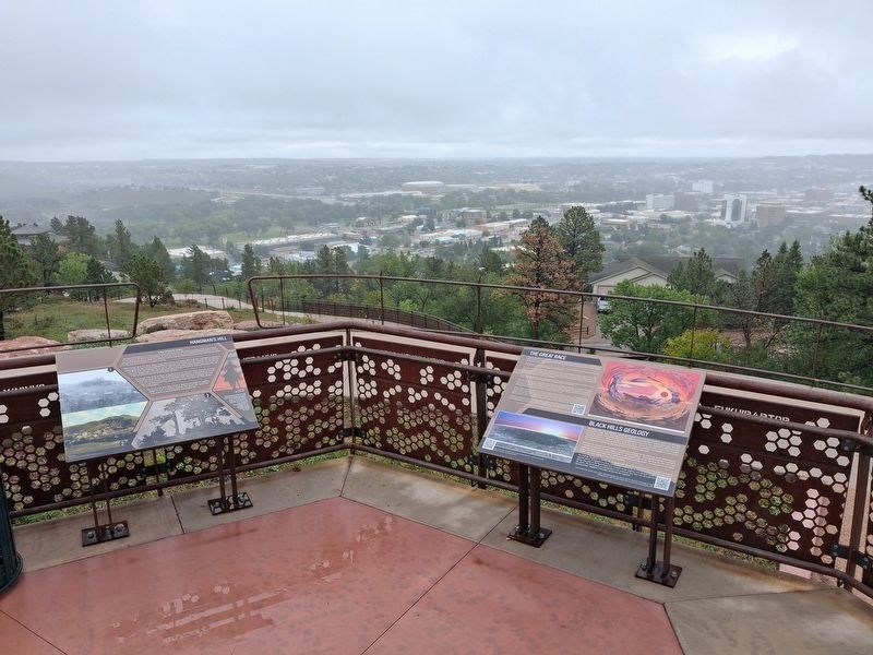
Right marker. Looking ENE into downtown Rapid City
This is only a brief excerpt of the story, Read the rest at the link by scanning this code:[QR Code]
[Painting] The Great Race #6 by Richard Red Owl here courtesy of the artist and Frances Davidson and Family.
BLACK HILLS GEOLOGY
The Black Hills are an elliptical dome approximately 125 miles from north to south, and 65 miles from east to west. They were formed by an uplift approximately 65-70 million years ago, near the time of the sudden Cretaceous-Paleogene global extinction event that caused the extinction of all non-avian dinosaurs. Millions of years of erosion of the various sedimentary layers have revealed the Precambrian core of the granitic intrusion visible today in the Hills at the Needles in Custer State Park, Crazy Horse Memorial, and Mount Rushmore National Memorial.
Between the central core of the Black Hills and the surrounding flat plains are three distinct zones: a Limestone Plateau, the Red Valley, and the Dakota Hogback. The limestone plateau is home to Spearfish Canyon and is wider and higher on the western side of the hills than the east. The Red Valley circles the Black Hills and is nearly two miles across at its widest. You can see it in the valley below. You are standing on the Dakota Hogback.
The Dakota Hogback is defined by its steep cliffs facing the valley and the long slopes stretching into the plains. A hogback is a long, narrow ridge created by the erosion of outcropping sedimentary strata. One side is the back-slope and consists of the sloping rock stratum called a dip slope. The front-slope or escarpment is an erosional face that cuts through that dipping strata. Together, that ridge comprises the hogback.
If this makes you curious about rocks and paleontology you should visit the Museum of Geology at South Dakota Mines - just 2.5 miles away! Find out more by scanning this code: [QR Code]
[Uncaptioned low earth orbital photo of the Black Hills]
Learn more about the Black Hills at The Journey Museum-just 2.2 miles away! Find out more by scanning this code: [QR Code]
Erected by City of Rapid City.
Topics. This historical marker is listed in these topic lists: Environment • Indigenous Peoples and Communities • Paleontology.
Location. 44° 4.705′ N, 103° 14.753′ W. Marker is in Rapid City, South Dakota, in Pennington County. Marker is in Dinosaur Park, along the walking path. Touch for map. Marker is at or near this postal address: 940 Skyline Drive, Rapid City SD 57701, United States of America. Touch for directions.

Regionally, this marker is in West River and in the Badlands. It is also in the American Black Hills, in the Lewis & Clark Corridor, on the prairies, and on the Northern Plains. Globally, it is in North America, the Western Hemisphere, the Western World, and the Anglosphere. Historically, it finds itself in what was once Rupert’s Land and also the Louisiana Purchase.
Other nearby markers. At least 8 other markers are within walking distance of this marker: Hangman's Hill (here, next to this marker); Local Lakota: Osh Kosh Camp (a few steps from this marker); Triceratops (a few steps from this marker); Tyrannosaurus Rex (a few steps from this marker); The Inconvenient Truth (a few steps from this marker); Apatosaurus (within shouting distance of this marker); Trachodon (within shouting distance of this marker); Stegosaurus (within shouting distance of this marker). Touch for a list and map of all markers in Rapid City.
Credits. This page was last revised on October 10, 2026. It was originally submitted on October 10, 2026, by William Fischer, Jr. of Reynoldsburg, Ohio. This page has been viewed 5 times since then. Photos: 1, 2. submitted on October 10, 2026, by William Fischer, Jr. of Reynoldsburg, Ohio.
