Golden in Columbia-Shuswap, British Columbia — Canada’s West Coast (North America)
Rivers & Railways
The Rotary Loop
| — | Golden Pathways & Other Destinations | — |
Photographed by Cosmos Mariner, July 3, 2022
1. Rivers & Railways Marker
Rivers
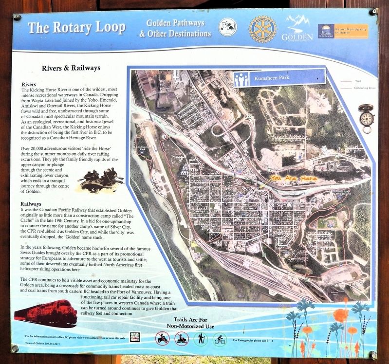
The Kicking Horse River is one of the wildest, most intense recreational waterways in Canada. Dropping from Wapta Lake and joined by the Yoho, Emerald, Amiskwi and Ottertail Rivers, the Kicking Horse flows wild and free, unobstructed through some of Canada's most spectacular mountain terrain. As an ecological, recreational, and historical jewel of the Canadian West, the Kicking Horse enjoys the distinction of being the first river in B.C. to be recognized as a Canadian Heritage River.
Over 20,000 adventurous visitors ‘ride the Horse’ during the summer months on daily river rafting excursions. They ply the family friendly rapids of the upper canyon or plunge through the scenic and exhilarating lower canyon, which ends in a tranquil journey through the centre of Golden.
Railways
It was the Canadian Pacific Railway that established Golden originally as little more than a construction camp called “The Cache” in the late 19th Century. In a bid for one-upmanship to counter the name for another camp's name of Silver City, the CPR re-dubbed it as Golden City, and while the ‘city’ was eventually dropped, the ‘Golden’ name stuck.
this page online
In the years following, Golden became home for several of the famous Swiss Guides brought over by the CPR as a part of its promotional strategy for Europeans to adventure to the west as tourists and settle; some of their descendants eventually birthed North Americas first helicopter skiing operations here.
The CPR continues to be a visible asset and economic mainstay for the Golden area, being a crossroads for commodity trains headed coast to coast and coal trains from south eastern BC headed to the Port of Vancouver. Having a functioning rail car repair facility and being one of the few places in western Canada where a train can be turned around continues to give Golden that railway feel and connection.
Erected by Town of Golden, Rotary International and British Columbia Resort Municipality Initiative.
Topics. This historical marker is listed in these topic lists: Parks & Recreational Areas • Railroads & Streetcars • Settlements & Settlers • Waterways & Vessels.
Location. 51° 17.887′ N, 116° 57.819′ W. Marker is in Golden, British Columbia, in Columbia-Shuswap.
Photographed by Cosmos Mariner, July 3, 2022
2. Rivers & Railways Marker
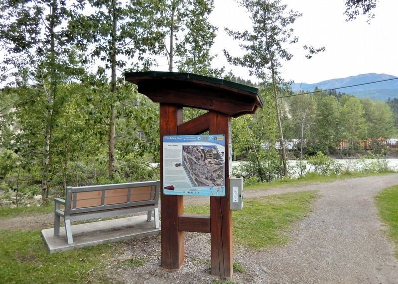
Looking east through Kumsheen Park from 10th Avenue South. The Rotary Trail and Kicking Horse River are in the background.

Regionally, this marker is in the BC Interior and in Thompson-Okanagan. Globally, it is in North America, in the Rocky Mountains, on the Ring of Fire, on the Pacific Rim, in the Western Hemisphere, in the Western World, and in the Anglosphere. Historically, it finds itself in what was once a British colony.
Other nearby markers. At least 8 other markers are within walking distance of this marker: War Memorial (within shouting distance of this marker); History of Mountain Tourism in Golden (within shouting distance of this marker); Skiing: resort, backcountry & heli-skiing (about 210 meters away, measured in a direct line); A Brief History of Covered Bridges (approx. 0.4 kilometers away); The Kicking Horse Pedestrian Bridge Story (approx. 0.4 kilometers away); Dig For Victory (approx. 0.7 kilometers away); Horse Drawn Hay Tedder (approx. 0.7 kilometers away); Riverboat Tales (approx. 0.7 kilometers away). Touch for a list and map of all markers in Golden.
Also see . . . Golden, BC - Where Rivers meet and history lives (Golden BC Museum).
Excerpt: Golden sits where the Columbia and Kicking Horse Rivers meet — a crossroads that shaped its destiny. In the early 1880s, surveyors for the Canadian Pacific Railway (CPR) established a camp here while charting a route through the rugged Rocky Mountain Trench. By 1885, the CPR line was complete, and Golden became a vital stop for trains crossing the mountains. The railway brought settlers, supplies, and opportunity. The Golden CPR Station, built in 1904, became the town’s hub — a place where families greeted loved ones, goods arrived from distant cities, and the rhythm of the trains defined daily life.(Submitted on October 10, 2026, by Cosmos Mariner of Cape Canaveral, Florida.)
Golden’s story is one of diversity. In 1905, Sikh workers who helped build the railway established North America’s first gurdwara, marking an enduring legacy of faith and community. Around the same time, Swiss mountain guides arrived to lead climbers into the Selkirks and Rockies. Their alpine homes in Edelweiss Village remain a cherished landmark and a symbol of Golden’s connection to mountaineering history.
Forestry, river transport, and mining shaped Golden’s growth through the early 20th century. The Columbia River carried logs to mills, while the surrounding mountains provided timber and minerals. Despite floods, fires, and economic shifts, the town endured — its people known for hard work and hospitality.
By the late 1900s, Golden had evolved from a railway town into a thriving mountain community. The CPR Station, saved from demolition and relocated near the museum, stands as a testament to local determination. Today, Golden blends history and adventure — a place where visitors can explore heritage sites, hike alpine trails, and experience the same spirit of discovery that built the town.
Credits. This page was last revised on October 10, 2026. It was originally submitted on October 10, 2026, by Cosmos Mariner of Cape Canaveral, Florida. This page has been viewed 11 times since then. Photos: 1, 2. submitted on October 10, 2026, by Cosmos Mariner of Cape Canaveral, Florida.
