Near Keystone in Pennington County, South Dakota — The American Midwest (Upper Plains)
Wilderness
| — | Black Hills National Forest | — |
Photographed by David Rozzelle, September 16, 2026
1. Wilderness Marker
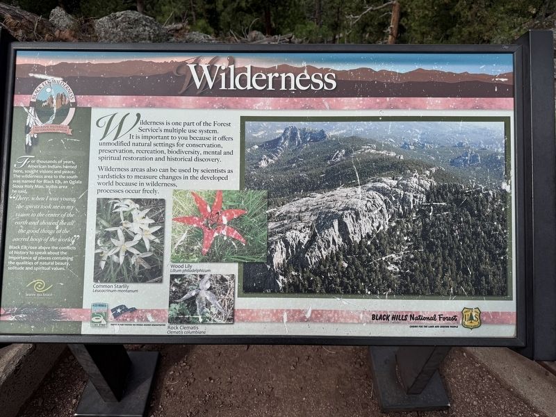
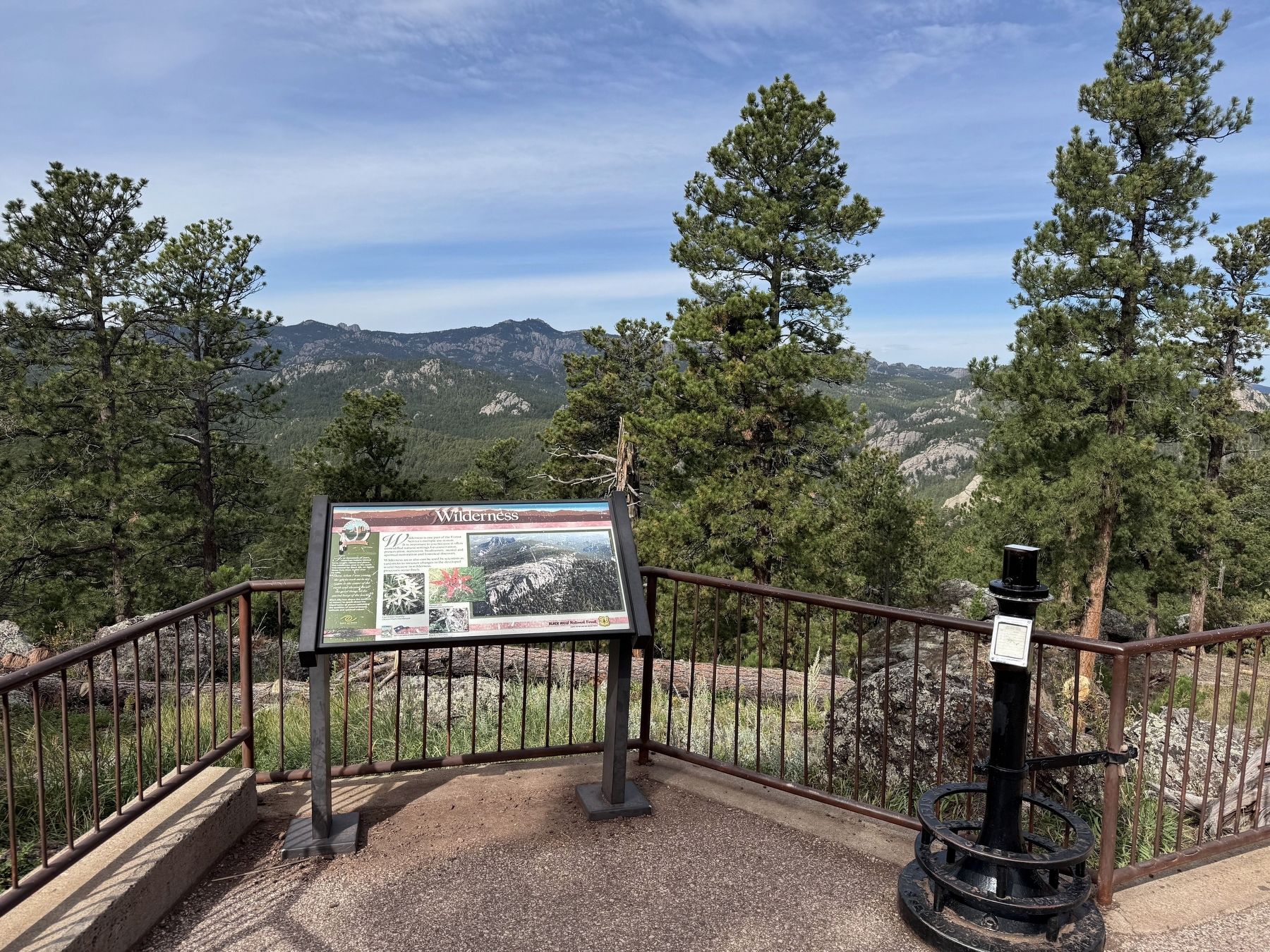
Wilderness
For thousands of years, American Indians hunted here, sought visions and peace. The wilderness area to the south was named for Black Elk, an Oglala Sioux Holy Man. In this area he said,
"There when I was young the spirits took me in my vision to the center of the earth and showed me all the good things in the sacred hoop of the world"Black Elk rose above the conflicts of history to speak about the importance of places containing the qualities of natural beauty, solitude and spiritual values.
Wilderness is one part of the Forest Service's multiple use system. It is important to you because it offers unmodified natural settings for conservation, preservation, recreation, biodiversity, mental and spiritual restoration and historical discovery.
Wilderness areas also can be used by scientists as yardsticks to measure changes in the developed world because in wilderness, processes occur freely.
Erected by U.S. Forest Service, Department of Agriculture.
Topics. This historical marker is listed in these topic lists: Indigenous Peoples and Communities • Parks & Recreational Areas.
Location. 43° 51.463′ N,
this page online

Regionally, this marker is in West River, in the Badlands, and in Greater Rapid City. It is also in the American Black Hills, in the Lewis & Clark Corridor, on the prairies, and on the Northern Plains. Globally, it is in North America, the Western Hemisphere, the Western World, and the Anglosphere. Historically, it finds itself in what was once Rupert’s Land and also the Louisiana Purchase.
Other nearby markers. At least 8 other markers are within 2 miles of this marker, measured as the crow flies: Peter Norbeck (about 300 feet away, measured in a direct line); The Father of Mount Rushmore (approx. 0.7 miles away); The Pigtail Bridges (approx. 0.8 miles away); Significant Black Hills Native American Sites (approx. 1.6 miles away); Traditional Ecological Knowledge (approx. 1.6 miles away); Ancient Stone Circles (approx. 1.6 miles away); Celestial and Earthly Locations
Photographed by David Rozzelle, September 16, 2026
2. Wilderness Marker
Credits. This page was last revised on October 14, 2026. It was originally submitted on October 11, 2026, by David Rozzelle of Knoxville, Tennessee. This page has been viewed 12 times since then. Photos: 1, 2. submitted on October 11, 2026, by David Rozzelle of Knoxville, Tennessee. • Andrew Ruppenstein was the editor who published this page.
