La Junta in Otero County, Colorado — The American Mountains (Southwest)
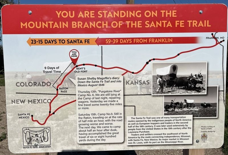
You are Standing on the Mountain Branch of the Santa Fe Trail
Photographed by Leslie Eudy, October 5, 2026
1. You are Standing on the Mountain Branch of the Santa Fe Trail Marker
Susan Shelby Magoffin’s diary: Down the Santa Fe Trail and into Mexico August 1846
Thursday 13th. “Purgatoire River” Camp No. 6. We are still lying at the Camp as of last night, repairing wagons. Yesterday we made a fine travel some twenty-five miles or more.
Saturday 15th. Camp No. 9. Still in the Raton, traveling on at the rate of half mile an hour, with the road growing worse and worse.
The next day. We came to camp about half an hour after dusk, having accomplished the great travel of six or eight hundred yards during the day.
The Santa Fe Trail was one of many transportation routes opened by the indigenous people of North America as well as European trappers and traders in the second half of the 18th century. It was later used extensively by people from the United States in the 19th century after the Louisiana Purchase.
Traders and settlers crossed the southwest of North America by the route connecting Independence, Missouri, with Santa Fe, New Mexico. Its major market in Missouri was St. Louis, with its port on the Mississippi River.
Erected by Bent’s
this page online
Topics. This historical marker is listed in these topic lists: Indigenous Peoples and Communities • Roads & Vehicles.
Location. 37° 59.237′ N, 103° 33.219′ W. Marker is in La Junta, Colorado, in Otero County. It is on West 3rd Street. Barnes Avenue, south of W First Street, in the parking lot next to the AT&SF 1024 locomotive. Touch for map. Marker is in this post office area: La Junta CO 81050, United States of America. Touch for directions.

Regionally, this marker is in the Arkansas River Valley and in the Eastern Plains. It is also in the American Mountain West, on the Great Plains, on the Southern Plains, on the High Plains, and on the Santa Fe Trail Corridor. Globally, it is in North America, the Western Hemisphere, the Western World, and the Anglosphere. Historically, it finds itself in what was once the Comanchería, the Dust Bowl, and the Republic of Texas.
Other nearby markers. At least 8 other markers are within 8 miles of this marker, measured as the crow flies: Bent's Old Fort along the Santa Fe Trail (here,
Photographed by Leslie Eudy, October 5, 2026
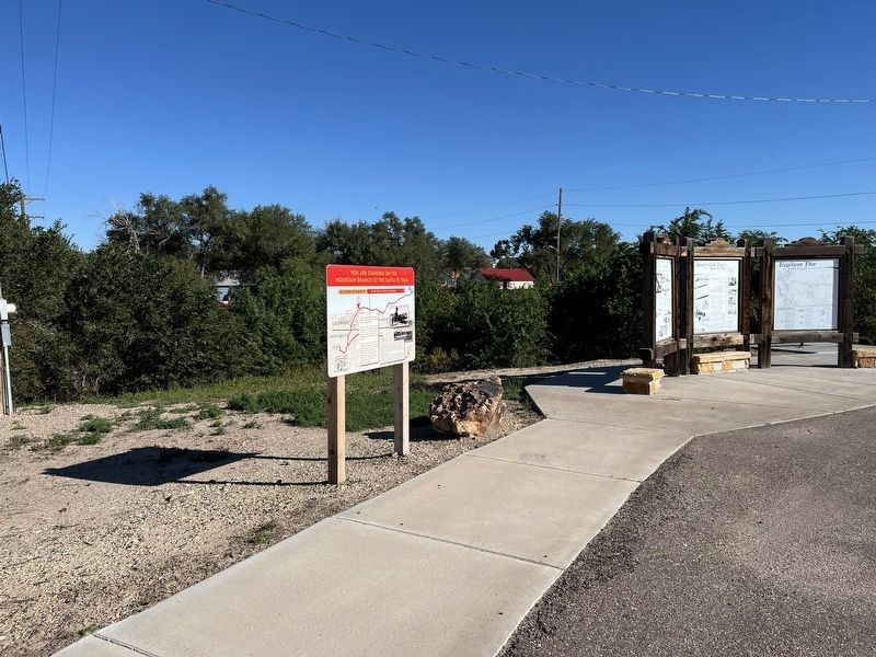
2. You are Standing on the Mountain Branch of the Santa Fe Trail Marker Wide View
Credits. This page was last revised on October 12, 2026. It was originally submitted on October 12, 2026, by Leslie Eudy of Golden, Colorado. This page has been viewed 7 times since then. Photos: 1, 2. submitted on October 12, 2026, by Leslie Eudy of Golden, Colorado. • Andrew Ruppenstein was the editor who published this page.
