Altstadt in Koblenz, Rhineland-Palatinate, Germany — Central Europe
Weisser Gasse
Photographed by James Hulse, October 2, 2026
1. Weisser Gasse Marker

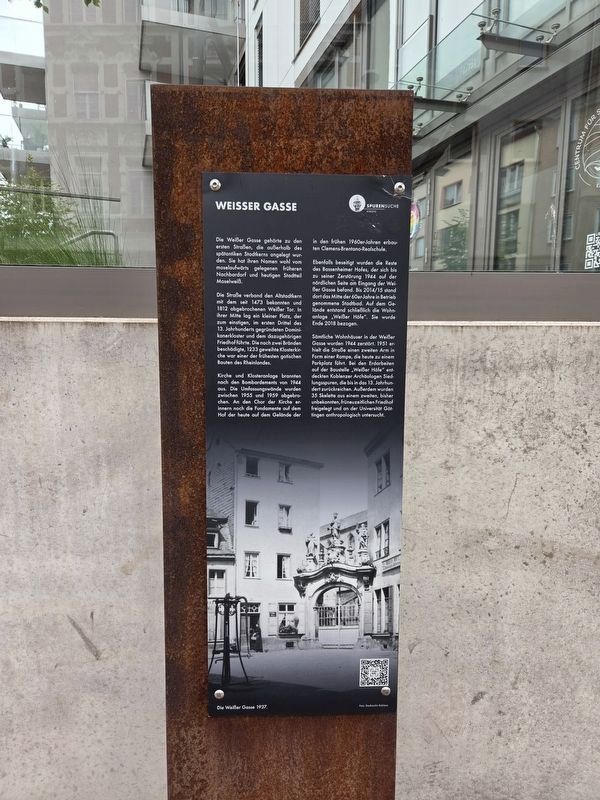
Die Weißer Gasse gehörte zu den ersten Straßen, die außerhalb des spätantiken Stadtkerns angelegt wurden. Sie hat ihren Namen wohl vom moselaufwärts gelegenen früheren Nachbardorf und heutigen Stadtteil Moselweiß.
Die Straße verband den Altstadtkern mit dem seit 1473 bekannten und 1812 abgebrochenen Weißer Tor. In ihrer Mitte lag ein kleiner Platz, der zum einstigen, im ersten Drittel des 13. Jahrhunderts gegründeten Dominikanerkloster und dem dazugehörigen Friedhof führte. Die nach zwei Bränden beschädigte, 1233 geweihte Klosterkirche war einer der frühesten gotischen Bauten des Rheinlandes.
Kirche und Klosteranlage brannten nach den Bombardements von 1944 aus. Die Umfassungswände wurden zwischen 1955 und 1959 abgebrochen. An den Chor der Kirche erinnern noch die Fundamente auf dem Hof der heute auf dem Gelände der in den frühen 1960er-Jahren erbauten Clemens-Brentano-Realschule.
Ebenfalls beseitigt wurden die Reste des Bassenheimer Hofes, der sich bis zu seiner Zerstörung 1944 auf der nördlichen Seite am Eingang der Weißer Gasse befand. Bis 2014/15 stand dort das Mitte der 60er-Jahre in Betrieb
this page online
Sämtliche Wohnhäuser in der Weißer Gasse wurden 1944 zerstört. 1951 erhielt die Straße einen zweiten Arm in Form einer Rampe, die heute zu einem Parkplatz führt. Bei den Erdarbeiten auf der Baustelle „Weißer Höfe“ entdeckten Koblenzer Archäologen Siedlungsspuren, die bis ins 13. Jahrhundert zurückreichen. Außerdem wurden 35 Skelette aus einem zweiten, bisher unbekannten, frühneuzeitlichen Friedhof freigelegt und an der Universität Göttingen anthropologisch untersucht.
Die Weißer Gasse 1937.
Foto: Stadtarchiv Koblenz
Weisser Gasse
Weißer Gasse was among the first streets laid out beyond the city center of late antiquity. Its name probably comes from Moselweiß, formerly a neighboring village upstream on the Moselle and now a district of Koblenz.
The street connected the old town center with the Weißer Gate, documented since 1473 and demolished in 1812. A small square midway along the street led to the former Dominican monastery, founded in the first third of the 13th century, and its cemetery.
Photographed by James Hulse, October 3, 2026
2. Weisser Gasse Marker
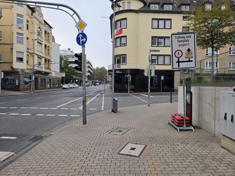
The church and monastery burned out following the bombing of 1944. Their outer walls were demolished between 1955 and 1959. Foundations in the courtyard of the Clemens-Brentano-Realschule, built on the site in the early 1960s, still mark the church’s choir.
The remains of the Bassenheimer Hof were also removed. Until its destruction in 1944, it stood on the northern side of the entrance to Weißer Gasse. The municipal swimming pool, opened in the mid-1960s, occupied the site until 2014–15. The “Weißer Höfe” residential development was subsequently built there and occupied at the end of 2018.
All the houses in Weißer Gasse were destroyed in 1944. In 1951, the street received a second branch in the form of a ramp that now leads to a parking lot. During excavation for the “Weißer Höfe” development, Koblenz archaeologists discovered traces of settlement dating back to the 13th century. They also uncovered 35 skeletons from a second, previously unknown cemetery of the early modern period. These were examined anthropologically at the University of Göttingen.
Weißer Gasse in 1937.
Photo: Koblenz City Archives
Erected by Spurensuche Koblenz.
Topics. This historical marker is listed in these topic lists: Anthropology & Archaeology • Roads & Vehicles • Settlements & Settlers. A significant historical year for this entry is 1473.
Location. 50° 21.693′ N, 7° 35.577′ E. Marker is in Koblenz, Rheinland-Pfalz (Rhineland-Palatinate). It is in Altstadt. It is at the intersection of An d. Moselbrücke and Weißer Gasse, on the left when traveling north on An d. Moselbrücke. Touch for map. Marker is at or near this postal address: Weißer G 2, Koblenz RP 56068, Germany. Touch for directions.

Regionally, this marker is in the German Rhineland, in the Upper Middle Rhine Valley, and specifically in the Moselle Valley. Globally, it is in Europe, the European Union, Atlantic Europe, Central Europe, the Schengen Area, Western Europe, and the Western World. Historically, it finds itself in what was once the Roman Empire, the Holy Roman Empire, and the former West Germany.
Other nearby markers. At least 8 other markers are within walking distance of this marker: Dominikaner Klosters / Dominican Monastery (within shouting distance of this marker); Ernst Albert Wolff (about 90 meters away, measured in a direct line); Walter Hübinger (about 90 meters away); Alte Burg / Old Castle (about 120 meters away); Vier Türme / Four Towers (about 150 meters away); Site of Guardhouse (about 150 meters away); Koblenz (about 150 meters away); Flora Daniel (about 180 meters away). Touch for a list and map of all markers in Koblenz.
Credits. This page was last revised on October 13, 2026. It was originally submitted on October 13, 2026, by James Hulse of Medina, Texas. This page has been viewed 6 times since then. Photos: 1, 2. submitted on October 13, 2026, by James Hulse of Medina, Texas.
