Bolivar in Tuscarawas County, Ohio — The American Midwest (Great Lakes)
Excavation
Fort Laurens
Photographed by Mike Wintermantel, March 15, 2015
1. Excavation Marker
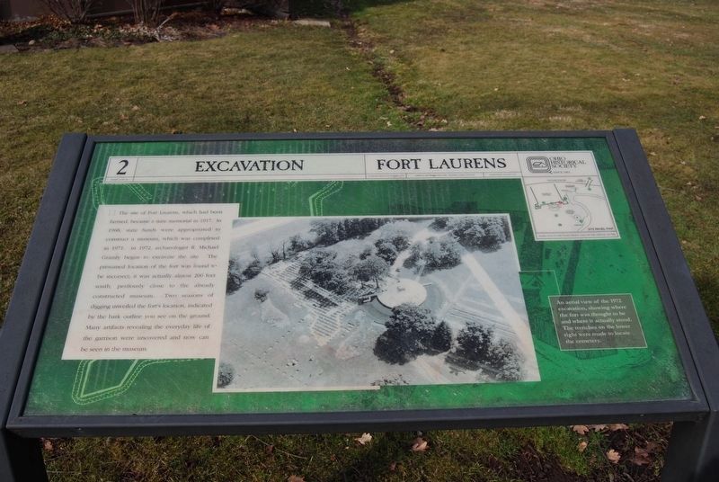
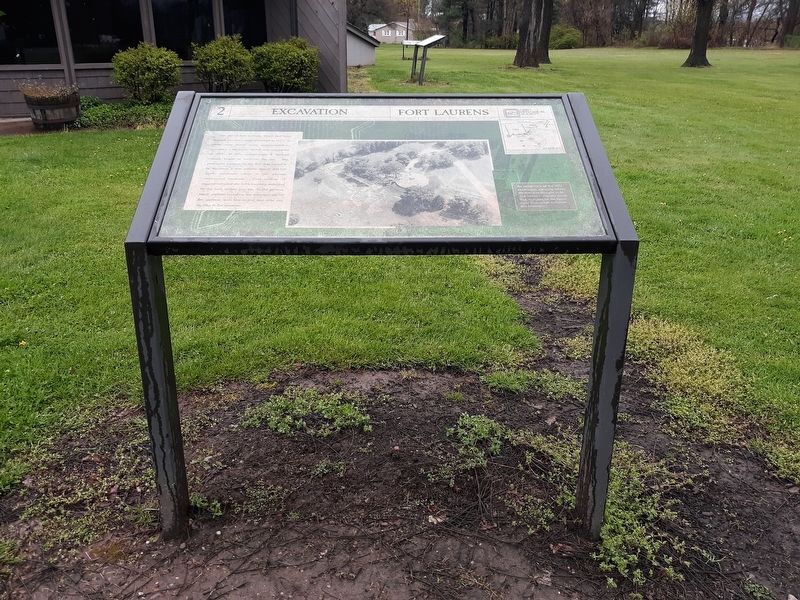
The site of Fort Laurens, which had been farmed, became a state memorial in 1917. In 1968, state funds were appropriated to construct a museum, which was completed in 1971. In 1972, archaeologist R. Michael Gramly began to excavate the site. The presumed location of the fort was found to be incorrect; it was actually almost 200 feet south, perilously close to the already constructed museum. Two seasons of digging unveiled the fort's location, indicated by the bark outline you see on the ground. Many artifacts revealing the everyday life of the garrison were uncovered and now can be seen in the museum.
Erected by Ohio Historical Society. (Marker Number 2.)
Topics and series. This historical marker is listed in these topic lists: Anthropology & Archaeology • Forts and Castles • War, French and Indian. In addition, it is included in the Ohio Historical Society / The Ohio History Connection series list. A significant historical year for this entry is 1917.
Location. Marker has been permanently removed. It was located near 40° 38.391′ N, 81° 27.309′ W. Marker was in Bolivar, Ohio, in Tuscarawas County. It could
this page online
We have been informed that this marker is no longer there and will not be replaced. This page is an archival view of what was.
Regionally, this marker was in Amish Country. It was also in the American Midwest, in Appalachia, and specifically in Northern Appalachia. Globally, it was in North America, the Western Hemisphere, the Western World, and the Anglosphere. Historically, it found itself in what was once the Haudenosaunee (Iroquois) Confederacy, the territory of the Mississippian Culture, and the Northwest Territory.

Other nearby markers. At least 7 other markers are within 2 miles of this location, measured as the crow flies: Fort Laurens (within shouting distance of this marker); Unknown Soldier (within shouting distance of this marker); In Commemoration of Our Patriot Ancestors (within shouting distance of this marker); Fort Laurens Continental Outpost of the Ohio Frontier / Survival on the Frontier
Photographed by Craig Doda, April 26, 2020
2. Excavation Marker
Other markers no longer nearby. Northwest Bastion (was a few steps from this marker but has been permanently removed); Barracks (was a few steps from this marker but has been permanently removed); Blockhouse (was within shouting distance of this marker but has been permanently removed); Introduction (was within shouting distance of this marker but has been permanently removed); Hospital (was within shouting distance of this marker but has been permanently removed); Cemetery (was within shouting distance of this marker but has been permanently removed); Tomb (was within shouting distance of this marker but has been permanently removed); Canal (was about 500 feet away but has been permanently removed); Interstate 77 (was about 500 feet away but has been permanently removed).
Also see . . . Fort Laurens - Ohio History Connection. (Submitted on December 21, 2020, by Mike Wintermantel of Pittsburgh, Pennsylvania.)
Photographed by Craig Doda, April 26, 2020
3. Sign at the entrance of Fort Laurens Historic Site
Credits. This page was last revised on October 13, 2026. It was originally submitted on December 21, 2020, by Mike Wintermantel of Pittsburgh, Pennsylvania. This page has been viewed 377 times since then and 44 times this year. Last updated on October 13, 2026, by Craig Doda of Napoleon, Ohio. Photos: 1. submitted on December 21, 2020, by Mike Wintermantel of Pittsburgh, Pennsylvania. 2, 3. submitted on January 27, 2021, by Craig Doda of Napoleon, Ohio. • Devry Becker Jones was the editor who published this page.
