Mille Lacs Kathio State Park near Onamia in Mille Lacs County, Minnesota — The American Midwest (Upper Plains)
The Palisade
Kathio Landmark Trail
| — | National Historic Landmark District | — |
Photographed by McGhiever, May 29, 2025
1. The Palisade Marker
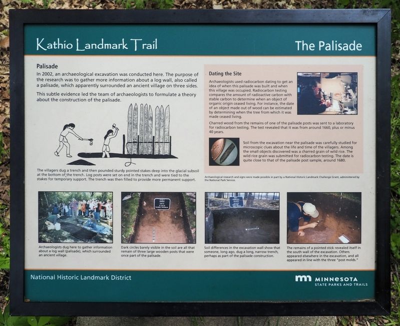
Palisade
In 2002, an archaeological excavation was conducted here. The purpose of the research was to gather more information about a log wall, also called a palisade which apparently surrounded an ancient village on three sides.
This subtle evidence led the team of archaeologists to formulate a theory about the construction of the palisade.
The villagers dug a trench and then pounded sturdy pointed stakes deep into the glacial subsoil at the bottom of the trench. Log posts were set on end in the trench and were tied to the stakes for temporary support. The trench was then filled to provide more permanent support.
Dating the Site
Archaeologists use radiocarbon dating to get an idea of when this palisade was built and when this village was occupied. Radiocarbon testing compares the amount of radioactive carbon with stable carbon to determine when an object of organic origin ceased living. For instance, the date of an object made out of wood can be estimated by determining when the tree from which it was made ceased living.
Charred wood from the remains of one of the palisade posts was sent to a laboratoryfor radiocarbon testing. The test revealed that it was from around 1660, plus or minus 40 years.
Click or scan to see
this page online
Soil from the excavation near the palisade was carefully studied for microscopic clues about the life and time of the villagers. Among the small objects discovered was a charred grain of wild rice. The wild rice grain was submitted for radiocarbon testing. The date is quite close to that of the palisade post sample, around 1680.
Archaeological research and signs were made possible in part by a National Historic Landmark Challenge Grant, administered by the National Park Service.
Archaeologists dug here to gather information about a log wall (palisade), which surrounded an ancient village.
Dark circles barely visible in the soil are all that remain of three large wooden posts that were once part of the palisade.
Soil differences in the excavation wall show that someone, long ago, dug a long, narrow trench, perhaps as part of the palisade construction.
The remains of a pointed stick revealed itself in the south wall of the excavation. Others appeared elsewhere in the excavation, and all appeared in line with the three "post molds."
Erected by Minnesota
Photographed by McGhiever, May 29, 2025
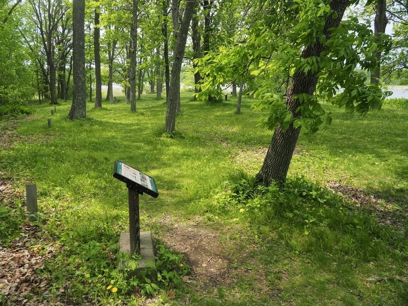
2. The Palisade Marker and modern posts (left) marking the ancestral palisade
Topics. This historical marker is listed in these topic lists: Anthropology & Archaeology • Indigenous Peoples and Communities. A significant historical year for this entry is 1660.
Location. 46° 8.725′ N, 93° 46.522′ W. Marker is near Onamia, Minnesota, in Mille Lacs County. It is in Mille Lacs Kathio State Park. It can be reached from the road to Ogechie Campground. The marker is at the Cooper Site on the Kathio Landmark Trail. Touch for map. Marker is at or near this postal address: 15066 Kathio State Park Road, Onamia MN 56359, United States of America. Touch for directions.

Regionally, this marker is in Central Minnesota. It is also in the American Midwest and in the Corn Belt. Globally, it is in North America, the Western Hemisphere, the Western World, and the Anglosphere. Historically, it finds itself in what was once Rupert’s Land, the territory of the Mississippian Culture, and the Northwest Territory.
Other nearby markers. At least 8 other markers are within walking distance of this marker: Dakota Village (a few steps from this marker); Archaeology Uncovers the Unwritten Past (a few steps from this marker); Ojibwe Wild Rice Harvest (within shouting distance of this marker); House & Home (within shouting distance of this marker); A Wealth of History (within shouting distance of this marker); Resources for the "Good Life" (within shouting distance of this marker); "Kathio" or "Isanti?" (about 300 feet away, measured in a direct line); A Wealth of Resources (about 400 feet away). Touch for a list and map of all markers in Onamia.
Credits. This page was last revised on October 15, 2026. It was originally submitted on October 15, 2026, by McGhiever of Minneapolis, Minnesota. This page has been viewed 4 times since then. Photos: 1, 2. submitted on October 15, 2026, by McGhiever of Minneapolis, Minnesota.
