Liverpool in Merseyside, England, United Kingdom — Northwestern Europe (the British Isles)
James Harrison
Photographed by Ian Lefkowitz, September 13, 2026
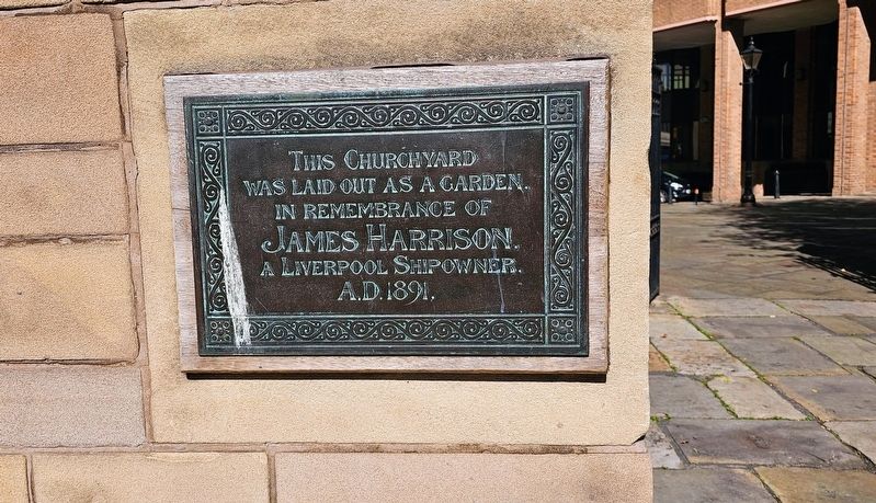
1. James Harrison Marker
This churchyard was laid out as a garden, in remembrance of
James Harrison,
a Liverpool shipowner.
A.D. 1891.
Topics. This historical marker is listed in these topic lists: Cemeteries & Burial Sites • Parks & Recreational Areas. A significant historical year for this entry is 1891.
Location. 53° 24.418′ N, 2° 59.675′ W. Marker is in Liverpool, England, in Merseyside. It can be reached from the intersection of Old Churchyard and Chapel Street, on the right when traveling south. The marker is located within Our Lady and St Nicholas Church Garden. Touch for map. Marker is at or near this postal address: 5 Old Churchyard, Liverpool, England L2 8TX, United Kingdom. Touch for directions.

Regionally, this marker is in North West England. Globally, it is on the Atlantic Ocean, in the North Atlantic Region, in Europe, in Atlantic Europe, on one of the British Isles, in the Western World, and in the Anglosphere. Historically, it finds itself in what was once the Roman Empire.
Other nearby markers. At least 8 other markers are within walking distance of this marker: MV Derbyshire (a few steps from this marker); Captain Luis Pardo
this page online
Also see . . . Gardens (Liverpool Parish Church).
The shipowner James Harrison, who founded Harrison Line in 1853, was the benefactor of the new Gardens. On 17 May 1892 a Deed of Faculty was granted for the laying out of the graveyard as an ‘Ornamental Ground’ by forming walks and making beds of shrubs or plants surrounded with turf. The newly laid out garden was given into the care of the Corporation of Liverpool – subject to conditions to be approved by the council and that “the proposed alterations will be a public benefit and make the said churchyard more comely and decent”. It is today designated a Protected Green Space and is part of the Castle Street Conservation Area.(Submitted on October 17, 2026, by Ian Lefkowitz of New York, New York.)
Photographed by Ian Lefkowitz, September 13, 2026
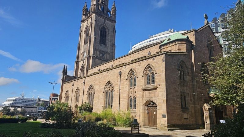
2. James Harrison Marker
The marker is located at the rear of St. Nick's Church, facing the garden. The church was rebuilt in 1952, after being destroyed by bombing in World War II.
Photographed by Ian Lefkowitz, September 13, 2026
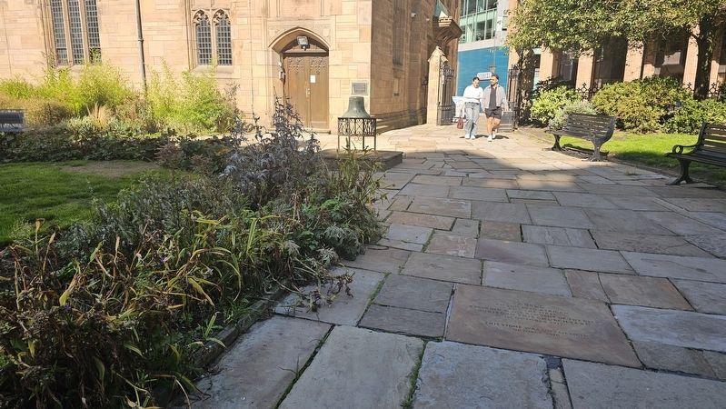
3. James Harrison Marker
The Chapel Street entrance to the gardens.
Credits. This page was last revised on October 17, 2026. It was originally submitted on October 17, 2026, by Ian Lefkowitz of New York, New York. This page has been viewed 5 times since then. Photos: 1, 2, 3. submitted on October 17, 2026, by Ian Lefkowitz of New York, New York. • Andrew Ruppenstein was the editor who published this page.
