Memorial Park in Rapid City in Pennington County, South Dakota — The American Midwest (Upper Plains)
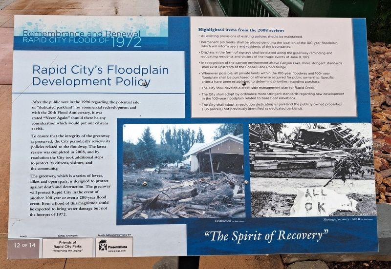
Rapid City's Floodplain Development Policy
Remembrance and Renewal • Rapid City Flood of 1972
| — | "The Spirit of Recovery" | — |
Photographed by William Fischer, Jr., September 21, 2026
1. Rapid City's Floodplain Development Policy Marker
After the public vote in the 1996 [resolution] regarding the potential sale of "dedicated parkland" for commercial redevelopment and with the 20th Flood Anniversary, it was stated "Never Again" should there be any consideration which would put our citizens at risk.
To ensure that the integrity of the greenway is preserved, the City periodically reviews its policies related to the floodway. The latest review was completed in 2008, and by resolution the City took additional steps to protect its citizens, visitors, and the community.
The greenway, which is a series of levees, dikes and open space, is designed to protect against death and destruction. The greenway will protect Rapid City in the event of another 100-year or even a 200-year flood event. Even a flood of this magnitude could be expected to bring water damage but not the horrors of 1972.
Highlighted items from the 2008 review:
• All existing provisions of existing policies should be maintained.
• Permanent pin marks shall be placed denoting the location of the 100-year floodplain, which will inform users and residents of the boundaries.
this page online
• In recognition of the canyon environment above Canyon Lake, more stringent standards shall exist upstream of the Chapel Lane Road bridge.
• Whenever possible, all private lands within the 100-year floodway and 100-year floodplain shall be purchased or otherwise acquired for public ownership. Specific criteria have been established to determine priorities regarding purchase.
• The City shall develop a creek side management plan for Rapid Creek.
• The City shall adopt by ordinance more stringent standards regarding new development in the 100-year floodplain related to base floor elevations.
• The City shall adopt a resolution dedicating as parkland the publicly owned properties (185 parcels) not previously identified as dedicated parklands.
Erected by Friends of Rapid City Parks. (Marker Number 12 of 14.)
Topics. This historical marker is listed in these topic lists: Disasters • Education • Parks & Recreational Areas • Waterways & Vessels. A significant historical date for this entry is June 9, 1972.
Location. 44° 5.096′ N,
Photographed by William Fischer, Jr., September 21, 2026
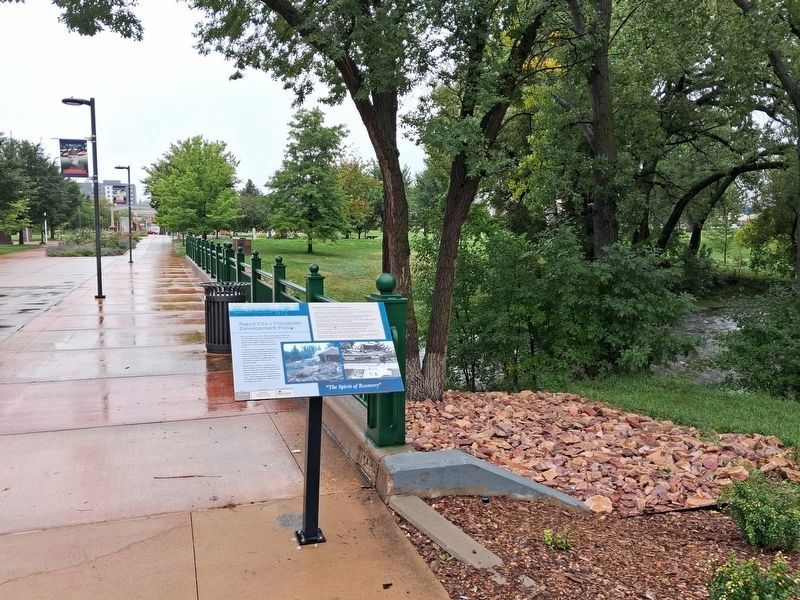
2. Rapid City's Floodplain Development Policy Marker
Looking south

Regionally, this marker is in West River and in the Badlands. It is also in the American Black Hills, in the Lewis & Clark Corridor, on the prairies, and on the Northern Plains. Globally, it is in North America, the Western Hemisphere, the Western World, and the Anglosphere. Historically, it finds itself in what was once Rupert’s Land and also the Louisiana Purchase.
Other nearby markers. At least 8 other markers are within walking distance of this marker: Black Hills Veterans Memorial (within shouting distance of this marker); Memorial Fountain (about 500 feet away, measured in a direct line); Tank Traps (about 600 feet away); Berlin Wall Segments (about 700 feet away); The American Commitment (about 700 feet away); The Cruel Border (about 700 feet away); The Berlin Wall Memorial (about 700 feet away); Confrontation (about 700 feet away). Touch for a list and map of all markers in Rapid City.
Also see . . . City of Rapid City Floodplain Management. (Submitted on October 18, 2026, by William Fischer, Jr. of Reynoldsburg, Ohio.)
Credits. This page was last revised on October 18, 2026. It was originally submitted on October 18, 2026, by William Fischer, Jr. of Reynoldsburg, Ohio. This page has been viewed 6 times since then. Photos: 1, 2. submitted on October 18, 2026, by William Fischer, Jr. of Reynoldsburg, Ohio.
