Pinardville in Goffstown in Hillsborough County, New Hampshire — The American Northeast (New England)
Hillsborough County Pauper Cemetery
| — | Goffstown Rail Trail | — |
October 17, 2026
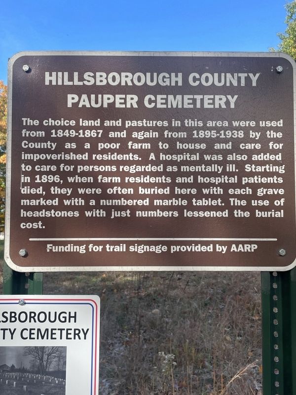
1. Hillsborough County Pauper Cemetery Marker
The choice land and pastures in this area were used from 1849-1867 and again from 1895-1938 by the County as a poor farm to house and care for impoverished residents. A hospital was also added to care for persons regarded as mentally ill. Starting in 1896, when farm residents and hospital patients died, they were often buried here with each grave marked with a numbered marble tablet. The use of headstones with just numbers lessened the burial cost.
Funding for trail signage provided by AARP
Topics. This historical marker is listed in these topic lists: Agriculture • Cemeteries & Burial Sites. A significant historical year for this entry is 1849.
Location. 43° 0.585′ N, 71° 32.08′ W. Marker is in Goffstown, New Hampshire, in Hillsborough County. It is in Pinardville. It can be reached from Mast Road (New Hampshire Route 14) 0.6 miles west of Danis Park Road, on the right when traveling west. Located on the Goffstown Rail Trail behind the Hillsborough County Complex. Touch for map. Marker is in this post office area: Goffstown NH 03045, United States of America. Touch for directions.

Regionally, this marker is in Greater
this page online
Other nearby markers. At least 8 other markers are within 4 miles of this marker, measured as the crow flies: In Memory of Michael J. Kos (approx. one mile away); Grasmere Town Hall (approx. one mile away); Merci Box Car (approx. 2.8 miles away); St. Mary's Bank Credit Union / La Caisse Populaire Saint-Marie (approx. 3.2 miles away); John Stark —Revolutionary War Hero (approx. 3.3 miles away); B&M Railroad Covered Bridge (approx. 3.3 miles away); National Colonnade (approx. 3.3 miles away); Notre Dame Bridge (approx. 3.3 miles away). Touch for a list and map of all markers in Goffstown.
Additional keywords. Hospital, Housing
October 24, 2026
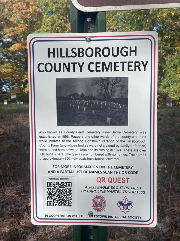
2. Hillsborough County Cemetery Marker
Also known as County Farm Cemetery, Pine Grove Cemetery, was established in 1896. Paupers and other wards of the county who died while inmates at the second Goffstown iteration of the Hillsborough County Farm (and whose bodies were not claimed by family or friends) were buried here between 1896 and its closing in 1924. There are over 710 burials here. The graves are numbered with no names. The names of approximately 600 individuals have been recovered.
QR Quest, a 2025 Eagle scout project by Caroline Martel Troop 106G
QR Quest, a 2025 Eagle scout project by Caroline Martel Troop 106G
Credits. This page was last revised on October 26, 2026. It was originally submitted on October 21, 2026. This page has been viewed 6 times since then. Photos: 1, 2. submitted on October 21, 2026. • Michael Herrick was the editor who published this page.
