Bandelier National Monument in Los Alamos County, New Mexico — The American Mountains (Southwest)
A Living Legacy
| — | Bandelier National Monument | — |
Photographed by Benjamin Rubin, October 16, 2026
1. A Lasting Legacy Marker
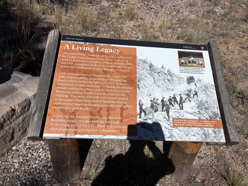
This amphitheater shares one of the many stories from the Civilian Conservation Corps (CCC) meticulous work in Bandelier National Monument. Between 1934 and 1941, young men of the CCC used this site as a rock quarry for construction projects throughout the park.
CCC crews transformed Bandelier. They improved trails, helped stabilize archaeological sites, and dug flood-control ditches. In eight years, CCC workers constructed 31 stone buildings, including the entrance station, residences, offices, and the fire lookout tower. When you explore Frijoles Canyon, check out the buildings. They were built with rock cut and shaped in this quarry. Hard work turned Bandelier from an undeveloped tourist destination accessible only by foot to a modern park for all.
As you visit the Ancestral Pueblo sites that make Bandelier unique, you also walk the trails built by the young men of the CCC. Their dedication and effort shaped how you experience Bandelier.
(caption)
Using only picks and shovels, CCC workers chiseled the first road into Frijoles Canyon. You drive this same steep, winding route into the park today.
Erected by National
this page online
Topics and series. This historical marker is listed in these topic lists: Anthropology & Archaeology • Charity & Public Work • Parks & Recreational Areas. In addition, it is included in the Civilian Conservation Corps (CCC) series list. A significant historical year for this entry is 1934.
Location. 35° 47.738′ N, 106° 16.923′ W. Marker is in Bandelier National Monument, New Mexico, in Los Alamos County. It is on Campground Road. Touch for map. Marker is at or near this postal address: 300 Campground Road, White Rock NM 87547, United States of America. Touch for directions.

Regionally, this marker is in Northern New Mexico. It is also in the American Southwest. Globally, it is in North America, the Rocky Mountains, the Western Hemisphere, the Western World, and the Anglosphere. Historically, it finds itself in what was once New Spain and also the territory of the Ancestral Puebloans.
Other nearby markers. At least 8 other markers are within 6 miles of this marker, measured as the crow flies: A Lasting Legacy (here, next to this marker); Houses (approx. 0.4 miles away); Plants (approx. 0.6 miles away); The Role of Fire (approx. 0.7 miles away); Sacred Spaces (approx. 0.7 miles away); Tyuonyi Overlook (approx. 0.8 miles away); Los Alamos Project Main Gate Park (approx. 5.8 miles away); Los Alamos (approx. 5.8 miles away). Touch for a list and map of all markers in Bandelier National Monument.
Credits. This page was last revised on October 31, 2026. It was originally submitted on October 22, 2026, by Benjamin Rubin of Columbia, South Carolina. This page has been viewed 25 times since then. Photo 1. submitted on October 22, 2026, by Benjamin Rubin of Columbia, South Carolina. • Andrew Ruppenstein was the editor who published this page.
