Battle Ground in Tippecanoe County, Indiana — The American Midwest (Great Lakes)
A Great Native Alliance
Photographed by Craig Doda, September 13, 2026
1. A Great Native Alliance Marker
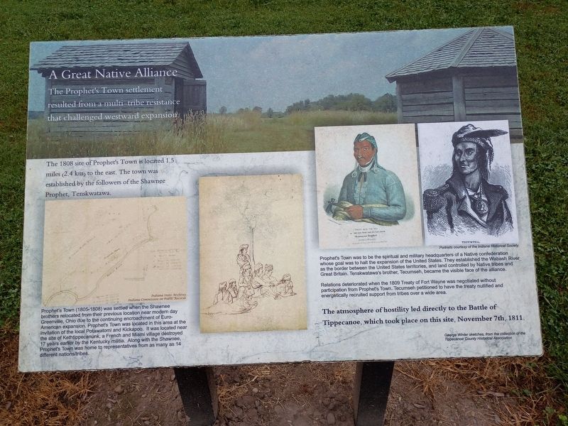
The Prophet's Town settlement resulted from a multi-tribe resistance that challenged westward expansion.
The 1808 site of Prophet's Town is located 1.5 miles (2.4 km) to the east. The town was established by the followers of the Shawnee Prophet, Tenskwatawa.
Prophet's Town (1805-1808) was settled when the Shawnee brothers relocated from their previous location near modern day Greenville, Ohio due to the continuing encroachment of Euro-American expansion. Prophet's Town was located in this area at the invitation of the local Potawatomi and Kickapoo. It was located near the site of Kethtippecanunk, a French and Miami village destroyed 17 years earlier by the Kentucky militia. Along with the Shawnee, Prophet's Town was home to representatives from as many as 14 different nations/tribes.
Prophet's Town was to be the spiritual and military headquarters of a Native confederation whose goal was to halt the expansion of the United States. They established the Wabash River as the border between the United States territories, and land controlled by Native tribes and Great Britain. Tenskwatawa's brother, Tecumseh, became
this page online
Relations deteriorated when the 1809 Treaty of Fort Wayne was negotiated without participation from Prophet's Town. Tecumseh petitioned to have the treaty nullified and energetically recruited support from tribes over a wide area.
The atmosphere of hostility led directly to the Battle of Tippecanoe, which took place on this site, November 7th, 1811.
Topics. This historical marker is listed in these topic lists: Indigenous Peoples and Communities • Settlements & Settlers • Wars, US Indian. A significant historical date for this entry is November 7, 1811.
Location. 40° 30.391′ N, 86° 50.638′ W. Marker is in Battle Ground, Indiana, in Tippecanoe County. It is at the intersection of Battleground Avenue and North 9th Street, on the right when traveling north on Battleground Avenue. Touch for map. Marker is at or near this postal address: 200 Battleground Ave, Battle Ground IN 47920, United States of America. Touch for directions.

Regionally, this marker is in Central Indiana. It is also in the American Midwest and in the Corn Belt. Globally, it is in North America, the Western Hemisphere, the Western
Photographed by Craig Doda, September 13, 2026
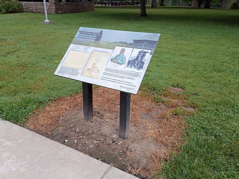
2. A Great Native Alliance Marker
Other nearby markers. At least 8 other markers are within walking distance of this marker: Potawatomi ‘Trail of Death’ Route (here, next to this marker); Potawatomi "Trail of Death" march: Sept. - Nov. 1838 (a few steps from this marker); The Battle of Tippecanoe (a few steps from this marker); The Methodist Camp (within shouting distance of this marker); Tippecanoe Battlefield Memorial (within shouting distance of this marker); Stricken Down in the Performance of Duty (within shouting distance of this marker); Harrisonville Cemetery (about 600 feet away, measured in a direct line); World War I Veterans Memorial (approx. 0.4 miles away). Touch for a list and map of all markers in Battle Ground.
Credits. This page was last revised on October 23, 2026. It was originally submitted on October 22, 2026, by Craig Doda of Napoleon, Ohio. This page has been viewed 7 times since then. Photos: 1, 2. submitted on October 22, 2026, by Craig Doda of Napoleon, Ohio. • Devry Becker Jones was the editor who published this page.
