Tippecanoe Township near Battle Ground in Tippecanoe County, Indiana — The American Midwest (Great Lakes)
The Prophetstown Story
Photographed by Craig Doda, September 13, 2026
1. The Prophetstown Story Marker
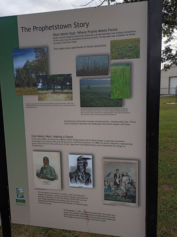
West Meets East: Where Prairie Meets Forest
North-central Indiana historically featured a divide between two unique ecosystems. To the west was the boundless American prairie. To the east was a blanket of forest running to the East Coast.
This region was a patchwork of forest and prairie.
Savannas represented the boundary between prairie and forest. With their towering oak trees and prairie understory, savannahs are a unique ecosystem in North America.
Wetlands flourished along rivers and where groundwater emerged. The fen along Harrison Creek is a result of gravel deposited by the glaciers that creates mineral-rich groundwater. Fens are the home to very specific plants and associated animal species.
Prophetstown State Park includes restored prairie, savanna and a fen. These rare ecosystems represent the landscape that Native people call home.
East Meets West: Making a Stand
In the early 1800s, the Shawnee religious leader Tenskwatawa (the Prophet) began a spiritual movement promoting unity among tribes and the pursuit of traditional practices. In 1808, he and his followers representing many tribes moved
this page online
The movement increased in numbers, and Tenskwatawa's brother, Tecumseh, joined to provide strategic planning and military leadership. As General William Henry Harrison saw the village population increasing under the strong leadership of Tenskwatawa and Tecumseh, he moved troops into the vicinity.
On November 7, 1811, a battle ensued while Tecumseh was away. The multiple tribes residing at Prophetstown became disenchanted with Tenskwatawa's movement and dispersed. The village was later burned by Harrison's troops.
Erected by Indiana Department of Natural Resources.
Topics. This historical marker is listed in these topic lists: Horticulture & Forestry • Indigenous Peoples and Communities • Settlements & Settlers • Wars, US Indian. A significant historical date for this entry is November 7, 1811.
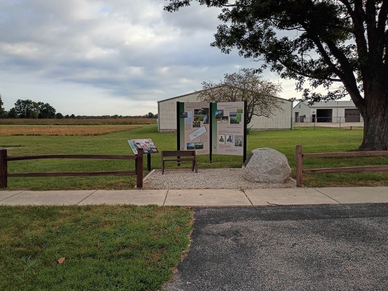
Location. 40° 30.036′ N, 86° 49.744′ W. Marker is near Battle Ground, Indiana, in Tippecanoe County. It is in Tippecanoe Township. It is at the intersection of Indiana 225 (Indiana Route 225) and North 9th Street, on the right when traveling
Photographed by Craig Doda, September 13, 2026
2. The Prophetstown Story Marker

Regionally, this marker is in Central Indiana. It is also in the American Midwest and in the Corn Belt. Globally, it is in North America, the Western Hemisphere, the Western World, and the Anglosphere. Historically, it finds itself in what was once the Viceroyalty of New France, the territory of the Mississippian Culture, and the Northwest Territory.
Other nearby markers. At least 8 other markers are within walking distance of this marker: Indiana State Parks (here, next to this marker); Welcome to Prophetstown State Park (here, next to this marker); Indiana State Parks: the First 100 Years (here, next to this marker); Medicine Lodge (approx. 0.2 miles away); Chief's Cabin (approx. 0.2 miles away); Woodland Indian Settlement (approx. 0.2 miles away); Village Structures (approx. 0.2 miles away); Granary (approx. 0.2 miles away). Touch for a list and map of all markers in Battle Ground.
Credits. This page was last revised on October 30, 2026. It was originally submitted on October 22, 2026, by Craig Doda of Napoleon, Ohio. This page has been viewed 8 times since then. Photos: 1, 2. submitted on October 22, 2026, by Craig Doda of Napoleon, Ohio. • Devry Becker Jones was the editor who published this page.
