Tippecanoe Township in Battle Ground in Tippecanoe County, Indiana — The American Midwest (Great Lakes)
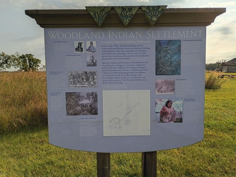
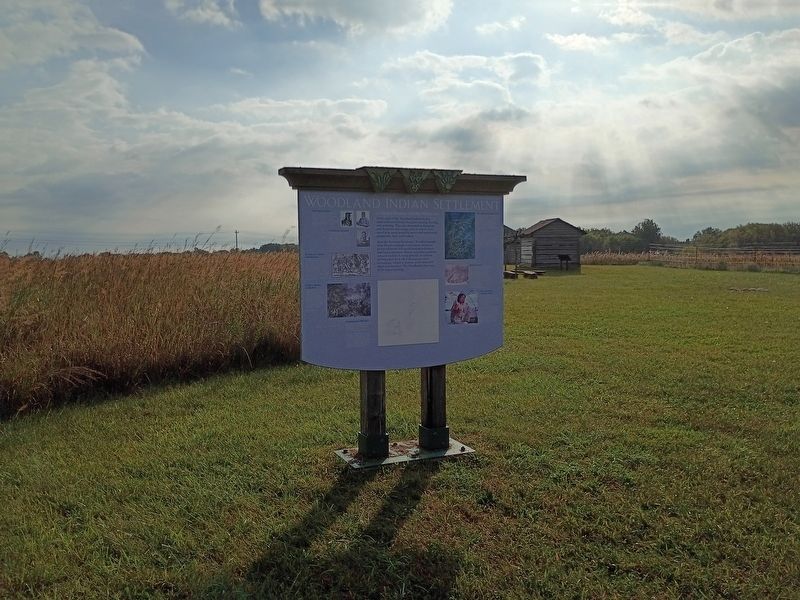
Woodland Indian Settlement
Photographed by Craig Doda, September 13, 2026
1. Woodland Indian Settlement Marker
The Prophet’s Town
In the spring of 1808, Shawnee brothers, Tecumseh (left) and The Prophet (Tenskwatawa) established Prophetstown, the capital of a Native American confederacy. The village was located on the north bank of the Wabash River, just below the mouth of the Tippecanoe River.
A Territorial Governor
General William Henry Harrison, governor of the Indiana Territory, was a champion of westward expansion and Tecumseh’s most powerful American adversary. On November 8, 1811, the day after the Battle of Tippecanoe, Harrison and a contingent of troops burned and destroyed Prophetstown. Harrison became the ninth President of the United States in 1841.
Promoting an Indian Confederation
Tecumseh, like his brother The Prophet, was a charismatic leader in the Indian resistance to pioneer settlement in the Indiana Territory. An outstanding orator, Tecumseh envisioned a strong Pan-Indian Confederacy that united all the tribes under a revolutionary goal—the common ownership of all Indian lands. His idea was alien to traditional tribal perspectives in which each tribe had its own territory.
A Call to Return to the Past
The
this page online
Prophetstown, 1808–1811
Part of the town stood in the prairie above the valley...not far from each other, were the two public buildings—the Council House and the Medicine Lodge.
Tenskwatawa supervised the construction of Prophetstown in 1808. The destruction of the settlement after the defeat at the Battle of Tippecanoe in 1811 marked the end of the Prophet’s influence, and he died in obscurity on a Kansas reservation in 1836. Tecumseh dominated the resistance movement until his death in battle in 1813.
A Lifeway Vanishes with the Wilderness
In the early 1700s, Woodland Indians lived a semi-traditional lifestyle based on farming, hunting, and gathering. They also depended on European and American technology, such as woven cloth, metal pots, metal projectile points and tomahawks, gunpowder, lead, and muskets.
After the American Revolution,
Photographed by Craig Doda, September 13, 2026
2. Woodland Indian Settlement Marker
Joseph Allen documented the layout of Prophetstown in his "Survey for Peter Longloi's Children," years after the United States Army destroyed the settlement in 1811.
From European Contact to Exile
The arrival of Europeans in the 1600s changed the lifeways of Woodland Indians forever. Initial contact was with French and English people who traded woolen cloth, brightly colored ribbons, metal jewelry, tools, utensils, weapons, glass beads, and alcohol for furs. Within a hundred years, the Woodland Indians had abandoned many of their traditional lifeways.
Native Americans became dependent for survival upon European products traded at outposts like Ouiatenon in Tippecanoe County. From 1805 to 1846, the United States government acquired almost 30,000,000 acres of Indian land and forced most of the Woodland Indians to move away, first to present-day Kansas and Missouri, and then to Oklahoma.
Indian Lands and Tribal Land Cessions in Indiana, circa 1776 to 1848
Forced Removal
It was a sad and mournful spectacle to witness
these children of the forest slowly retiring
from the home of their childhood....
I saw several of the aged warriors casting
glances toward the sky...imploring aid
from the spirits of their departed heroes...
or from the Great Spirit, who would
ultimately redress the wrongs of the red man,
whose broken bow had fallen from his hand,
and whose sad heart was bleeding within him....
Sanford Cox, 1860
Recollections of the Early Settlement of the Wabash Valley
Native Americans in America Today
Many Native American people strive to maintain aspects of their culture and language today. They, along with people of other cultures, are interested in Native American ideals and lifeways that have influenced United States history and customs.
Many contemporary Americans prize Woodland Indian traditions: significant roles of women in society, for example, symbolic art based on environment and natural resources, decisions made by consensus, and egalitarian leadership. The Woodland Indian Settlement at Historic Prophetstown is a place to explore these and other aspects of Native American life in Indiana.
Topics. This historical marker is listed in these topic lists: Indigenous Peoples and Communities • Settlements & Settlers • Wars, US Indian. A significant historical date for this entry is November 8, 1811.
Location. 40° 29.909′ N, 86° 49.808′ W. Marker is in Battle Ground, Indiana, in Tippecanoe County. It is in Tippecanoe Township. It is at the intersection of Indiana Route 225 and Pretty Prairie Road, on the right when traveling south on Indiana Route 225. The marker is located in Prophetstown State Park. Touch for map. Marker is at or near this postal address: 4265 IN-225, Battle Ground IN 47920, United States of America. Touch for directions.

Regionally, this marker is in Central Indiana. It is also in the American Midwest and in the Corn Belt. Globally, it is in North America, the Western Hemisphere, the Western World, and the Anglosphere. Historically, it finds itself in what was once the Viceroyalty of New France, the territory of the Mississippian Culture, and the Northwest Territory.
Other nearby markers. At least 8 other markers are within walking distance of this marker: Granary (a few steps from this marker); Village Structures (within shouting distance of this marker); Chief's Cabin (within shouting distance of this marker); Medicine Lodge (within shouting distance of this marker); Indiana State Parks (approx. 0.2 miles away); The Prophetstown Story (approx. 0.2 miles away); Indiana State Parks: the First 100 Years (approx. 0.2 miles away); Welcome to Prophetstown State Park (approx. 0.2 miles away). Touch for a list and map of all markers in Battle Ground.
Credits. This page was last revised on November 1, 2026. It was originally submitted on October 22, 2026, by Craig Doda of Napoleon, Ohio. This page has been viewed 20 times since then. Photos: 1, 2. submitted on October 22, 2026, by Craig Doda of Napoleon, Ohio. • Andrew Ruppenstein was the editor who published this page.
