Near Guernsey in Platte County, Wyoming — The American West (Mountains)
North Platte River: More to Explore
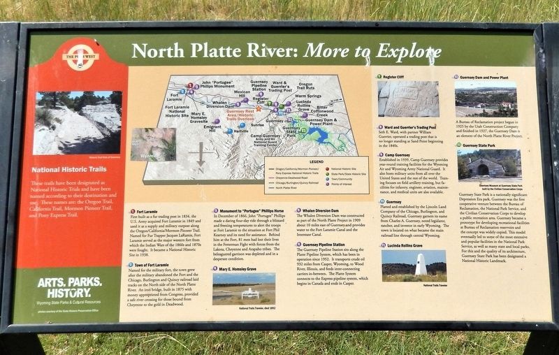
Photographed by Cosmos Mariner, July 9, 2018
1. North Platte River: More to Explore Marker
1. Fort Laramie
First built as a fur trading post in 1834, the U.S. Army acquired Fort Laramie in 1849 and used it as a supply and military outpost along the Oregon/California/Mormon Pioneer Trail. Named for Fur Trapper Jacques LaRamie, Fort Laramie served as the major western fort from which the Indian Wars of the 1860s and 1870s were fought. It became a National Historic Site in 1938.
2. Town of Fort Laramie
Named for the military fort, the town grew after the military abandoned the Fort and the Chicago, Burlington and Quincy railroad laid tracks on the North side of the North Platte River. An iron bridge, built in 1875 with money appropriated from Congress, provided a safe river crossing for those bound from Cheyenne to the gold in Deadwood.
3. Monument to “Portugee” Phillips Horse
In December of 1866, John “Portugee” Phillips made a daring four-day ride through a blizzard and freezing temperatures to alert the troops at Fort Laramie to the situation at Fort Phil Kearney and its need for assistance. Behind him at the Fort, 81 men had lost their lives in the Fetterman Fight with forces from the Lakota, Cheyenne and Arapaho
this page online
4. Mary E. Homsley Grave
National Trails Traveler, died 1852
5. Whalen Diversion Dam
The Whalen Diversion Dam was constructed as part of the North Platte Project in 1909 about 10 miles east of Guernsey and provides water to the Fort Laramie Canal and the Interstate Canal.
6. Guernsey Pipeline Station
The Guernsey Pipeline Station sits along the Platte Pipeline System, which has been in operation since 1952. It transports crude oil 932 miles from Casper, Wyoming, to Wood River, Illinois, and feeds inter-connecting carriers in-between. The Platte System connects to the Express pipeline system, which begins in Canada and ends in Casper.
7. Register Cliff
8. Ward and Guerrier’s Trading Post
Seth E. Ward, with partner William Guerrier, operated a trading post that is no longer standing at Sand Point beginning in the 1840s.
9. Camp Guernsey
Established in 1939, Camp Guernsey provides year-round training facilities for the Wyoming Air and Wyoming Army National Guard. It also hosts military units from all over the United States and the rest of the world. Training focuses on
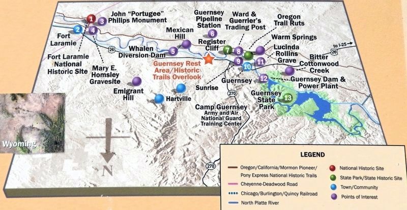
2. Marker detail: Map
10. Guernsey
Platted and established by the Lincoln Land Company of the Chicago, Burlington, and Quincy Railroad, Guernsey garners its name from Charles A. Guernsey, noted legislator, rancher, and investor in early Wyoming. The town is located on what became the main railroad line through central Wyoming.
11. Lucinda Rollins Grave
National Trails Traveler
12. Guernsey Dam and Power Plant
A Bureau of Reclamation project begun in 1925 by the Utah Construction Company and finished in 1927, the Guernsey Dam is an element of the North Platte River Project.
13. Guernsey State Park
Guernsey State Park is a nationally significant Depression Era park. Guernsey was the first cooperative venture between the Bureau of Reclamation, the National Park Service, and the Civilian Conservation Corps to develop a public recreation area. Guernsey became a prototype for developing recreational facilities at Bureau of Reclamation reservoirs and the concept was widely copied. This model eventually led to some of the most extensive and popular
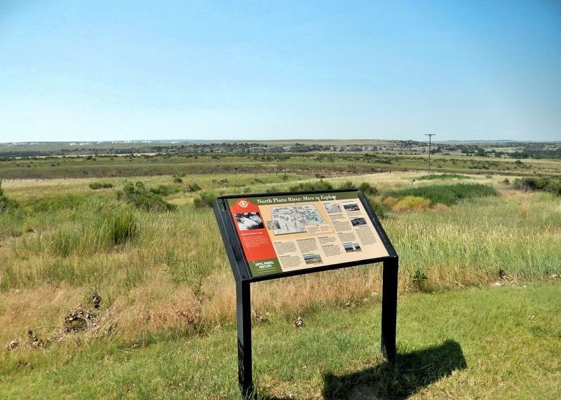
Photographed by Cosmos Mariner, July 9, 2018
3. North Platte River: More to Explore Marker
Looking southwest from the Guernsey Rest Area. The North Platte River is visible in the distance.
[sidebar] The Push West
National Historic Trails
These trails have been designated as National Historic Trails and have been named according to their destination and use. These names are: the Oregon Trail, California Trail, Mormon Pioneer Trail, and Pony Express Trail.
Erected by Wyoming State Parks & Cultural Resources.
Topics. This historical marker is listed in these topic lists: Forts and Castles • Settlements & Settlers • Wars, US Indian • Waterways & Vessels.
Location. 42° 15.655′ N, 104° 41.847′ W. Marker is near Guernsey, Wyoming, in Platte County. It can be reached from Heartland Expressway (U.S. 26) 1.2 miles east of State Highway 270, on the right when traveling east. The marker is in the Guernsey Rest Area. Touch for map. Marker is in this post office area: Guernsey WY 82214, United States of America. Touch for directions.

Regionally, this marker is in the Laramie Basin and in the Westward Expansion Trails Region. It is also in the American Mountain West, on the Great Plains, and specifically on the High Plains. Globally, it is in North America, the Western Hemisphere, the Western World, and the Anglosphere. Historically, it finds itself in what was once the Louisiana Purchase.
Other nearby markers. At least 8 other markers are within 3 miles of this marker, measured as the crow flies: North Platte River (a few steps from this marker); Lock and Roll Down a Rocky Road (within shouting distance of this marker); Oregon Trail Memorial (approx. 1.1 miles away); Register Cliff (approx. 1.1 miles away); Register Cliff State Historic Site (approx. 1.2 miles away); Pvt Gerald W. Sharp (approx. 1.2 miles away); Centre Star Station (approx. 1.4 miles away); Historic Guernsey Area (approx. 2.3 miles away). Touch for a list and map of all markers in Guernsey.
Credits. This page was last revised on October 24, 2026. It was originally submitted on October 24, 2026, by Cosmos Mariner of Cape Canaveral, Florida. This page has been viewed 6 times since then. Photos: 1, 2, 3. submitted on October 24, 2026, by Cosmos Mariner of Cape Canaveral, Florida.
