Near Boulder in Sublette County, Wyoming — The American West (Mountains)
More Than Tracks Through the Brush
The Lander Road
| — | California National Historic Trail | — |
Photographed by Cosmos Mariner, August 14, 2015
1. More Than Tracks Through the Brush Marker
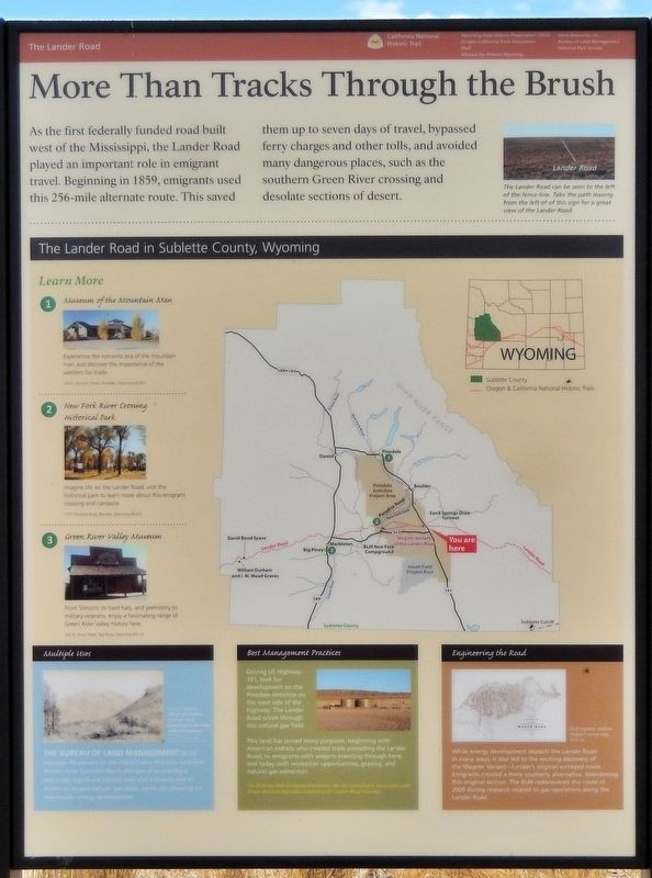
As the first federally funded road built west of the Mississippi, the Lander Road played an important role in emigrant travel. Beginning in 1859, emigrants used this 256-mile alternate route. This saved them up to seven days of travel, bypassed ferry charges and other tolls, and avoided many dangerous places, such as the southern Green River crossing and desolate sections of desert.
The Lander Road in Sublette County, Wyoming
Learn More
1. Museum of the Mountain Man
Experience the romantic era of the mountain man and discover the importance of the western fur trade.
2. New Fork River Crossing Historical Park
Imagine life on the Lander Road: visit the historical park to learn more about this emigrant crossing and campsite.
3. Green River Valley Museum
From Stetsons to hard hats, and prehistory to military veterans, enjoy a fascinating range of Green River Valley history here.
Multiple Uses
The Bureau of Land Management (BLM) manages 80 percent of the 198,037 acre Pinedale Anticline Project Area. Consider the challenges of protecting a nationally significant historic trail that transects one of America’s largest natural gas fields,
this page online
Best Management Practices
Driving US Highway 191, look for development on the Pinedale Anticline on the west side of the highway. The Lander Road winds through this natural gas field.
This land has served many purposes beginning with American Indians who created trails preceding the Lander Road; to emigrants with wagons traveling through here; and today with recreation opportunities, grazing, and natural gas extraction.
Engineering the Road
While energy development impacts the Lander Road in many ways, it also led to the exciting discovery of the Wagner Variant — Lander’s original surveyed route. Emigrants created a more southerly alternative, abandoning this original section. The BLM rediscovered this route in 2009 during research related to gas operations along the Lander Road.
Erected by Wyoming State Historic Preservation Office, Oregon-California Trails Association, Shell, and Alliance for Historic Wyoming.
Topics and series. This historical marker is listed in these topic lists: Indigenous Peoples and Communities • Roads & Vehicles • Settlements & Settlers.
Photographed by Cosmos Mariner, August 14, 2015
2. More Than Tracks Through the Brush Marker
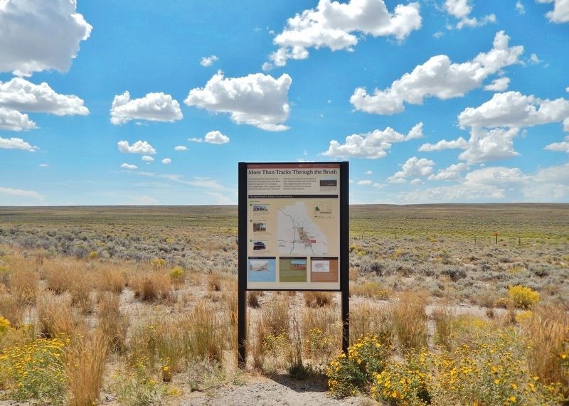
Looking west from US Highway 191. Traces of the Lander Road are visible beyond the marker.
Location. 42° 37.575′ N, 109° 39.527′ W. Marker is near Boulder, Wyoming, in Sublette County. It is on U.S. 191 1.9 miles north of State Highway 351, on the left when traveling north. The marker is in a pullout on the west side of US Highway 191. Touch for map. Marker is in this post office area: Boulder WY 82923, United States of America. Touch for directions.

Regionally, this marker is in Greater Yellowstone. It is also in the American Mountain West. Globally, it is in North America, the Rocky Mountains, the Western Hemisphere, the Western World, and the Anglosphere.
Other nearby markers. At least 8 other markers are within 10 miles of this marker, measured as the crow flies: Sand Springs - A Stop on the Oregon Trail (a few steps from this marker); “The Best Mountain Road in the West” (within shouting distance of this marker); To All Pioneers Who Passed This Way to Win and Hold the West (within shouting distance of this marker); Lieutenant J.C. Fremont's Week in Sublette County (approx. 9 miles away); New Fork River Crossing
Photographed by Cosmos Mariner, August 14, 2015
3. The Lander Road
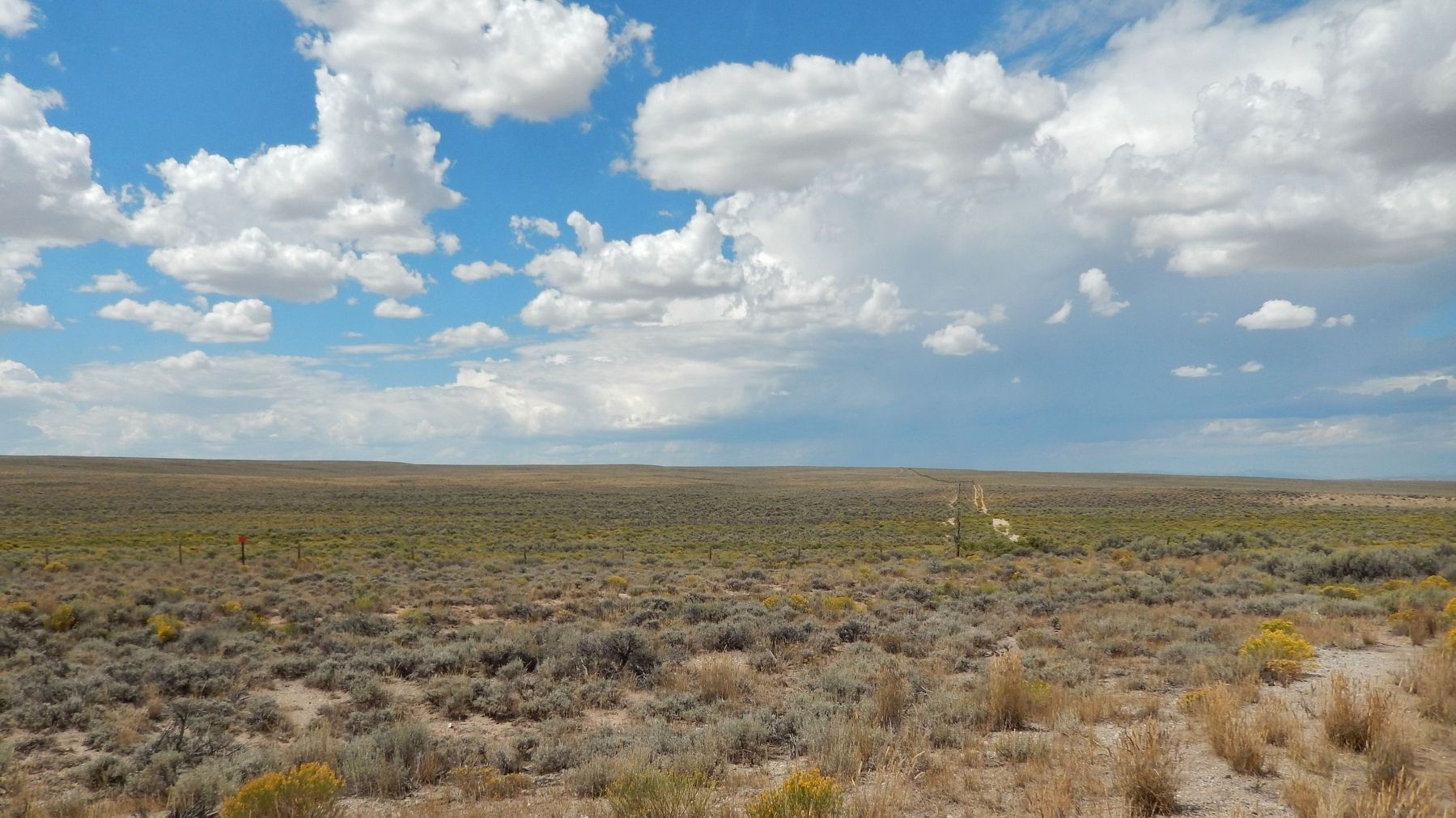
(photo caption from the marker:) The Lander Road can be seen to the left of the fenceline. Take the path leaving from the left of this sign for a great view of the Lander Road.
Also see . . . The Lander Road, California National Historic Trail (National Park Service).
Excerpt: The Lander Road, also known as the Lander Trail or Lander Cutoff, was the first US government-sponsored road for emigrants heading to Oregon and California. The Lander Road gave travelers on the Oregon Trail and the California Trail a straight path through the mountain ranges in southwestern Wyoming and southeastern Idaho.(Submitted on October 24, 2026, by Cosmos Mariner of Cape Canaveral, Florida.)
The Lander Road project started in 1857 when Frederick W. Lander was sent west from Washington, D.C. His assigned task was to survey several routes between Wyoming and Idaho for the purpose of reducing the length of the combined Oregon and California Trails. Lander selected the most suitable route and began its construction in 1858. Lander used a work crew of more than 100 people to build the road. In total, the workers moved over 80,000 tons of rock and soil, removed miles of timber and willows, and built several bridges. They also leveled the road the best they could for emigrants and their wagons. By using several existing Native American trails to reduce the workload, Lander and his work crew completed most of the work in 1858. Emigrant wagon trains actually began using the road before it was finished and continued to do so throughout the 1860s.
Today, the Lander Road is an official part of the California National Historic Trail. Parts of it still exist in local roads and state highways. Remnants of the actual road, in the form of trail ruts and swales, are visible in several locations.
Credits. This page was last revised on October 24, 2026. It was originally submitted on October 24, 2026, by Cosmos Mariner of Cape Canaveral, Florida. This page has been viewed 4 times since then. Photos: 1, 2, 3. submitted on October 24, 2026, by Cosmos Mariner of Cape Canaveral, Florida.
