Ball Ground in Cherokee County, Georgia — The American South (South Atlantic)
Battle of Taliwa
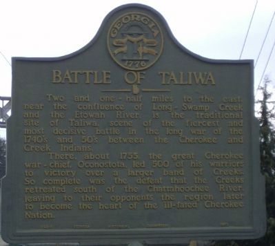
Photographed by David Tibbs, January 19, 2009
1. Battle of Taliwa Marker
Two and one-half miles to the east, near the confluence of Long-Swamp Creek and the Etowah River, is the traditional site of Taliwa, scene of the fiercest and most decisive battle in the long war of the 1740's and 50's between the Cherokee and Creek Indians.
There, about 1755, the great Cherokee war-chief, Oconostota, led 500 of his warriors to victory over a larger band of Creeks. So complete was the defeat that the Creeks retreated south of the Chattahoochee River, leaving to their opponents the region later to become the heart of the ill-fated Cherokee Nation.
Erected 1953 by Georgia Historic Marker. (Marker Number 028-1.)
Topics and series. This historical marker is listed in these topic lists: Indigenous Peoples and Communities • Wars, US Indian. In addition, it is included in the Georgia Historical Society series list. A significant historical year for this entry is 1755.
Location. Marker has been reported permanently removed. It was located near 34° 20.259′ N, 84° 22.558′ W. Marker was in Ball Ground, Georgia, in Cherokee County. It was at the intersection of Gilmer Ferry Road (Georgia Route 372) and
this page online
We have been informed that this marker is no longer there and will not be replaced. This page is an archival view of what was.
Regionally, this marker was in the Mountains and in Metro Atlanta. It was also in the American South, specifically in the Deep South, in Appalachia, and specifically in Southern Appalachia. Globally, it was in North America, the Western Hemisphere, the Western World, and the Anglosphere. Historically, it found itself in what was once the original Cherokee Nation, the territory of the Mississippian Culture, one of the original Thirteen Colonies, one of the Confederate States of America, and the Antebellum South.

Other nearby markers. At least 8 other markers are within 10 miles of this location, measured as the crow flies: Georgia Marble Company and the Village of Tate (approx. 5.3 miles away); John Tate (approx. 5.3 miles away); a different marker also named Old Federal Road (approx. 5.4 miles away); Poole's Mill Covered Bridge
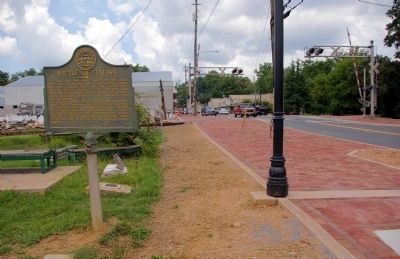
Photographed by David Seibert, August 13, 2009
2. Battle of Taliwa Marker
Looking west on Georgia Highway 372 in Ball Ground
Other markers no longer nearby. Old Federal Road (was approx. 5.3 miles away but has been replaced with another marker now near it); Fort Buffington (was approx. 7.1 miles away but has been confirmed missing).
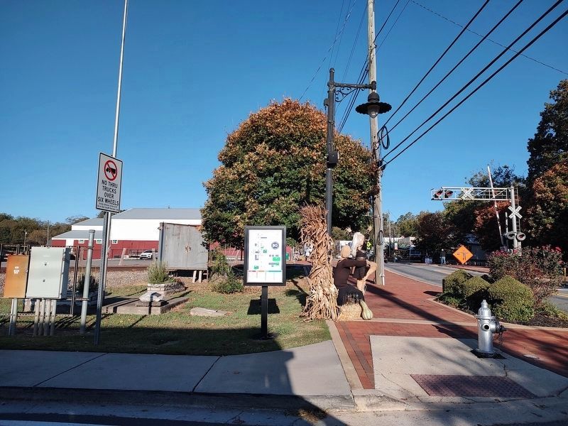
Photographed by Jimmy Emerson, October 25, 2026
3. Battle of Taliwa Marker
The marker had been in front of the concrete slab by the small plaque on the concrete base in the ground.
Credits. This page was last revised on November 3, 2026. It was originally submitted on January 20, 2009, by David Tibbs of Resaca, Georgia. This page has been viewed 3,686 times since then and 133 times this year. Last updated on October 25, 2026, by Jimmy Emerson of Dalton, Georgia. Photos: 1. submitted on January 20, 2009, by David Tibbs of Resaca, Georgia. 2. submitted on August 16, 2009, by David Seibert of Sandy Springs, Georgia. 3. submitted on October 25, 2026, by Jimmy Emerson of Dalton, Georgia. • Devry Becker Jones was the editor who published this page.
