Port Melbourne in Port Phillip, Victoria, Australia — Oceania
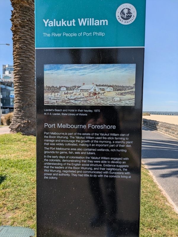
Port Melbourne Foreshore
| — | Yalukut Willam - The River People of Port Phillip | — |
Photographed by Dean Barton-Ancliffe, September 29, 2026
1. Port Melbourne Foreshore Marker
The Port Melbourne area also contained wetlands, rich hunting grounds for game, fish, eels and tubers.
In the early days of colonisation the Yalukut Willam engaged with the colonists, demonstrating that they were able to develop an understanding of the English social structure. Evidence suggests that the leaders of the Boon Wurrung, and their neighbours, the Woi Wurrung, negotiated and communicated with Europeans with power and authority. They had little to do with the convicts living at the colony.
(Rear of Marker)
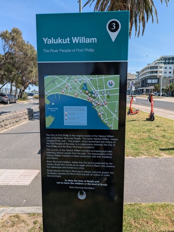
The City of Port Phillip is the original estate of the Yalukut Willam clan of the Boon Wurrung People. The name Yalukut Willam, means "people of the river". This project, which remembers the history of the First People of the area, is a collaboration between the City of Port Phillip and the Boon Wurrung Foundation.
The country of the Yalukut
this page online
Boon Wurrung tradition, states that the land is protected by the creator Bunjil who travels as an eagle and by Waarn who protects the waterways and travels as a crow.
Bunjil teaches the Boon Wurrung to always welcome guests, but he always requires the Boon Wurrung ask all visitors to make two promises:
to obey the laws of Bunjil; and not to harm the children or the land of Bunjil.
Boon Wurrung Foundation
Erected by City of Port Phillip. (Marker Number 3.)
Topics. This historical marker is listed in these topic lists: Colonial Era • Indigenous Peoples and Communities • Settlements & Settlers. A significant historical year for this entry is 1875.
Location. 37° 50.594′ S, 144° 56.274′ E. Marker is in Port Melbourne, Victoria, in Port Phillip. It is at the intersection of Beach Street (Victoria Route 33) and Bay Street ( Route 30), on the left when traveling west on Beach Street. Touch for map. Marker is at or near this postal address:
Photographed by Dean Barton-Ancliffe, September 29, 2026
2. Port Melbourne Foreshore Rear of Marker

Regionally, it is in Oceania, in Australasia, in the Pacific Ocean, in South Pacific, on the Pacific Rim, in the Western World, and in the Anglosphere. Historically, it finds itself in what was once a British colony.
Other nearby markers. At least 8 other markers are within walking distance of this marker: Sandridge Town Pier (here, next to this marker); Great War Drinking Fountain Memorial Port Melbourne (within shouting distance of this marker); War Memorial Port Melbourne (within shouting distance of this marker); The Liardet Memorial (about 120 meters away, measured in a direct line); Answering the Call - Naval Heritage Foundation (about 150 meters away); Neptune (about 180 meters away); The Sandridge Hotel (about 210 meters away); World War I Rotunda Memorial Port Melbourne (about 240 meters away). Touch for a list and map of all markers in Port Melbourne.
Credits. This page was last revised on October 26, 2026. It was originally submitted on October 25, 2026, by Dean Barton-Ancliffe of Rowville, Victoria. This page has been viewed 13 times since then. Photos: 1, 2. submitted on October 25, 2026, by Dean Barton-Ancliffe of Rowville, Victoria. • Andrew Ruppenstein was the editor who published this page.
