Koblenz-Ehrenbreitstein , Rhineland-Palatinate, Germany — Central Europe
Der Mensch wird sesshaft
⎯⎯⎯
People Adopt a Settled Way of Life
Photographed by James Hulse, October 3, 2026
1. Der Mensch wird sesshaft / People Adopt a Settled Way of Life Marker

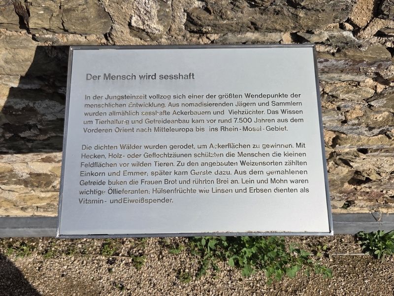
In der Jungsteinzeit vollzog sich einer der größten Wendepunkte der menschlichen Entwicklung. Aus nomadisierenden Jägern und Sammlern wurden allmählich sesshafte Ackerbauern und Viehzüchter. Das Wissen um Tierhaltung und Getreideanbau kam vor rund 7.500 Jahren aus dem Vorderen Orient nach Mitteleuropa bis ins Rhein-Mosel-Gebiet.
Die dichten Wälder wurden gerodet, um Ackerflächen zu gewinnen. Mit Hecken, Holz- oder Geflechtzäunen schützten die Menschen die kleinen Feldflächen vor wilden Tieren. Zu den angebauten Weizensorten zählten Einkorn und Emmer; später kam Gerste dazu. Aus dem gemahlenen Getreide buken die Frauen Brot und rührten Brei an. Lein und Mohn waren wichtige Öllieferanten; Hülsenfrüchte wie Linsen und Erbsen dienten als Vitamin- und Eiweißspender.
People Adopt a Settled Way of Life
One of the greatest turning points in human development occurred during the Neolithic period. Nomadic hunters and gatherers gradually became settled crop farmers and livestock breeders. Knowledge of animal husbandry and grain cultivation reached Central Europe, including
this page online
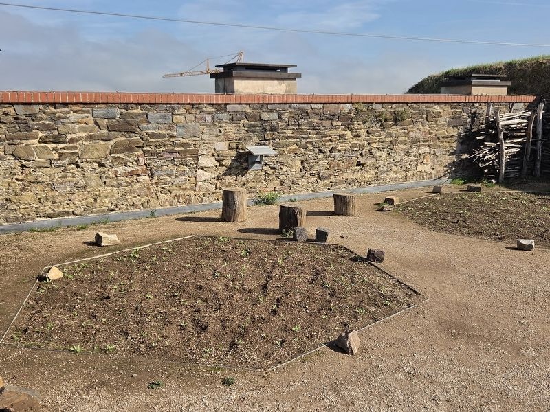
Dense forests were cleared to create farmland. People protected their small fields from wild animals using hedges, wooden fences or woven fencing. The wheat varieties grown included einkorn and emmer; barley was added later. Women used ground grain to bake bread and prepare porridge. Flax and poppies were important sources of oil, while legumes such as lentils and peas supplied vitamins and protein.
Topics. This historical marker is listed in these topic lists: Agriculture • Animals • Food & Drink • Indigenous Peoples and Communities.
Location. 50° 21.879′ N, 7° 36.991′ E. Marker is in Koblenz, Rheinland-Pfalz (Rhineland-Palatinate). It is in Koblenz-Ehrenbreitstein. It is on Greiffenklaustraße 2 kilometers west of Friesenstraße. The marker is located on the grounds of the Ehrenbreitstein Fortress. Touch for map. Marker is in this post office area: Koblenz RP 56077, Germany. Touch for directions.

Regionally, this marker is in the German Rhineland, in the Upper Middle Rhine Valley, and specifically
Photographed by James Hulse, October 3, 2026
2. Der Mensch wird sesshaft / People Adopt a Settled Way of Life Marker
Other nearby markers. At least 8 other markers are within walking distance of this marker: Ein Garten der Römerzeit (a few steps from this marker); Historische Zeitgärten / Historical Period Gardens (within shouting distance of this marker); Ein mittelalterlicher Bauerngarten / A Medieval Cottage Garden (within shouting distance of this marker); Ein 50er Jahre Garten / A 1950s Garden (within shouting distance of this marker); Brunnendenkmal / Fountain Monument (about 210 meters away, measured in a direct line); Preußische Festung Coblenz und Ehrenbreitstein / Prussian Fortress of Coblenz and Ehrenbreitstein (about 240 meters away); Demokratischer Widerstand Junger Menschen zu Allen Zeiten (approx. 0.8 kilometers away); Gegen das Vergessen des Unrechts der Sed-Diktatur (approx. 0.8 kilometers away). Touch for a list and map of all markers in Koblenz.
More about this marker.
Photographed by James Hulse, October 3, 2026
3. Der Mensch wird sesshaft / People Adopt a Settled Way of Life Marker
Credits. This page was last revised on October 26, 2026. It was originally submitted on October 25, 2026, by James Hulse of Medina, Texas. This page has been viewed 3 times since then. Photos: 1, 2, 3. submitted on October 26, 2026, by James Hulse of Medina, Texas.
