Valparaiso in Porter County, Indiana — The American Midwest (Great Lakes)
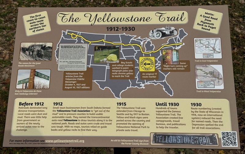
The Yellowstone Trail 1912-1930
The first coast-to-coast auto route across the northern tier of states
| — | Motto: A Good Road from Plymouth Rock to Puget Sound | — |
Photographed by Lou Donkle, October 26, 2026
1. The Yellowstone Trail 1912-1930 Marker
Before 1912
Railroads dominated long distance transportation. Local roads were dust and mud. There was little help from the government so owners of the newly arrived autos rose to the challenge.
1912
Small town businessmen from South Dakota formed the Yellowstone Trail Association to “get out of the mud” and to pressure counties to build usable automobile roads. They named it the transcontinental auto road Yellowstone to draw tourists along it to the national park. Roads and autos were crude and travel was tough. With no maps tourists relied on guidebooks and yellow rocks to find their way.
1915
The Yellowstone Trail was extended from Chicago to Seattle and by 1917 to Boston. Yellow and black signs were posted across the country and promoted the opening of Yellowstone National Park to private auto travel.
Until 1930
Hundreds of towns supported the famous Yellowstone Trail. The Association created free campgrounds, travel bureaus, and publications to help the traveler.
1930
Route numbering (created by the State of Wisconsin in 1918, now an international system) reduced the need for named roads. Then the Depression
this page online
[Captions:]
• The reason for the Good Roads Movement
• Only in Valparaiso do these two roadways intersect
• Boy Scouts and college students worked to paint telegraph poles and rocks chrome yellow to mark the Trail
• An original YT route marker
• Some “Right turn coming up” markers still remain
• Trail in East Valparaiso
• Trail in West Valparaiso
• An old tin Yellowstone Trail sign from the Porter County Museum
• Valparaiso Vidette Messenger October 4, 1927
Yellowstone Trail Route to be Turned Back as a Unit of Porter County Highway System
Porter county will soon have another addition to Its county road system. It is the Yellowstone Trail, turned over to the Indiana State Highway commission some years ago as a part of the state system. Now that the Yellowstone, or more commonly known as State Road 30, has been relocated by way of Main Street, the state is anxious to be rid of the maintenance cost which is a considerable burden on the highway funds.
Just when the giving-back ceremony will take place is not known. Joseph Crowe, county highway superintendent, is expected to add it to the 425 miles of county road, and will endeavor to maintain it from the $90,000 gravel road fund, of which $9,000 goes to the City of Valparaiso. Appearing at the tax hearing yesterday at the county commissioners' room, Superintendent Crowe said the average maintenance cost of Porter county roads was $256 per mile. This is in comparison with the state highway commission's figures on the Hebron road of $800 per mile, and from $1,000 to $1,200 per mile on more heavily traveled highways.
• Valparaiso Vidette Messenger August 10, 1927
Mr. and Mrs. Dorman Entertain Group By Social Evening
Mr. and Mrs. Ulery Dorman of Academy Street entertained a group of friends at their home last evening. Bridge was played, after which the guests were regaled with the season's delicacies. Mr. Dorman, the host, will be remembered as the state highway commission's chief engineer on the new state highway known as the Yellowstone Trail. And in the language of the society editor, 'everyone enjoyed a pleasant evening.'
For
Photographed by Lou Donkle, October 29, 2026
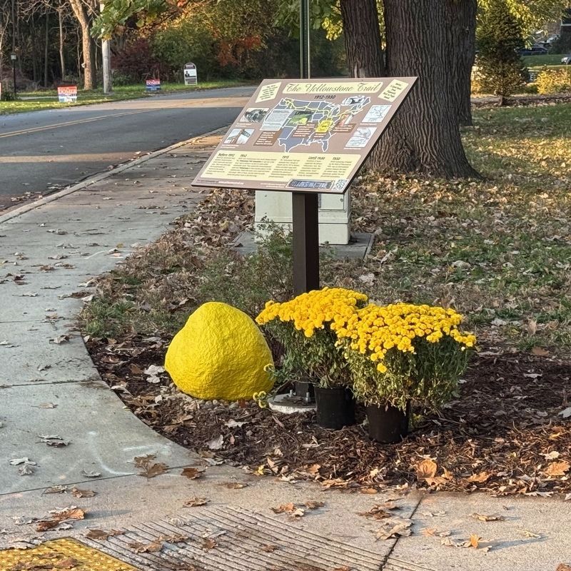
2. Marker and "Yellow Stone" at Northeast Corner of Yellowstone Rd. and Park Ave.
Credits: John & Alice Ridge 2006, 2012, & 2017
Erected 2026 by Jessee-Pifer Neighborhood Group, City of Valparaiso.
Topics. This historical marker is listed in these topic lists: Charity & Public Work • Industry & Commerce • Parks & Recreational Areas • Roads & Vehicles. A significant historical year for this entry is 1912.
Location. 41° 28.429′ N, 87° 4.536′ W. Marker is in Valparaiso, Indiana, in Porter County. It is at the intersection of Yellowstone Road and Park Avenue, on the right when traveling north on Yellowstone Road. Touch for map. Marker is at or near this postal address: 610 Yellowstone Road, Valparaiso IN 46385, United States of America. Touch for directions.

Regionally, this marker is in Northwest Indiana and in the Calumet Region. It is also in the American Midwest and in the Corn Belt. Globally, it is in North America, on the Great Lakes, in the Western Hemisphere, in the Western World, and in the Anglosphere. Historically, it finds itself in what was once the territory of the Mississippian Culture and also the Northwest Territory.
Other nearby markers. At
Photographed by Lou Donkle, October 26, 2026
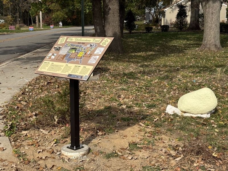
3. Marker and "Yellow Stone" at Northeast Corner of Yellowstone Rd. and Park Ave.
Note - Photo is before landscaping and permanent location of the Yellow Stone.
Also see . . . Welcome to the Yellowstone Trail Association. The official Yellowstone Trail Association website.
Established when roads were still wagon routes and automobiles were rare, the Yellowstone Trail helped transform America from the age of railroads to the era of highways.(Submitted on October 29, 2026, by Lou Donkle of Valparaiso, Indiana.)
Much of the Yellowstone Trail still exists today. Our Travel Guide and Travel Map sections will assist you while traveling the Yellowstone Trail!
Credits. This page was last revised on November 3, 2026. It was originally submitted on July 6, 2026, by Lou Donkle of Valparaiso, Indiana. This page has been viewed 72 times since then. Last updated on October 28, 2026, by Lou Donkle of Valparaiso, Indiana. Photos: 1. submitted on October 26, 2026, by Lou Donkle of Valparaiso, Indiana. 2. submitted on October 29, 2026, by Lou Donkle of Valparaiso, Indiana. 3. submitted on October 26, 2026, by Lou Donkle of Valparaiso, Indiana. • Devry Becker Jones was the editor who published this page.
