Blackrock near Independence in Inyo County, California — The American West (Pacific Coastal)
The March of 1863
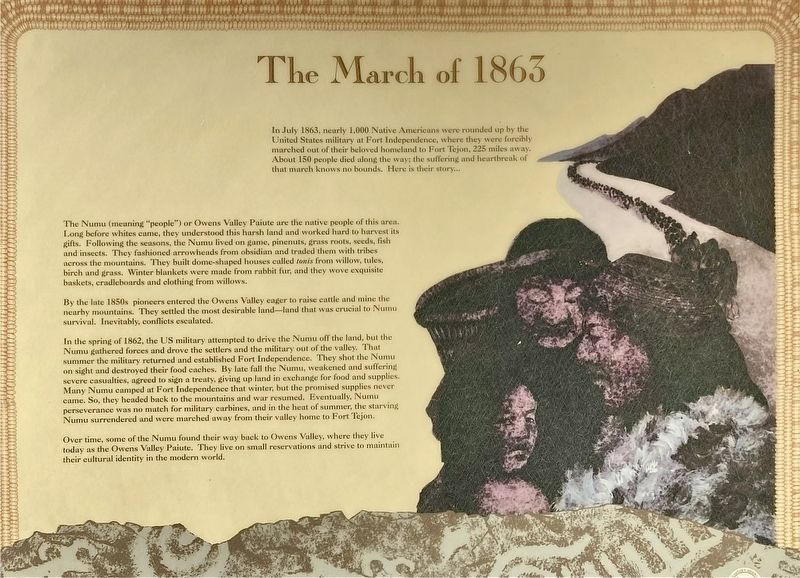
Photographed by Craig Baker
1. The March of 1863 Marker
In July 1863, nearly 1,000 Native Americans were rounded up by the United States military at Fort Independence, where they were forcibly marched out of their beloved homeland to Fort Tejon, 225 miles away. About 150 people died along the way; the suffering and heartbreak of that march knows no bounds. Here is their story....
The Numu (meaning "people") or Owens Valley Paiute are the native people of this area. Long before whites came, they understood this harsh land and worked hard to harvest its gifts. Following the seasons, the Numu lived on game, pinenuts, grass roots, seeds, fish and insects. They fashioned arrowheads from obsidian and traded them with tribes across the mountains. They built dome-shaped houses called tonis from willow, tules, birch and grass. Winter blankets were made from rabbit fur, and they wove exquisite baskets, cradleboards and clothing from willows.
By the late 1850s pioneers entered the Owens Valley eager to raise cattle and mine the nearby mountains. They settled the most desirable land — land that was crucial to Numu survival. Inevitably, conflicts escalated.
this page online
In the spring of 1862, the US military attempted to drive the Numu off the land, but the Numu gathered forces and drove the settlers and the military out of the valley. That summer the military returned and established Fort Independence. They shot the Numu on sight and destroyed their food caches. By late fall the Numu, weakened and suffering severe casualties, agreed to sign a treaty, giving up land in exchange for food and supplies. Many Numu camped at Fort Independence that winter, but the promised supplies never came. So, they headed back to the mountains and war resumed. Eventually, Numu perseverance was no match for military carbines, and in the heat of summer, the starving Numu surrendered and were marched away from their valley home to Fort Tejon.
Over time, some of the Numu found their way back to Owens Valley, where they live today as the Owens Valley Paiute. They live on small reservations and strive to maintain their cultural identity in the modern world.
Topics. This historical marker is listed in these topic lists: Civil Rights • Indigenous Peoples and Communities. A significant historical month for this entry is July 1863.
Location. 36° 56.74′ N,
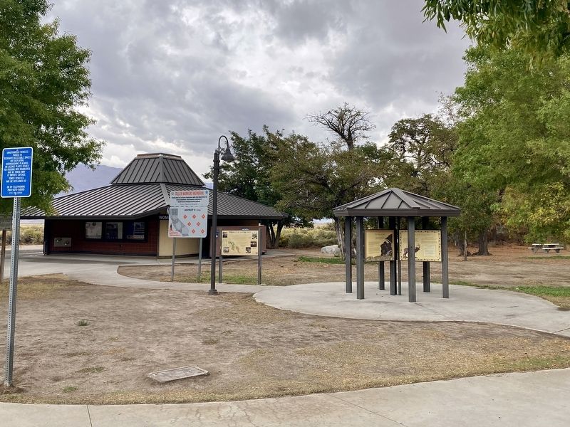
Photographed by Craig Baker, October 21, 2026
2. The March of 1863 Marker

Regionally, this marker is in the Sierra Nevada. It is also in the American Mountain West. Globally, it is in North America, on the Ring of Fire, on the Pacific Rim, in the Western Hemisphere, in the Western World, and in the Anglosphere. Historically, it finds itself in what was once New Spain and also Mexico’s Alta California.
Other nearby markers. At least 8 other markers are within 11 miles of this marker, measured as the crow flies: Los Angeles Aqueduct Intake (approx. 2.2 miles away); Los Angeles Aqueduct (approx. 2.6 miles away); Oak Creek Community Park (approx. 7.3 miles away); Camp Independence (approx. 7.8 miles away); Mt. Whitney Fish Hatchery (approx. 7.9 miles away); Historic Independence (approx. 9.9 miles away); Inyo County Courthouse
Photographed by Craig Baker, October 21, 2026
3. Division Creek Rest Area, Est. 1966
More about this marker. Other panels describe Indigenous irrigation, Tule Elk, and Water in the Owens Valley.
Credits. This page was last revised on October 30, 2026. It was originally submitted on October 30, 2026, by Craig Baker of Sylmar, California. This page has been viewed 15 times since then. Photos: 1, 2, 3. submitted on October 30, 2026, by Craig Baker of Sylmar, California.
