Dayton's Bluff in Saint Paul in Ramsey County, Minnesota — The American Midwest (Upper Plains)
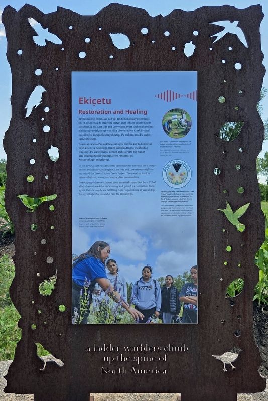
Ekic̣etu
Restoration and Healing
Photographed by McGhiever, June 13, 2026
1. Ekic̣etu Marker

Daḳota ekta wic̣oḣ'aŋ uŋkiṭawapi kiŋ he maḳoc̣e kiŋ ded aiḳoyake héuŋ kawitaya nauŋżiŋpi. Daḳod winuḣcadaŋ k'a wic̣aḣcadaŋ wóyakapi k'a wawokiyapi. Dehaŋn Daḳota oyate kiŋ Waḳaŋ Ṭípi awaŋyaŋkapi ic'ic̣uŋzapi. Hena "Waḳaŋ Ṭípi Awaŋyaŋkapi" ewic̣akiyapi.
East Side k'a Lowertown etaŋhaŋ ṭéca k'a nakuŋ umag kena iyuŋwiŋc̣odaŋ maḳoc̣e kiŋ de ekic̣etupi k'a ḣtanipi.
In the 1990s, Saint Paul residents came together to repair the damage caused by industry and neglect. East Side and Lowertown neighbors organized the Lower Phalen Creek Project. They worked hard to restore the land, water, and native plant communities.
Daḳota people have reclaimed their ancestral connection here. Tribal elders have shared the site's history and guided its restoration. Once again, Daḳota people are fullfilling [sic] their responsibility was Waḳaŋ Ṭípi Awaŋyaŋkapi: the ones who care for Waḳaŋ Ṭípi.
up the spine of
North America
Topics.
this page online
Location. 44° 57.135′ N, 93° 4.447′ W. Marker is in Saint Paul, Minnesota, in Ramsey County. It is in Dayton's Bluff. It can be reached from the intersection of Commercial Street and 4th Street E.. The marker is southeast of the Waḳaŋ Ṭípi Center. Touch for map. Marker is at or near this postal address: 590 4th Street E, Saint Paul MN 55106, United States of America. Touch for directions.

Regionally, this marker is in the Twin Cities Metropolitan Area. It is also in the American Midwest, in the Corn Belt, and in the Great River Road Region. Globally, it is in North America, the Western Hemisphere, the Western World, and the Anglosphere. Historically, it finds itself in what was once Rupert’s Land, the territory of the Mississippian Culture, and the Louisiana Purchase.
Other nearby markers. At least 8 other markers are within walking distance of this marker: Maḳoc̣e Ṭueŋḣiŋdapi (here,
Photographed by McGhiever, June 13, 2026
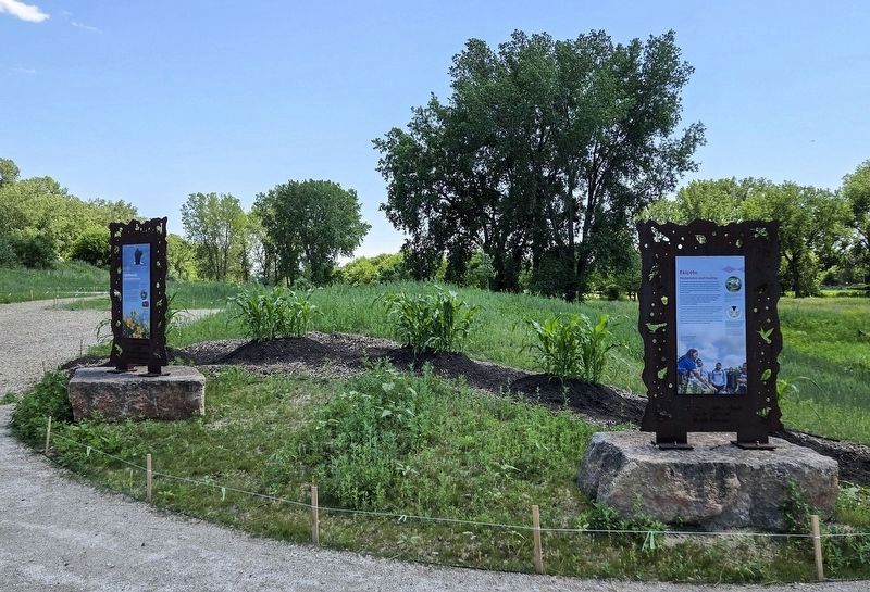
2. Ekic̣etu Marker (right) at the head of the trails into Waḳaŋ Ṭípi
Other markers no longer nearby. A time of environmental and cultural change (was within shouting distance of this marker but has been permanently removed); Preserving history on the land (was within shouting distance of this marker but has been permanently removed); Dakota life along Wakpa Tanka (was within shouting distance of this marker but has been permanently removed); Nature and history in the Phalen Creek valley (was within shouting distance of this marker but has been permanently removed).
Credits. This page was last revised on October 31, 2026. It was originally submitted on October 31, 2026, by McGhiever of Minneapolis, Minnesota. This page has been viewed 15 times since then. Photos: 1. submitted on October 31, 2026, by McGhiever of Minneapolis, Minnesota. 2. submitted on October 6, 2026, by McGhiever of Minneapolis, Minnesota.
