Near Homer in Dakota County, Nebraska — The American Midwest (Upper Plains)
Fish Camp
| — | Lewis and Clark National Historic Trail | — |
Photographed by Cosmos Mariner, August 24, 2022
1. Fish Camp Marker
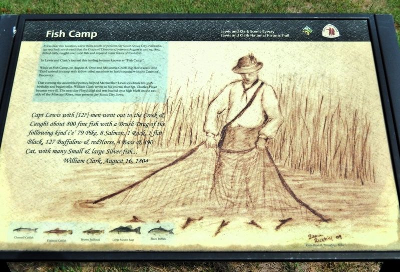
It was near this location, a few miles south of present day South Sioux City, Nebraska, (as you look north east) that the Corps of Discovery, between August 13 and 19, 1804 fished daily, caught over 1,100 fish and enjoyed many feasts of fresh fish.
In Lewis and Clark's journal this landing became known as “Fish Camp”.
While at Fish Camp, on August 18, Otoe and Missouria Chiefs Big Horse and Little Thief arrived in camp with fellow tribal members to hold counsel with the Corps of Discovery.
That evening the assembled parties helped Meriwether Lewis celebrate his 30th birthday and began talks. William Clark wrote in his journal that Sgt. Charles Floyd became very ill. The next day Floyd died and was buried on a high bluff on the east side of the Missouri River, near present day Sioux City, Iowa.
Capt Lewis with [12?] men when out to the Creek & Caught about 800 fine fish with a Brush Drag of the following kind i’e’ 79 Pike, 8 Salmon, 1 Rock, 1 flat Black, 127 Buffalow & redhorse, 4 Bass, & 490 Cat, with many Small and large Silver fish…
—William Clark, August 16, 1804
Channell Catfish • Flathead Catfish • Brown Bullhead • Large Mouth Bass • Black Buffalo
Erected by Lewis
this page online
Topics and series. This historical marker is listed in these topic lists: Exploration • Indigenous Peoples and Communities • Waterways & Vessels. In addition, it is included in the Lewis & Clark Expedition series list. A significant historical date for this entry is August 18, 1804.
Location. 42° 21.257′ N, 96° 27.792′ W. Marker is near Homer, Nebraska, in Dakota County. It is on U.S. 77 one mile north of 225th Street, on the right when traveling north. The marker is in an interpretive wayside on the east side of the highway. Touch for map. Marker is in this post office area: Homer NE 68030, United States of America. Touch for directions.

Regionally, this marker is in Eastern Nebraska. It is also in the American Midwest, in the Lewis & Clark Corridor, in the Corn Belt, and on the prairies. Globally, it is in North America, the Western Hemisphere, the Western World, and the Anglosphere. Historically, it finds itself in what was once the Louisiana Purchase.
Other nearby markers. At least 8 other markers are within 6 miles of this marker, measured as the crow
Photographed by Cosmos Mariner, August 24, 2022
2. Fish Camp Marker
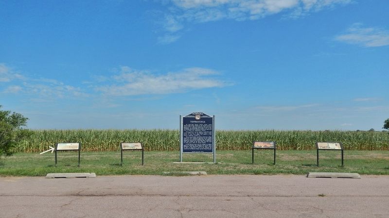
This is marker is the leftmost of four interpretive panels alongside the Nebraska State Historical Society “Tonwantonga” marker at this wayside.
Also see . . .
1. Journals of the Lewis & Clark Expedition, August 16, 1804. (Submitted on November 2, 2026, by Cosmos Mariner of Cape Canaveral, Florida.)
2. Journals of the Lewis & Clark Expedition, August 19, 1804.
Excerpt: [Clark] “Sergt. Floyd was taken violently bad with the Beliose Cholick and is dangerously ill — we attempt in Vain to releive him, I am much concerned for his Situation — we could get nothing to Stay on his Stomach a moment — nature appear exosting fast in him — every man is attentive to him”(Submitted on November 2, 2026, by Cosmos Mariner of Cape Canaveral, Florida.)
Credits. This page was last revised on November 2, 2026. It was originally submitted on October 31, 2026, by Cosmos Mariner of Cape Canaveral, Florida. This page has been viewed 10 times since then. Photos: 1, 2. submitted on November 2, 2026, by Cosmos Mariner of Cape Canaveral, Florida.
