Winnebago in Thurston County, Nebraska — The American Midwest (Upper Plains)
Relocation of the Winnebago People
Photographed by Cosmos Mariner, August 24, 2022
1. Relocation of the Winnebago People Marker
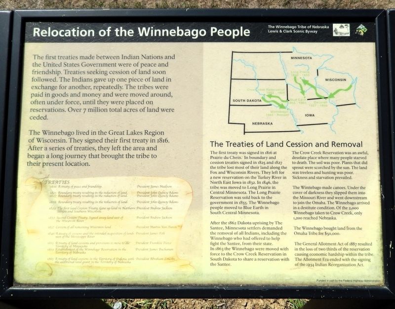
The first treaties made between Indian Nations and the United States Government were of peace and friendship. Treaties seeking cession of land soon followed. The Indians gave up one piece of land in exchange for another, repeatedly. The tribes were paid in goods and money and were moved around, often under force, until they were placed on reservations. Over 7 million total acres of land were ceded.
The Winnebago lived in the Great Lakes Region of Wisconsin. They signed their first treaty in 1816. After a series of treaties, they left the area and began a long journey that brought the tribe to their present location.
The Treaties of Land Cession and Removal
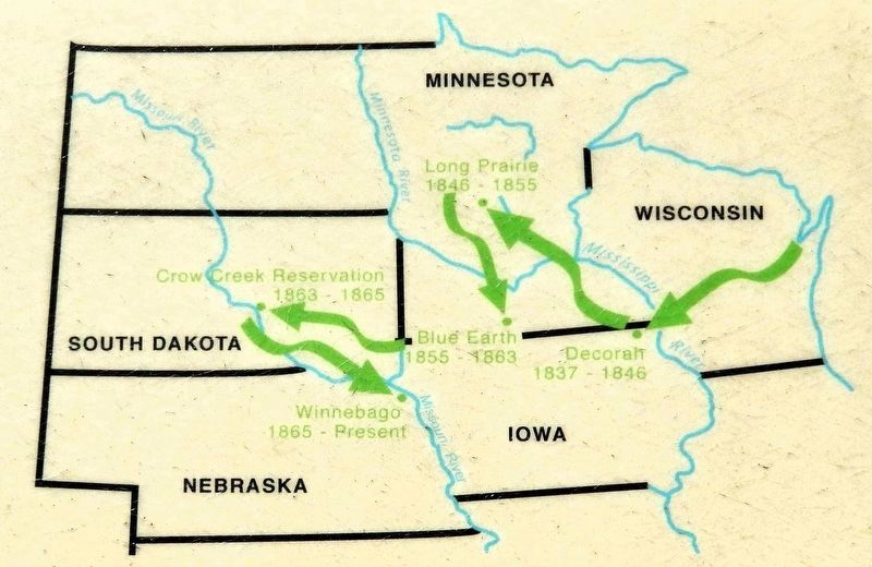
The first treaty was signed in 1816 at Prairie du Chein. In boundary and cession treaties signed in 1825 and 1827 the tribe lost most of their land along the Fox and Wisconsin Rivers. They left for a new reservation on the Turkey River in North East Iowa in 1832. In 1846, the tribe was moved to Long Prairie in Central Minnesota. The Long Prairie Reservation was sold back to the government in 1855. The Winnebago people moved to Blue Earth in South Central Minnesota.
After
this page online
The Crow Creek Reservation was an awful, desolate place where many people starved to death. The soil was poor. Plants that did sprout were scorched by the sun. The land was treeless and hunting was poor. Sickness and starvation prevailed.
The Winnebago made canoes. Under the cover of darkness they slipped them into the Missouri River and went downstream to join the Omaha. The Winnebago arrived in a destitute condition. Of the 2,000 Winnebago taken to Crow Creek, only 1,200 reached Nebraska.
The Winnebago bought land from the Omaha Tribe for $50,000.
The General Allotment Act of 1887 resulted in the loss of two thirds of the reservation causing economic hardship within the tribe. The Allotment Era ended with the signing of the 1934 Indian Reorganization Act.
Treaties
1816 — A treaty of peace and friendship. President James Madison
1825
2. Marker detail: Relocation Map
1827 — Boundary treaty resulting in the reduction of land. President John Quincy Adams
1828 — Boundary treaty resulting in the reduction of land. President John Quincy Adams
1829 — The first land Cession Treaty. Gave up land in Northern Illinois and Southern Wisconsin. President Andrew Jackson
1832 — Second Cession Treaty. Signed away land east of the Wisconsin River. President Andrew Jackson
1837 — Cession of all remaining Wisconsin land. President Martin Van Buren
1846 — A treaty of cessions and the intended acquisition of lands west of the Mississippi River. President James Polk
1855 — A treaty of land cessions and provisions to move to the Territory of Minnesota. President Franklin Pierce
1859 — Establishment of the Winnebago Reservation in the Territory of Nebraska. President James Buchanan
1865 — A treaty of land cessions in the Territory of Dakota, with the additional land grant in the Territory of Nebraska. President Abraham Lincoln
Erected by Lewis & Clark Scenic Byway and Federal Highway Administration.
Topics. This historical marker is listed
Photographed by Cosmos Mariner, August 24, 2022
3. Relocation of the Winnebago People Marker
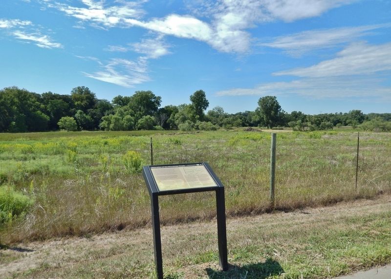
Location. 42° 14.737′ N, 96° 28.374′ W. Marker is in Winnebago, Nebraska, in Thurston County. It is on U.S. 75/77 ¼ mile north of Saint Augustine Drive (C Avenue), on the left when traveling north. The marker is a pull-out/wayside on the west side of the highway. Touch for map. Marker is at or near this postal address: 215 US Highway 77, Winnebago NE 68071, United States of America. Touch for directions.

Regionally, this marker is in Eastern Nebraska. It is also in the American Midwest, in the Lewis & Clark Corridor, in the Corn Belt, and on the prairies. Globally, it is in North America, the Western Hemisphere, the Western World, and the Anglosphere. Historically, it finds itself in what was once the Louisiana Purchase.
Other nearby markers. At least 8 other markers are within 8 miles of this marker, measured as the crow flies: Winnebago Scouts (here, next to this marker); Combs School (approx. 3½ miles away); Susan LaFlesche Picotte Memorial Hospital (approx. 6½ miles
Photographed by Cosmos Mariner, August 24, 2022
4. Relocation of the Winnebago People Marker
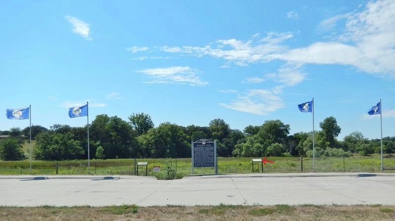
Looking west from US Highway 75/77. This marker is the rightmost of three related markers at the wayside.
Credits. This page was last revised on November 1, 2026. It was originally submitted on November 1, 2026, by Cosmos Mariner of Cape Canaveral, Florida. This page has been viewed 8 times since then. Photos: 1, 2, 3, 4. submitted on November 1, 2026, by Cosmos Mariner of Cape Canaveral, Florida.
