Fort Leonard Wood in Pulaski County, Missouri — The American Midwest (Upper Plains)
The Berlin Wall
Photographed by Marc Hayot, October 30, 2026
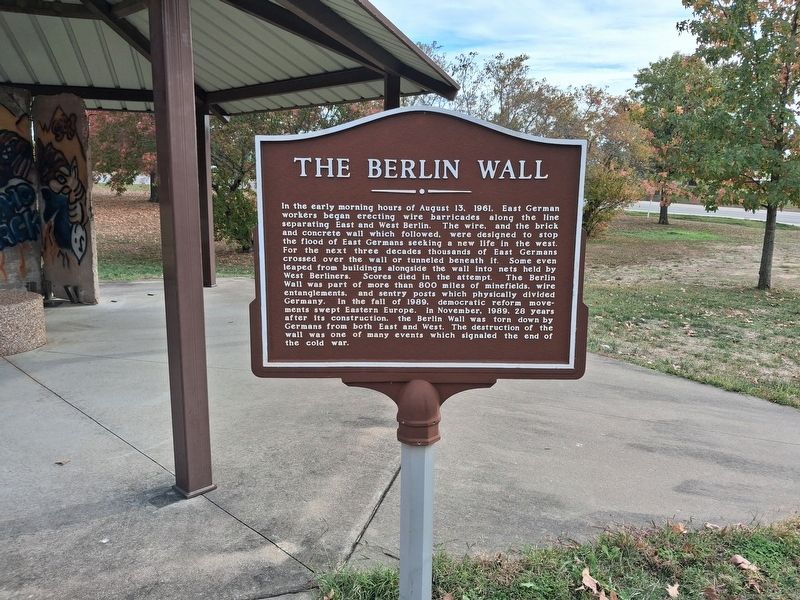
1. The Berlin Wall Marker
In the early morning hours of August 13, 1961, East German workers began erecting wire barricades along the line separating East and West Berlin. The wire, and the brick and concrete wall which followed, were designed to stop the flood of East Germans seeking a new life in the west. For the next three decades thousands of East Germans crossed over the wall or tunneled beneath it. Some even leaped from buildings alongside the wall into nets held by West Berliners. Scores died in the attempt. The Berlin Wall was part of more than 800 miles of minefields, wire entanglements, and sentry posts which physically divided Germany. In the fall of 1989, democratic reform movements swept Eastern Europe. In November, 1989, 28 years after its construction, the Berlin Wall was torn down by Germans from both East and West. The destruction of the wall was one of many events which signaled the end of the cold war.
Erected 2015 by U.S. Army.
Topics and series. This memorial is listed in these topic lists: Man-Made Features • War, Cold. In addition, it is included in the Berlin Wall series list. A significant historical date for this entry is November 9, 1989.
Location. 37° 44.718′ N,
this page online

Regionally, this memorial is in South-Central Missouri. It is also in the American Ozarks, in the Lewis & Clark Corridor, and in the Corn Belt. Globally, it is in North America, the Western Hemisphere, the Western World, and the Anglosphere. Historically, it finds itself in what was once the territory of the Mississippian Culture, the Louisiana Purchase, and the Antebellum South.
Other nearby markers. At least 8 other markers are within 6 miles of this marker, measured as the crow flies: 75th Infantry Division (approx. 0.7 miles away); The Trailblazers (approx. ¾ mile away); Welcome to St. Roberts (approx. 5.6 miles away); Alura Motel (approx. 5.6 miles away); "Grow With Us" (approx. 5.6 miles away); Skyline Garage Auto Service (approx. 5.6 miles away); George M. Reed
Photographed by Marc Hayot, October 30, 2026
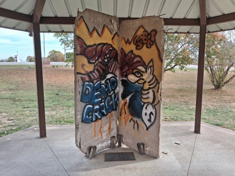
2. The Berlin Wall piece
Regarding The Berlin Wall. The Berlin Wall was constructed in 1961 and remained as a barrier that divided Berlin's east and west areas until the wall was torn down in 1989. Pieces of the wall have been brought to the United States and erected in different states.
Also see . . .
1. Berlin Wall. This link from History.com provides a history of the Berlin Wall from construction until it was torn down.
The Berlin Wall was constructed in 1961 by communist East Germany as a supposed "antifascist bulwark," though it served mainly to prevent East Germans from defecting to the West.(Submitted on November 1, 2026, by Marc Hayot of Siloam Springs, Arkansas.)
2. Berlin Wall at Fort Leonard Wood. This blog provides a brief history of the Berlin Wall fragment at Fort Leonard Wood.
Although I have visited Berlin in the past, it has been several years. On a visit to Fort Leonard Wood, it was neat to see that a piece of German Cold War history has been preserved right here in Missouri.(Submitted on November 1, 2026, by Marc Hayot of Siloam Springs, Arkansas.)
Credits. This page was last revised on November 3, 2026. It was originally submitted on November 1, 2026, by Marc Hayot of Siloam Springs, Arkansas. This page has been viewed 9 times since then. Photos: 1, 2. submitted on November 1, 2026, by Marc Hayot of Siloam Springs, Arkansas. • Andrew Ruppenstein was the editor who published this page.
