Near Homer in Dakota County, Nebraska — The American Midwest (Upper Plains)
A Trial and a Council
| — | Lewis and Clark National Historic Trail | — |
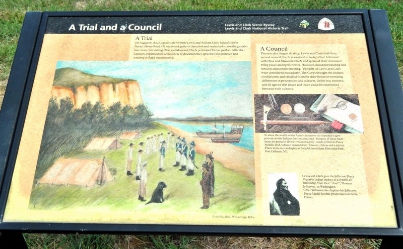
Photographed by Cosmos Mariner, August 24, 2022
1. A Trial and a Council Marker
A Trial
On August 18, 1804 Captains Meriwether Lewis and William Clark held a trial for Private Moses Reed. He was found guilty of desertion and sentenced to run the gauntlet four times, but visiting Otoe and Missouri Chiefs petitioned for his pardon. After the Captains explained the seriousness of desertion they agreed to the sentence and watched as Reed was punished.
A Council
The next day, August 18, 1804, Lewis and Clark held their second council (the first was held at today's Fort Atkinson) with Otoe and Missouri Chiefs and spoke of their mission to bring peace among the tribes. However, misunderstanding and tensions marked the meeting. The gifts of Lewis and Clark were considered inadequate. The Corps thought the Indians troublesome and rebuked them for their behavior revealing differences in perceptions and cultures. Order was restored and all agreed that peace and trade could be established between both cultures.
Erected by Lewis and Clark Scenic Byway and Lewis and Clark National Historic Trail.
Topics and series. This historical marker is listed in these topic lists: Exploration • Indigenous Peoples and Communities
this page online
Location. 42° 21.256′ N, 96° 27.792′ W. Marker is near Homer, Nebraska, in Dakota County. It is on U.S. 77 one mile north of 225th Street, on the right when traveling north. The marker is in an interpretive wayside on the east side of the highway. Touch for map. Marker is in this post office area: Homer NE 68030, United States of America. Touch for directions.

Regionally, this marker is in Eastern Nebraska. It is also in the American Midwest, in the Lewis & Clark Corridor, in the Corn Belt, and on the prairies. Globally, it is in North America, the Western Hemisphere, the Western World, and the Anglosphere. Historically, it finds itself in what was once the Louisiana Purchase.
Other nearby markers. At least 8 other markers are within 6 miles of this marker, measured as the crow flies: Fish Camp (here, next to this marker); Tonwantonga (here, next to this marker); Umoⁿhoⁿ Nation (here, next to this marker); Combs School (approx. 4.3 miles away); Territorial Church (approx.
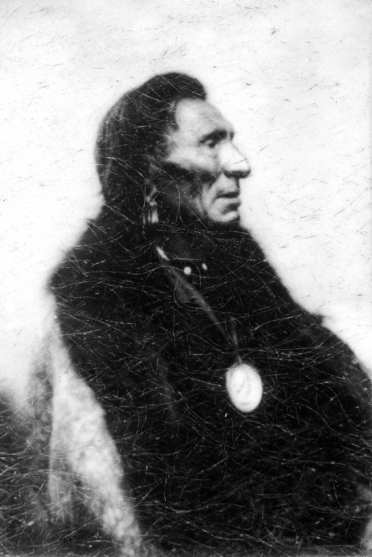
2. Marker detail: Chief Yellowsmoke
Lewis and Clark gave the Jefferson Peace Medal to Indian leaders as a symbol of friendship from their “chief”, Thomas Jefferson, in Washington. Chief Yellowsmoke display his Jefferson Peace Medal for this photo taken in Paris, France.
Also see . . . Journals of the Lewis & Clark Expedition, August 18, 1804. (Submitted on November 2, 2026, by Cosmos Mariner of Cape Canaveral, Florida.)
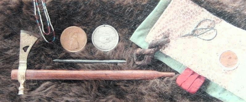
3. Marker detail: Trade Items
To show the wealth of the American nation the expedition gave presents to the Indians they encountered. Samples of these trade items are pictured above: tomahawk/pipe, beads, Jefferson Peace Medals, lead, tobacco twists, fabric, scissors, ribbon and a mirror. These items are on display at Fort Atkinson State Historical Park, Fort Calhoun, NE.
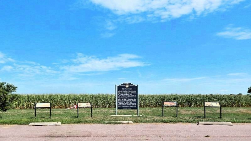
Photographed by Cosmos Mariner, August 24, 2022
4. A Trial and a Council Marker
This is marker is the second from the left of four interpretive panels alongside the Nebraska State Historical Society “Tonwantonga” marker at this wayside.
Credits. This page was last revised on November 2, 2026. It was originally submitted on November 2, 2026, by Cosmos Mariner of Cape Canaveral, Florida. This page has been viewed 9 times since then. Photos: 1, 2, 3, 4. submitted on November 2, 2026, by Cosmos Mariner of Cape Canaveral, Florida.
