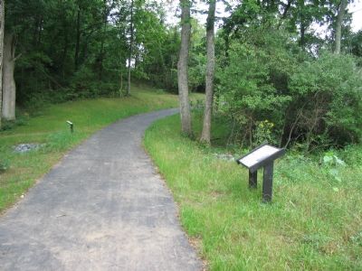
Near Winchester in Frederick County, Virginia — The American South (Mid-Atlantic)
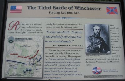
The Third Battle of Winchester
Fording Red Bud Run
"To stop was death. To go on was probably the same; but on we started again."
Col. Rutherford B. Hayes, U.S.A.
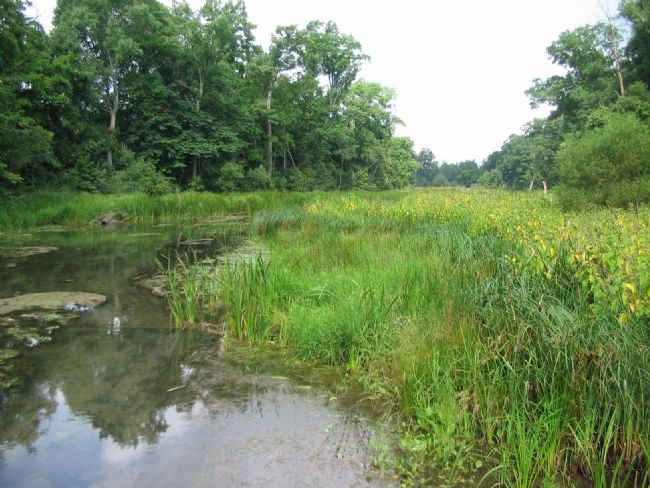
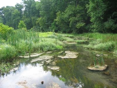
Red Bud Run is as wide and boggy today as it was in 1864. During their attack, the men of the Eighth Corps sank into the marshy flood plain on the north bank, then trudged through the waistdeep water.
The men forged on amid enemy fire and some reportedly fell wounded and drowned in the crossing. Hayes reported that "the rear and front lines and different regiments of the same line mingled together and reached the rebel side of the creek with lines and organizations broken; but all seemed inspired by the right spirit, and charged the rebel works pell-mell in the most determined manner."
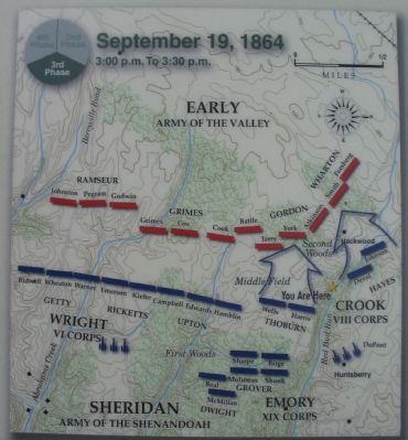
They joined Union Col. Thoburn's troops and later with the Sixth and Nineteenth Corps to push Gordon's forces out of their hard-won position in the Second Woods near the Hackwood House.
Erected by Civil War Preservation Trust.
Topics and series. This historical marker is listed in this topic list: War, US Civil. In addition, it is included in the Former U.S. Presidents: #19 Rutherford B. Hayes series list. A significant historical year for this entry is 1864.
Location. Marker has been reported permanently removed. It was located near 39° 12.146′ N, 78° 7.591′ W. Marker was near Winchester, Virginia, in Frederick County. Marker could be reached from Redbud Road (County Route 661), on the right when traveling east. Located at the Red Bud Run Wayside, along the Confederate Flank Trail, inside the CWPT Third Winchester Battlefield site. The marker is on the south side of the creek. The closest trailhead to this marker is along Redbud Road. Touch for map. Marker was in this post office area: Winchester VA 22603, United States of America.
We have been informed that this sign or monument is no longer there and will not be replaced. This page is an archival view of what was.
Other nearby markers. At least 8 other markers are within walking distance of this location. In Memory of Gilcin F. Meadors III (a few steps from this marker); Sheridan Renews The Attack (a few steps from this marker); Fury On The Fence Line (within shouting distance of this marker); Stuck In The Mud (about 400 feet away, measured in a direct line); Ohio (about 400 feet away); Hackwood And Patton (about 500 feet away); Duval's Attack (about 700 feet away); Ten Thousand Devils (approx. 0.2 miles away). Touch for a list and map of all markers in Winchester.
More about this marker. The marker displays a portrait of

2. Help Preserve 3rd Winchester
Details of CWPT efforts to save this battlefield.
Click for more information.
Click for more information.
Also see . . .
1. Summary of the Battle of Third Winchester. The action described on the marker falls under Phase 8 of this National Parks Service summary. (Submitted on October 25, 2007, by Craig Swain of Leesburg, Virginia.)
2. CWPT Walking Tour of The Third Battle of Winchester. This marker is one along the walking trail around a portion of the Third Winchester Battlefield, preserved by the Civil War Preservation Trust. (Submitted on October 25, 2007, by Craig Swain of Leesburg, Virginia.)
Photographed By Craig Swain, August 26, 2007
5. Looking East from the Bridge
Thoburn's men had a little easier advance, with their right flank resting on the creek bed, and their line of march generally parallel to Redbud Run (the tree line on the right side of this photo). This view does show the marshy ground. This picture was taken in mid-summer, during one of the worst droughts on record for the region. Yet the bottom ground is still what one would consider "slow going" at best.
Photographed By Craig Swain, August 26, 2007
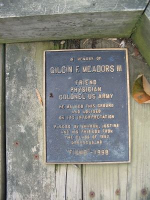
8. In Memory of Gilcin F. Meadors III
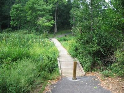
The footbridge is dedicated to the memory of COL Meadors:
Friend
Physician
Colonel US Army
He walked this ground
and advised
on its interpretation
Placed by Sharon, Justine
and his friends from
the class of 1962
Damascus, MD
"FIGMO"-1998
FIGMO is military slang which stands for "Forget it I've Got My Orders" in the polite translation.
Physician
Colonel US Army
He walked this ground
and advised
on its interpretation
Placed by Sharon, Justine
and his friends from
the class of 1962
Damascus, MD
"FIGMO"-1998
FIGMO is military slang which stands for "Forget it I've Got My Orders" in the polite translation.
Credits. This page was last revised on October 20, 2023. It was originally submitted on October 25, 2007, by Craig Swain of Leesburg, Virginia. This page has been viewed 2,432 times since then and 13 times this year. Photos: 1. submitted on October 25, 2007, by Craig Swain of Leesburg, Virginia. 2. submitted on March 13, 2009, by Craig Swain of Leesburg, Virginia. 3, 4, 5, 6, 7, 8. submitted on October 25, 2007, by Craig Swain of Leesburg, Virginia.
