Port Tobacco in Charles County, Maryland — The American Northeast (Mid-Atlantic)
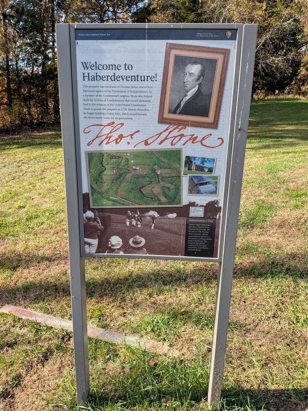
Welcome to Haberdeventure!
Thomas Stone National Historic Site
| — | National Park Service, U.S. Department of the Interior | — |
Photographed by Evan Dwyer, October 31, 2026
1. Welcome to Haberdeventure! Marker
Independence Day
Visitors enjoy celebrating July 4th at Thomas Stone National Historic Site. On this day in 1776, Thomas Stone and other colonial representatives agreed to a Declaration of Independence from Great Britain. The American Revolution continued for five more years before Great Britain conceded defeat.
Erected by National Park Service, U.S. Department of the Interior.
Topics. This historical marker is listed in these topic lists: Agriculture • Colonial Era • Patriots & Patriotism • War, US Revolutionary. A significant historical year for this entry is 1770.
Location. 38° 31.954′ N, 77° 2.461′ W. Marker is in Port Tobacco, Maryland, in Charles County. It can be
this page online

Regionally, this marker is in the Washington Metropolitan Area and in Southern Maryland. It is also in the American South, specifically in the Upper South, in the Mid-Atlantic, in the Tidewater, and on the Eastern Seaboard. Globally, it is in the North Atlantic Region, North America, the Western Hemisphere, the Western World, and the Anglosphere. Historically, it finds itself in what was once one of the original Thirteen Colonies and also the Antebellum South.
Other nearby markers. At least 8 other markers are within walking distance of this marker: The Stones of Maryland (about 600 feet away, measured in a direct line); Maryland Liberty Tree Project (about 700 feet away); Thomas Stone (approx. ¼ mile away); a different marker also named Welcome to Haberdeventure!
Photographed by Evan Dwyer, October 31, 2026
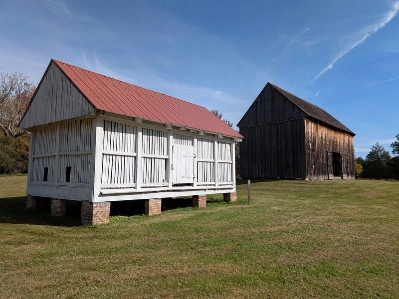
2. Haberdeventure Corn Crib & Barn
Both are from the first half of the 1800s. The marker is immediately south of the corncrib on the opposite side of the walking trail.
More about this marker. There are multiple identical copies of the marker on the grounds of the park.
Photographed by Evan Dwyer, October 31, 2026
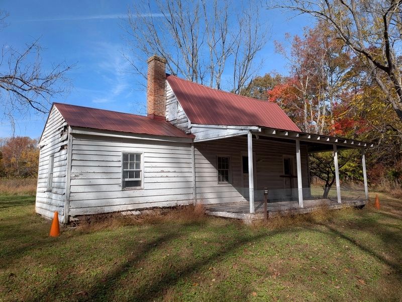
3. Tenant Farmhouse
The marker is just west of where the trail splits between the main loop and the path out to the ca. 1840s-50s Tenant Farmhouse, shown here, which sits about 800' south of the marker at the end of an old farm road.
Photographed by Evan Dwyer, October 31, 2026
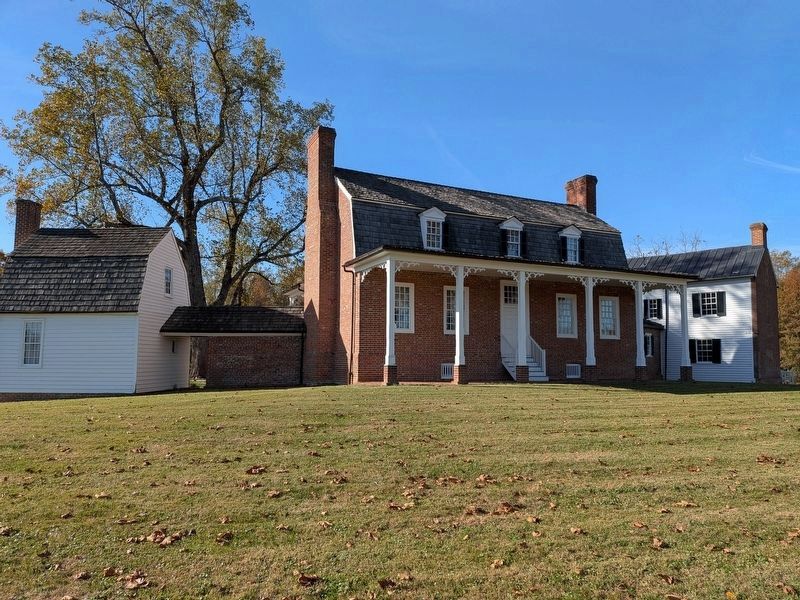
4. Haberdeventure
The plantation house itself. At right is the kitchen, joined to the main house (at center) with a hyphen that served as additional living space for Thomas Stone's siblings and their families. At left is an outbuilding moved closer to the house to serve as an office for Stone, who was a lawyer. The center house was gutted by fire in the 1970s but the interior walls and roof were reconstructed by the Park Service. The outer walls are original.
Credits. This page was last revised on November 5, 2026. It was originally submitted on November 5, 2026, by Evan Dwyer of Richmond, Virginia. This page has been viewed 6 times since then. Photos: 1, 2, 3, 4. submitted on November 5, 2026, by Evan Dwyer of Richmond, Virginia.
