Napierville in Les Jardins-de-Napierville, Québec — Central Canada (French-Canadian)
La Prison
| — | Du rêve à l'exil — 1838 | — |
Photographed by Cosmos Mariner, May 19, 2024
1. La Prison Marker

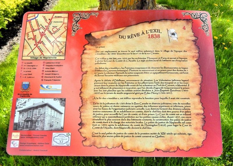
Cet édifice a été bâti vers 1834 par les architectes Thompson et Parry et servait à l'époque à abriter la Cour du Comté de L'Acadie. Le style architectural du bâtiment est d'inspiration palladienne.
Au début des « troubles », les Patriotes s'empressent de désarmer les Bureaucrates ou loyaux (fidèles à la Couronne britannique). Plusieurs se retrouveront ici en prison pour des durées de 1 à 7 jours. Le docteur Sarrault, lui-même suspecté d'être un sympathisant bureaucrate, est forcé de donner les soins médicaux aux prisonniers.
Après la défaite d'Odelltown, renversement de situation. Les Volontaires (miliciens loyaux) prennent leur revanche sur les Patriotes en les pillant (avec l'aide des troupes) et en les incarcérant dans la prison de Napierville avant de les acheminer au Pied-du-Courant, à Montréal. Il y eut tellement de prisonniers à incarcérer, que l'on décida d'agrandir temporairement la prison avec les 200 planches que les soldats avaient dérobées à Jean-Baptiste
this page online
À la fin des « troubles », cet édifice reprendra la fonction pour laquelle il avait été construit.
La loi de la judicature de 1793 divise le Bas-Canada en districts judiciaires, crée de nouvelles cours de justice et donne naissance au système des tribunaux supérieurs et inférieurs, jetant ainsi les bases de l'organisation judiciaire actuelle. Les districts forment des divisions administratives autonomes. Ils se subdivisent en comtés, dont le chef-lieu doit être pourvu d'un palais de justice, pour accueillir la Cour de comté, et d'une prison. La Cour de comté est un tribunal inférieur qui a essentiellement juridiction sur les petites causes civiles. Avant 1857, ces cours s'installent le plus souvent dans ces bâtiments existants, la construction des palais de justice de comté étant à la charge des autorités locales. Le palais de justice de Napierville est construit en 1834, après la subdivision du comté de Huntingdon (1829), pour loger la Cour du Comté de l'Acadie, dont Napierville devient le chef-lieu.
C'est le seul palais de justice de comté de
Photographed by Cosmos Mariner, May 19, 2024
2. La Prison Marker
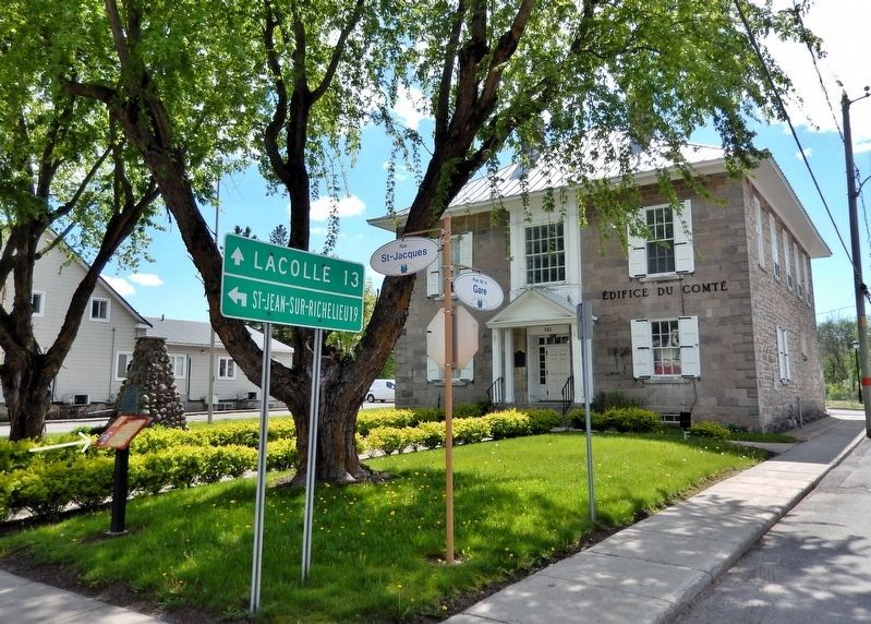
The marker (left) is near the northeast corner of the old Acadie County Courthouse and jail grounds.
— From Dream to Exile — 1838 —
On this site stands the only remaining building from the village of the “troubles” era of 1838. You are on lot number 10 of Christie Street.
This building was constructed around 1834 by architects Thompson and Parry and at the time served to house the Acadian County Court. The architectural style of the building is Palladian-inspired.
At the beginning of the “troubles,” the Patriots rushed to disarm the Bureaucrats or Loyalists (faithful to the British Crown). Several ended up here in prison for periods of 1 to 7 days. Doctor Sarrault, himself suspected of being a bureaucrat sympathizer, was forced to provide medical care to the prisoners.
After the defeat at Odelltown, the situation reversed. The Volunteers (loyal militias) took their revenge on the Patriots by looting them (with the help of the troops) and incarcerating them in the Napierville prison before sending them to Pied-du-Courant in Montreal. There were so many prisoners to incarcerate that it
Photographed by Cosmos Mariner, May 19, 2024
3. Napierville 150th Anniversary Monument
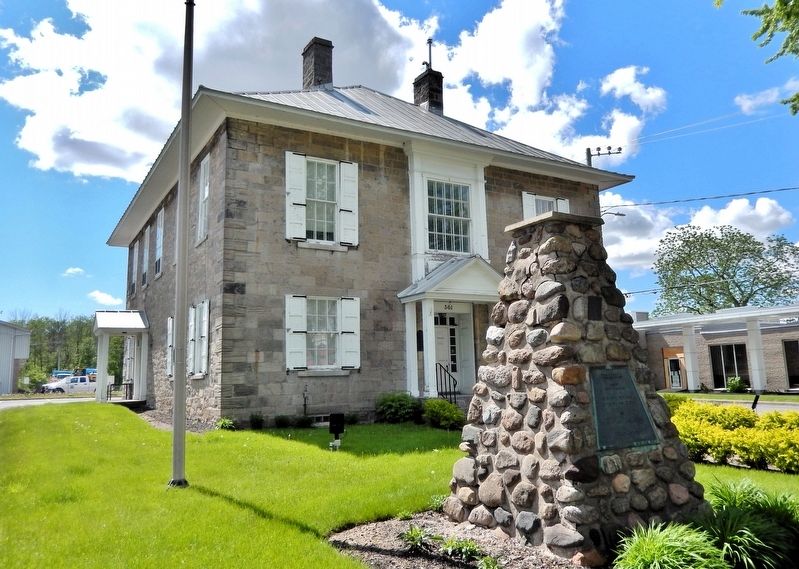
The southeast corner of the old Acadie County Courthouse and jail is in the background.
At the end of the “troubles,” this building would resume the function for which it had been built.
The Judiciary Act of 1793 divided Lower Canada into judicial districts, created new courts of justice, and gave rise to the system of superior and inferior courts, thus laying the foundations of the current judicial organization. The districts formed autonomous administrative divisions. They were subdivided into counties, whose chief town was to be provided with a courthouse to host the County Court, and a prison. The County Court was an inferior court that basically had jurisdiction over small civil cases. Before 1857, these courts were most often set up in existing buildings, since the construction of county courthouses was the responsibility of local authorities. The Napierville courthouse was built in 1834, after the subdivision of Huntingdon County (1829), to house the Acadia County Court, with Napierville becoming the county seat.
Photographed by Cosmos Mariner, May 19, 2024
4. Napierville 150th Anniversary Marker
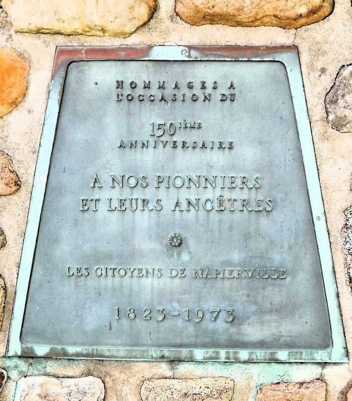
A nos pionniers et leurs ancêtres
Les Citoyens de Napierville
1823-1973
• • •
Tributes on the occasion of the 150th anniversary
To our pioneers and their ancestors
The Citizens of Napierville
It’s the only county courthouse from the first half of the 19th century that still exists, and also the oldest surviving county courthouse in Quebec.
Erected by Municipalité de Napierville / Municipality of Napierville. (Marker Number 4.)
Topics. This historical marker is listed in these topic lists: Architecture • Law Enforcement • Patriots & Patriotism • Wars, Non-US. A significant historical year for this entry is 1834.
Location. 45° 11.275′ N, 73° 24.362′ W. Marker is in Napierville, Québec, in Les Jardins-de-Napierville. It is at the intersection of Rue Saint-Jacques (Québec Route 219/221) and Rue de la Gare, on the left when traveling north on Rue Saint-Jacques. The marker is beside the sidewalk at the northeast corner of the old Acadie County Courthouse grounds. Touch for map. Marker is at or near this postal address: 361 Rue Saint-Jacques, Napierville QC J0J 1L0, Canada. Touch for directions.

Regionally, this marker is in Central Canada. Globally, it is in North America, the Western Hemisphere, and the Western World. Historically, it finds itself in what was once a British colony, the Viceroyalty
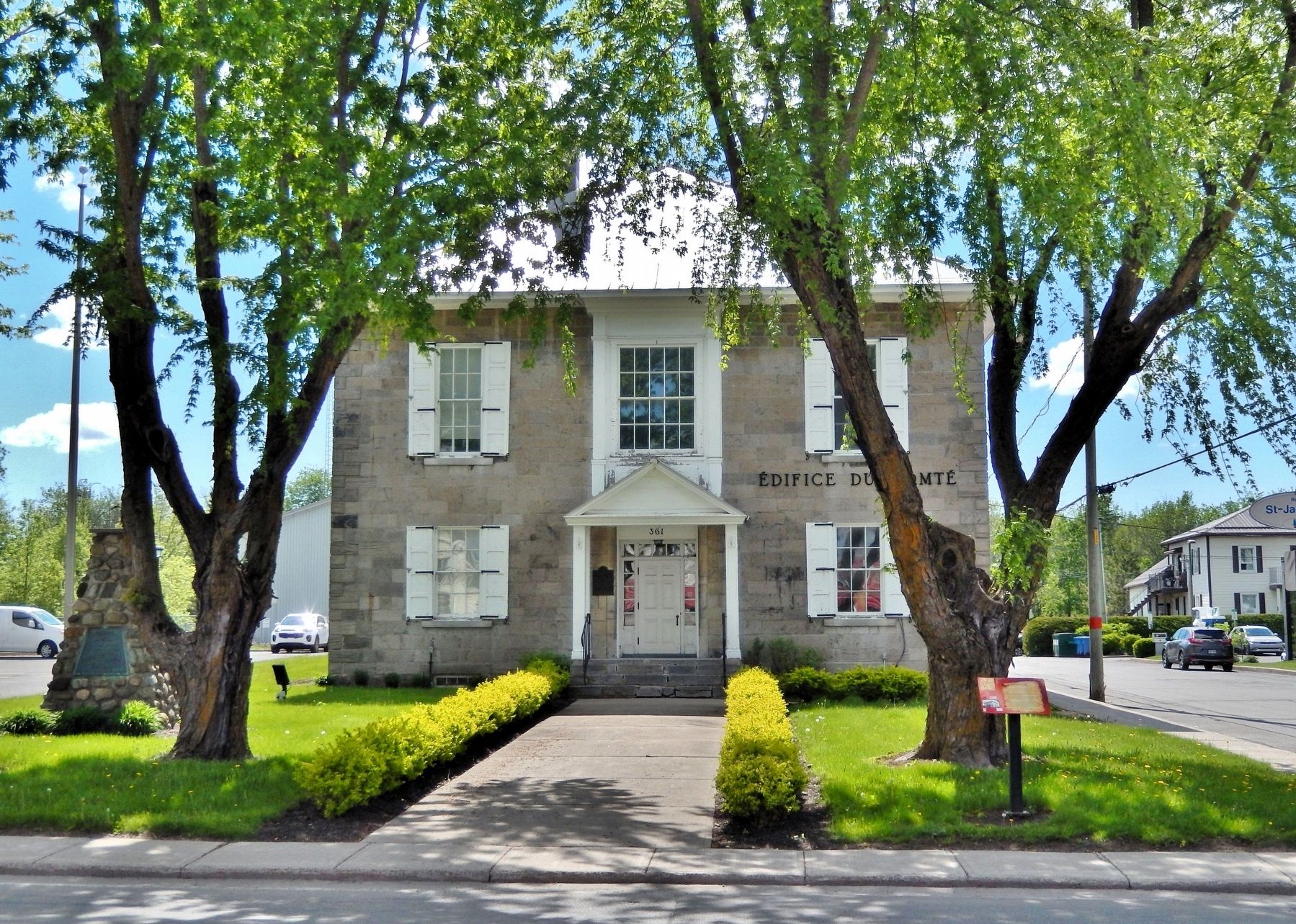
Photographed by Cosmos Mariner, May 19, 2024
5. Old Acadie County Courthouse and Jail
Looking west from Rue Saint-Jacques. The marker is on the right side of the center walkway.
Other nearby markers. At least 8 other markers are within walking distance of this marker: Palais de Justice et prison du comté de L'Acadie / Acadie County Court House and Goal (a few steps from this marker); Docteur C.-H.-O. Côté, m.d. (within shouting distance of this marker); C'est ici que fut proclamée la République du Bas-Canada (about 120 meters away, measured in a direct line); Jean-Baptiste Lukin N.P. (about 120 meters away); Loop Odell (about 150 meters away); Napierville Historique (about 210 meters away); Magasin d'Allen Clark (about 210 meters away); La Chapelle-Presbytère (1825-1886) (about 210 meters away). Touch for a list and map of all markers in Napierville.
Related markers. Click here for a list of markers that are related to this marker.
Also see . . . Lower Canada Rebellion (Wikipedia).
Excerpt: The Lower Canada Rebellion, commonly referred to as the Patriots' Rebellion in French, is the name given to the armed conflict in 1837–38 between rebels and the British colonial government of Lower Canada (now southern Quebec). Together with the simultaneous rebellion in the neighbouring colony of Upper Canada (now southern Ontario), it formed the Rebellions of 1837–38. As a result of the rebellions, the Province of Canada was created from the former Lower Canada and Upper Canada. In Quebec, the rebellion, as well as the parliamentary and popular struggle, is now commemorated as the Journée nationale des Patriotes (National Patriots' Day) on the Canadian statutory holiday, Victoria Day.(Submitted on November 7, 2026, by Cosmos Mariner of Cape Canaveral, Florida.)
Credits. This page was last revised on November 7, 2026. It was originally submitted on November 6, 2026, by Cosmos Mariner of Cape Canaveral, Florida. This page has been viewed 8 times since then. Photos: 1, 2, 3, 4, 5. submitted on November 7, 2026, by Cosmos Mariner of Cape Canaveral, Florida.
