Vermillion in Clay County, South Dakota — The American Midwest (Upper Plains)
Frost Wilderness Game Production Area
North Alabama Bend Wildlife Area
Photographed by Barry Swackhamer, July 18, 2025
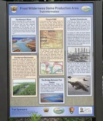
1. Frost Wilderness Game Production Area Marker
Image: (left, top) Goat Island; (left, bottom) Gunerson Backwater; (center, top) 1900 Map of Vermillion; (center, middle) Map of 1881 Flood; (center, bottom) Vermillion Bridge; (right, top) The North Alabama; (right, bottom) North Alabama wreckage.
this page online
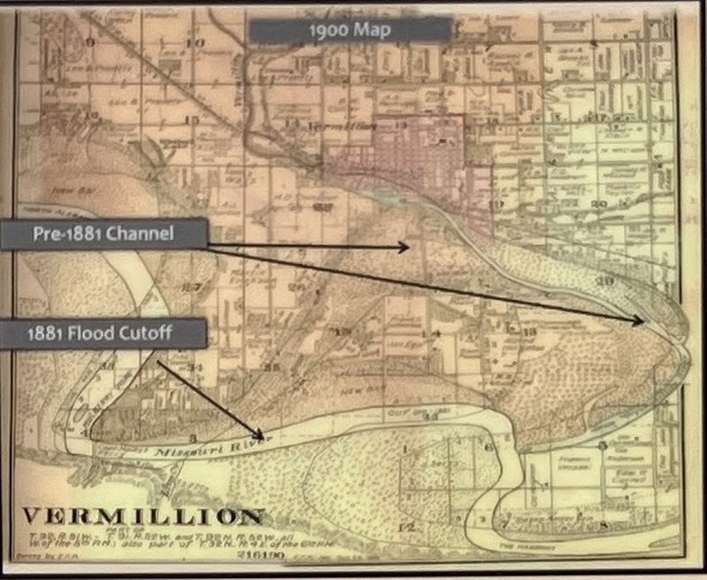
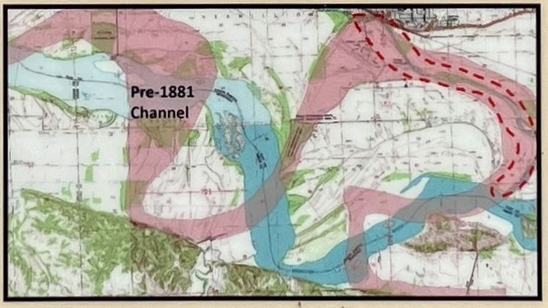
The Missouri River near Vermillion took a much different course before the 1881 flood. The present-day Vermillion River flows through the abandoned channel of the former Missouri River (seen in the red dashes line below). This catastrophic flood significantly changed the fluvial landscape of the Missouri River.
On October 27, 1870, the North Alabama steamboat hit a snag and sank near present-day Goat Island, just upstream from the Frost Wilderness GPA. Valued at $12,000, the North Alabama was property
Photographed by Barry Swackhamer, July 18, 2025
2. 1900 Map of Vermillion, SD
In the years of low flow along the Missouri River, the remnants of the North Alabama are exposed. University of South Dakota researchers analyzed journals, historical river maps, and took measurements of the wreckage to confirm that the exposed wreckage was in fact the North Alabama steamboat.
Erected by South Dakota Game, Fish & Parks; Friends of the Missouri National Recreational River South Dakota Game, Fish & Parks; Friends of the Missouri National Recreational River South Dakota Game, Fish & Parks; Friends of the Missouri National Recreational River.
Topics. This historical marker is listed in these topic lists: Bridges & Viaducts • Disasters • Natural Features • Waterways & Vessels. A significant historical date for this entry is October 27, 1870.
Location. 42° 45.009′ N, 96° 56.975′ W. Marker is in Vermillion, South Dakota, in Clay County. It can be reached from State Highway 19 near South Dakota
Photographed by Barry Swackhamer, July 18, 2025
3. 1881 Flood diagram

Regionally, this marker is in East River. It is also in the American Lewis & Clark Corridor, on the prairies, and on the Northern Plains. Globally, it is in North America, the Western Hemisphere, the Western World, and the Anglosphere. Historically, it finds itself in what was once Rupert’s Land and also the Louisiana Purchase.
Other nearby markers. At least 8 other markers are within 2 miles of this marker, measured as the crow flies: Confluence of the Vermillion and Missouri Rivers (approx. 1.8 miles away); Vermillion (approx. 1.8 miles away); Lewis and Clark / Vermillion (approx. 1.8 miles away); Welcome to Cotton Park (approx. 1.9 miles away); Grand Lodge Constitution Site (approx. 2 miles away); Site of the First Permanent School House in Dakota Territory (approx. 2 miles away); Old Vermillion (approx. 2 miles away); a different marker also named Old Vermillion (approx.
Photographed by Barry Swackhamer, July 18, 2025
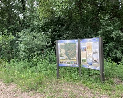
4. Frost Wilderness Game Production Area Marker
Also see . . . A Note From Cottonwood Corners - Gregory County Historical Society. "On October 27th, 1870, the North Alabama was snagged and sunk at Vermillion near the mouth of the Vermillion River and Goat Island. A large cottonwood log pierced the hull of the boat and created a gash two-feet wide and eight-feet long." (Submitted on November 8, 2026, by Barry Swackhamer of Brentwood, California.)
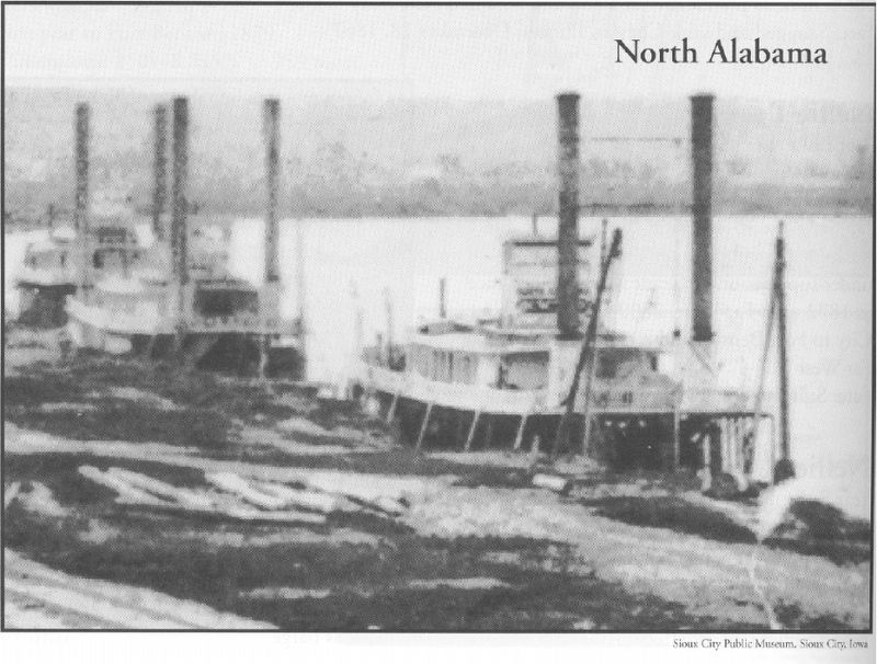
Photographed by Sioux City Public Museum
5. Steamboat North Alabama
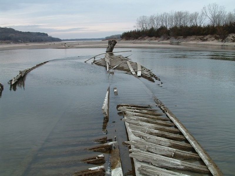
Photographed by National Park Service, circa 2004
6. Wreck of the Steamboat North Alabama
Credits. This page was last revised on November 8, 2026. It was originally submitted on November 8, 2026, by Barry Swackhamer of Brentwood, California. This page has been viewed 5 times since then. Photos: 1, 2, 3, 4, 5, 6. submitted on November 8, 2026, by Barry Swackhamer of Brentwood, California.
