West Nyack in Rockland County, New York — The American Northeast (Mid-Atlantic)
Colonial Clarkstown
Photographed by Bill Coughlin, July 5, 2011
1. Colonial Clarkstown Marker
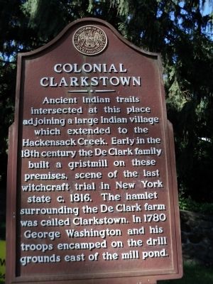
Ancient Indian trails intersected at this place adjoining a large Indian village which extended to the Hackensack Creek. Early in the 18th century the De Clark family built a gristmill on these premises, scene of the last witchcraft trial in New York state c. 1816. The hamlet surrounding the De Clark farm was called Clarkstown. In 1780 George Washington and his troops encamped on the drill grounds east of the mill pond.
Erected by Historical Society of Rockland County.
Topics and series. This historical marker is listed in these topic lists: Colonial Era • Indigenous Peoples and Communities • War, US Revolutionary. In addition, it is included in the New York, Historical Society of Rockland County series list. A significant historical year for this entry is 1816.
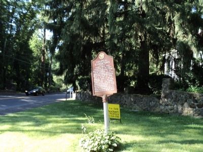
Location. 41° 6.235′ N, 73° 58.349′ W. Marker is in West Nyack, New York, in Rockland County. It is at the intersection of Strawtown Road and Germonds Road (County Route 27), on the left when traveling north on Strawtown Road. Touch for map. Marker is at or near this postal address: 373 Germonds Rd, West Nyack NY 10994, United States of America.
this page online

Regionally, this marker is in the Hudson Valley and in the New York City Metropolitan Area. It is also in the American Northeast, in the Mid-Atlantic, and on the Eastern Seaboard. Globally, it is in the North Atlantic Region, North America, the Western Hemisphere, the Western World, and the Anglosphere. Historically, it finds itself in what was once New Netherland and also one of the original Thirteen Colonies.
Other nearby markers. At least 8 other markers are within walking distance of this marker: Pye's Corner (here, next to this marker); Washington’s Encampment (within shouting distance of this marker); Clarkstown Reformed Church (about 700 feet away, measured in a direct line); West Nyack World War I Memorial (about 800 feet away); The Old Parsonage (approx. 0.2 miles away); West Nyack's Last Horse Trough (approx. 0.4 miles away); Site of the First Reformed Protestant Dutch Church of New Hempstead (approx. 0.6 miles away); Old Clarkstown Reformed Church Cemetery (approx. 0.6 miles away). Touch for a list and map of all markers in West Nyack.
Photographed by Bill Coughlin, July 5, 2011
2. Marker in West Nyack

Photographed by Bill Coughlin, July 5, 2011
3. Colonial Clarkstown Marker
Credits. This page was last revised on November 12, 2026. It was originally submitted on July 5, 2011, by Bill Coughlin of Woodland Park, New Jersey. This page has been viewed 2,600 times since then and 158 times this year. Last updated on November 11, 2026, by Kevin Vincent of Arlington, Virginia. Photos: 1, 2, 3. submitted on July 5, 2011, by Bill Coughlin of Woodland Park, New Jersey. • Devry Becker Jones was the editor who published this page.
