
Gettysburg in Adams County, Pennsylvania — The American Northeast (Mid-Atlantic)
Christ Lutheran Church
"Those poor wounded men…"
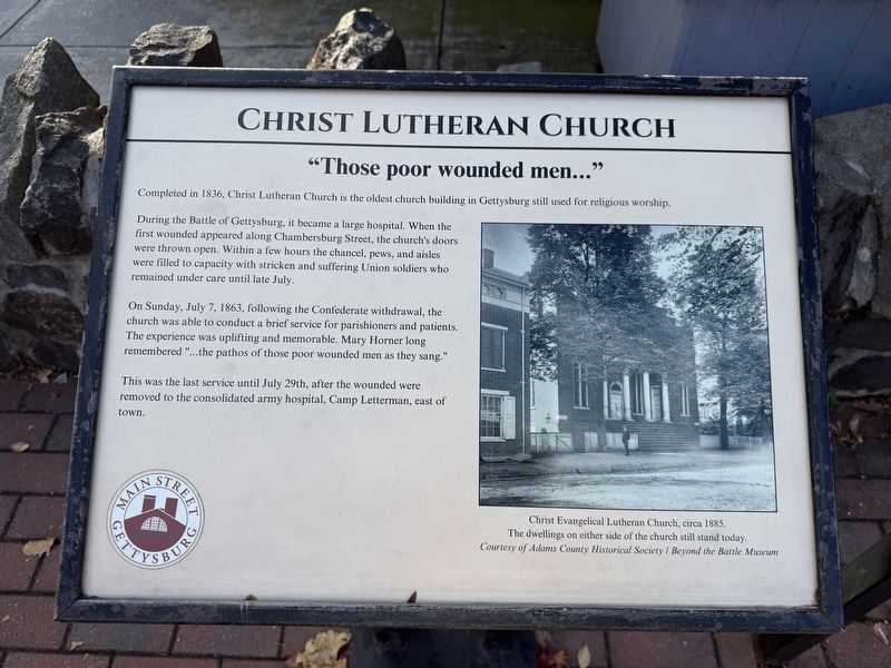
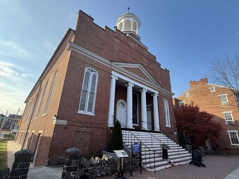
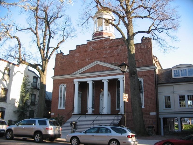
Completed in 1836, Christ Lutheran Church was the oldest church building in Gettysburg still used for religious worship.
During the Battle of Gettysburg, it became a large hopsital. When the first wounded appeared along Chambersburg Street, the church's doors were thrown open. Within a few hours the chancel, pews, and aisles were filled to capacity with stricken and suffering Union soldiers who remained under care until late July.
On Sunday, July 7, 1863, following the Confederate withdrawal, the chruch was able to conduct a brief service for parishioners and patients. The experience was uplifting and memorable. Mary Horner long remembered "…the pathos of those poor wounded men as they sang."
Ths was the last service until July 29th, after the wounded were removed to the consolidated army hospital, Camp Letterman, east of town.
[Caption:]
Christ Evangelical Lutheran Church, circa 1885. The dwellings on either side of the church still stand today.
Courtesy of Adams County Historical Society / Beyond the Battle Museum
Erected 2024 by Main Street Gettysburg. (Marker Number 6.)
Topics and series.
this page online
Location. 39° 49.85′ N, 77° 13.947′ W. Marker is in Gettysburg, Pennsylvania, in Adams County. It is on Chambersburg Street (U.S. 30) east of South Washington Street. Touch for map. Marker is at or near this postal address: 30 Chambersburg St, Gettysburg PA 17325, United States of America. Touch for directions.

Regionally, this marker is in South-Central Pennsylvania. It is also in the American Northeast, in the Mid-Atlantic, in Appalachia, and specifically in Northern Appalachia. Globally, it is in North America, the Western Hemisphere, the Western World, and the Anglosphere. Historically, it finds itself in what was once the Haudenosaunee (Iroquois) Confederacy and also one of the original Thirteen Colonies.
Other nearby markers. At least 8 other markers are within walking distance of this marker: Reverend Horatio S. Howell (here,
Other markers no longer nearby. "…the pathos of those poor wounded men…" (was here, next to this marker but has been replaced with another marker now near it); "…expecting to find all dead." (was a few steps from this marker but has been replaced with another marker now near it); the Eagle Hotel (was within shouting distance of this marker but has been replaced with another marker now near it).
Related marker. Click here for another marker that is related to this marker. This marker has replaced the linked marker.
Photographed by Craig Swain
3. The Christ Lutheran Church
Credits. This page was last revised on November 12, 2026. It was originally submitted on November 12, 2026, by Devry Becker Jones of Washington, District of Columbia. This page has been viewed 12 times since then. Photos: 1, 2. submitted on November 12, 2026, by Devry Becker Jones of Washington, District of Columbia. 3. submitted on April 14, 2009, by Craig Swain of Leesburg, Virginia.
