
Gettysburg in Adams County, Pennsylvania — The American Northeast (Mid-Atlantic)
St. Paul's A.M.E. Zion Church
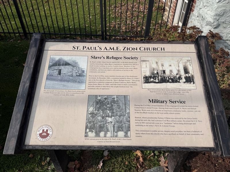
Slave's Refugee Society
St. Paul's A.M.E. Zion Church, built in 1917, is the third church to be used by Gettysburg's oldest Black congregation-founded circa 1843 in a small wooden building on nearby Franklin Street. Members of this congregation have long been active and prominent in the town's Black community, and have provided a rich tradition of service to the community and to the nation.." Prior to the Civil War, many members became part of the abolitionist movement. In December 1840, a committee headed by Henry O. Childer met at the first church to form the "Slave's Refugee Society." This group appointed a committee composed of James Cameron, Hnery Butler, James Jones, Henry O. Chiler, and John Jones to draft a constitution and seek a means to help those who sought freedom from "the tyrannical yoke of oppression."
Military Service
During the Civil War, several members of the congregation joined he newly formed United States Colored Troops. Among them were Lloyd F.A. Watts and Samuel Stanton. Watts went on to become an important community leader, minister, and one of the first Black teachers in the local public
this page online
Stanton, whose grandmother Sydney O'Brien was enslaved by the Gettys family during her early life, had a diverse Civil War military career. He joined the U.S. Navy early in 1863 and served a year as a "landsman" before being discharged and reenlisting in the army's 3rd U.S. Colored Troops.
This commitment to public service, despite racial prejudice, has been a hallmark of many others from this church who have sacrificed on behalf of their community and country.
[Captions:]
This photograph of Gettysburg's first Black church (along current Franklin Street) was taken shortly before its demolition in 1962.
Courtesy of Linda Miller Golden
WWII veterans pose on the steps of St. Paul's A.M.E. Zion Church.
Courtesy of Jeann Howard-Green
Many of Gettysburg's Black families gather for a photograph on West High Street in front of the "Colored Elks' Lodge," circa 1920s.
Courtesy of Adams County Historical Society
Erected 2024 by Main Street Gettysburg. (Marker Number 33.)
Topics and series. This historical marker is listed in these topic lists: Abolition & Underground RR • African Americans •
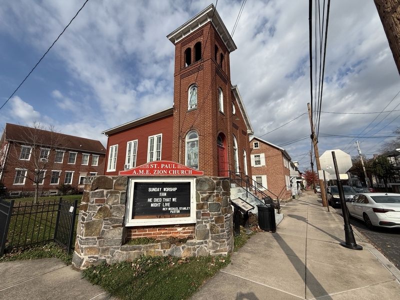
Location. 39° 49.616′ N, 77° 14.005′ W. Marker is in Gettysburg, Pennsylvania, in Adams County. It is at the intersection of South Washington Street and Breckenridge Street, on the right when traveling south on South Washington Street. Touch for map. Marker is at or near this postal address: 270 S Washington St, Gettysburg PA 17325, United States of America. Touch for directions.

Regionally, this marker is in South-Central Pennsylvania. It is also in the American Northeast, in the Mid-Atlantic, in Appalachia, and specifically in Northern Appalachia. Globally, it is in North America, the Western Hemisphere, the Western World, and the Anglosphere. Historically, it finds itself in what was once the Haudenosaunee (Iroquois) Confederacy and also one of the original Thirteen Colonies.
Other nearby markers. At least 8 other markers are within walking distance of this marker: Mary Virginia Wade Lived in This House (within shouting distance of this marker); Goodwill Cemetery (about 500 feet away); Shriver's Four Square Garden (about 600 feet away); First Home of Seminary and College (about 600 feet away); Old Academy Building (about 600 feet away); 267 Baltimore St. (about 600 feet away); The Pierce House (about 600 feet away); Lincoln Cemetery (about 600 feet away). Touch for a list and map of all markers in Gettysburg.
Other markers no longer nearby. St. Paul's A.M.E. Zion Church (has been replaced with this marker); The "Jack" Hopkins House (was about 400 feet away, measured in a direct line but has been permanently removed); "…run home as quickly as you can." (was about 600 feet away but has been replaced with another marker now near it); “… the battle itself proved a relief.” (was about 600 feet away but has been permanently removed); “I can see them yet…” (was about 600 feet away but has been replaced with another marker now near it).
Credits. This page was last revised on November 14, 2026. It was originally submitted on November 14, 2026, by Devry Becker Jones of Washington, District of Columbia. This page has been viewed 10 times since then. Photos: 1, 2. submitted on November 14, 2026, by Devry Becker Jones of Washington, District of Columbia.
