
Medford in Middlesex County, Massachusetts — The American Northeast (New England)
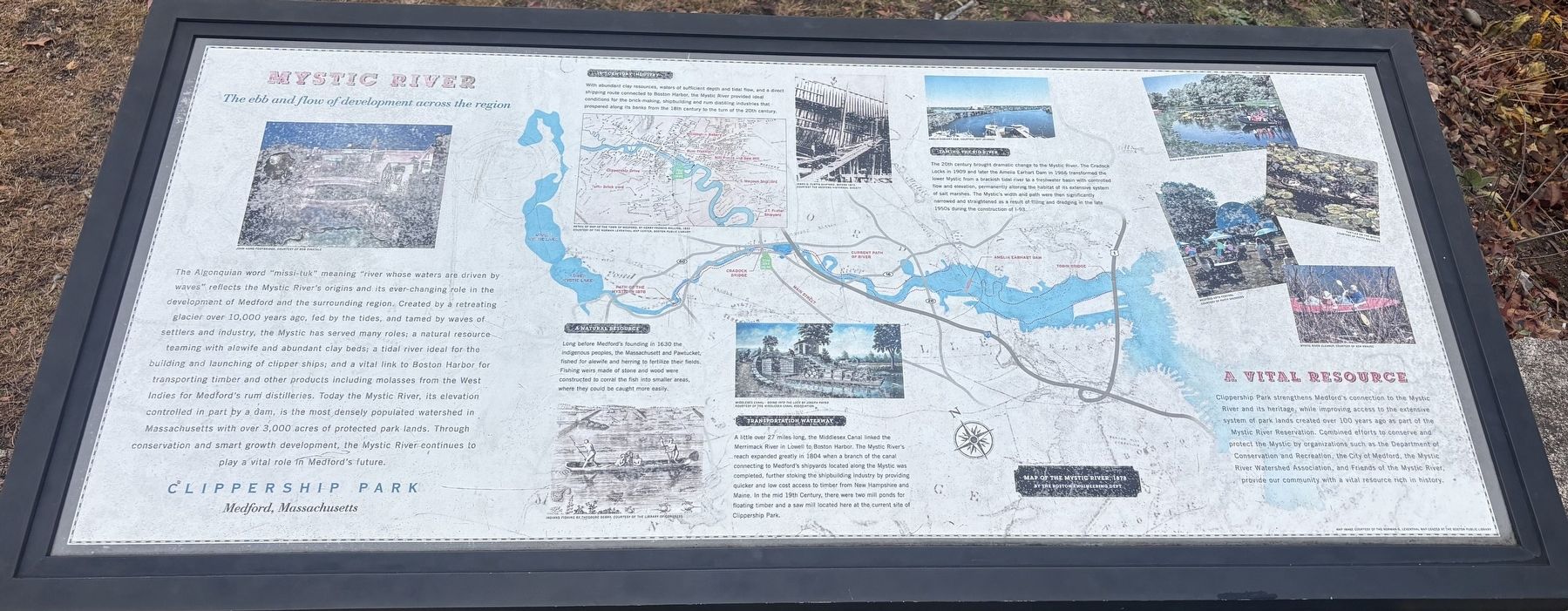
Mystic River
The ebb and flow of development across the region
| — | Clippership Park, Medford, Massachusetts | — |
Photographed by Sean P. Flynn, November 8, 2026
1. Mystic River Marker
19th Century Industry
With abundant clay resources, waters of sufficient depth and tidal flow, and a direct shipping route connected to Boston Harbor, the Mystic River provided ideal conditions for the brick-making,
this page online
A Natural Resource
Long before Medford's founding in 1630 the indigenous peoples, the Massachusett and Pawtucket, fished for alewife and herring to fertilize their fields. Fishing weirs made of stone and wood were constructed to corral the fish into smaller areas, where they could be caught more easily.
Transportation Waterway
A little over 27 miles long, the Middlesex Canal linked the Merrimack River in Lowell to Boston Harbor. The Mystic River's reach expanded greatly in 1804 when a branch of the canal connecting to Medford's shipyards located along the Mystic was completed, further stoking the shipbuilding industry by providing quicker and low cost access to timber from New Hampshire and. Maine. In the mid 19th Century, there were two mill ponds for floating timber and a saw mill located here at the current site of Clippership Park.
Taming the River
The 20th century brought dramatic change to the Mystic River. The Cradock Locks in 1909 and later the Amelia Earhart Dam in 1966 transformed the
Photographed by Sean P. Flynn, November 8, 2026
2. Mystic River Marker
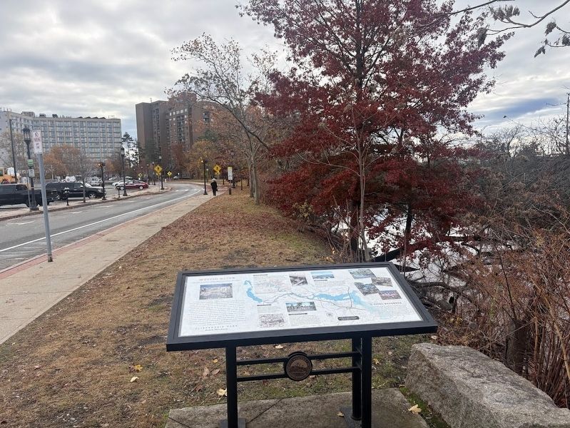
The river is on the right side, and Clippership Drive is on the left.
A Vital Resource
Clippership Park strengthens Medford's connection to the Mystic River and its heritage, while improving access to the extensive system of park lands created over 100 years ago as part of the Mystic River Reservation. Combined efforts to conserve and protect the Mystic by organizations such as the Department of Conservation and Recreation, the City of Medford, the Mystic River Watershed Association, and Friends of the Mystic River, provide our community with a vital resource rich in history.
Topics. This historical marker is listed in these topic lists: Indigenous Peoples and Communities • Industry & Commerce • Settlements & Settlers • Waterways & Vessels. A significant historical year for this entry is 1630.
Location. 42° 25.023′ N, 71° 6.508′ W. Marker is in Medford,
Photographed by Sean P. Flynn, November 8, 2026
3. Rear view of the Mystic River Marker
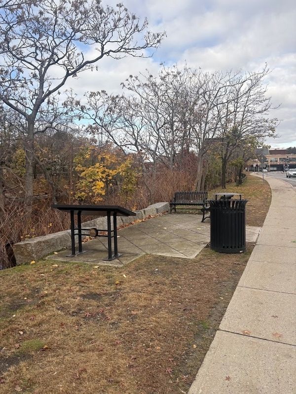
The river runs on the left side.

Regionally, this marker is in Historic Boston and specifically in Greater Boston. It is also in the American Northeast, in New England, and on the Eastern Seaboard. Globally, it is in the North Atlantic Region, North America, the Western Hemisphere, the Western World, and the Anglosphere. Historically, it finds itself in what was once one of the original Thirteen Colonies.
Other nearby markers. At least 8 other markers are within walking distance of this marker: Salem Street Burying Ground (about 400 feet away, measured in a direct line); Cemetery for the Enslaved (about 400 feet away); Medford Revolutionary War Memorial (about 400 feet away); Site of the Sarah Bradlee Fulton House (about 400 feet away); New Hampshire Soldiers Bunker Hill Memorial (about 500 feet away); The Medford Rum Distilleries (about 500 feet away); Captain Isaac Hall (about 500 feet away); Shipbuilding (about 600 feet
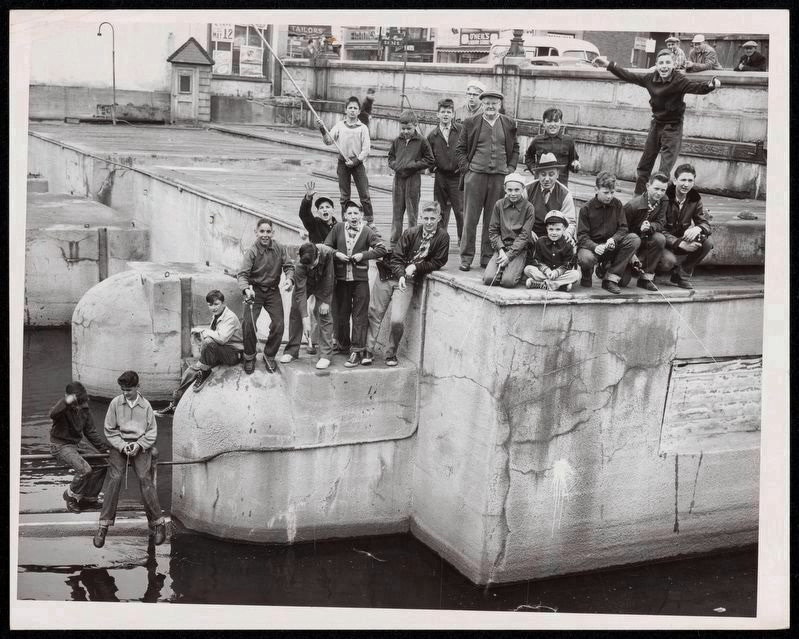
Photo by Herbert Stier; Boston Herald-Traveler Photo Morgue, courtesy of Boston Public Library, May 1953
4. Fishing for Herring at the Cradock Locks in Medford
A newspaper photographer captured a group of boys (along with, it appears, two adult chaperones, with some onlookers in the far background) fishing in the Mystic River at the Cradock Locks, which operated at the site of today's Cradock Bridge, about 150 yards to the west of this historical marker. The locks became functionally obsolete in 1966 after the completion of the Amelia Earhart Dam, a little more than 2 miles downstream to the southeast of Medford.
Also see . . . History of the Mystic River. From the Mystic River Watershed Association.
Excerpt: "Cities change rivers. This is certainly true of the Mystic River and surrounding watershed, which is one of the most urbanized areas in New England. Initially this river was tidal, and much of the lower watershed was salt marsh. Every spring it was filled with herring, and the Massachusett, Nipmuc, and Pawtucket people called it home. As it became more populated people began to change the river--damming it in three locations, as well as filling land in multiple areas from Island End to Medford (when I-93 was built). At the same time, industry used the river to power mills, and unfortunately at times dump dangerous chemicals."(Submitted on November 16, 2026, by Sean P. Flynn of Oak Park, Illinois.)
Credits. This page was last revised on November 17, 2026. It was originally submitted on November 15, 2026, by Sean P. Flynn of Oak Park, Illinois. This page has been viewed 10 times since then. Photos: 1. submitted on November 15, 2026, by Sean P. Flynn of Oak Park, Illinois. 2, 3. submitted on November 16, 2026, by Sean P. Flynn of Oak Park, Illinois. 4. submitted on November 17, 2026, by Sean P. Flynn of Oak Park, Illinois.
