
Ferntree Gully in Knox, Victoria, Australia — Oceania
Ferntree Gully Cemetery
Photographed by Dean Barton-Ancliffe, October 8, 2026
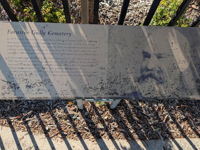
1. Ferntree Gully Cemetery Marker
Trustee names were submitted to the Health Department in 1873 but it was not until 1882 that the first trustees of the cemetery were officially appointed. It was still another three years before she first burial took place. This was the locally well respected Albert Selman (pictured right) of the 'Willow Vale' property who died in 1885.
The local postmistress, Ada Friberg, had an administrative role with the cemetery from 1901 to 1982. In 1982, the Knox City Council took over the operation of the cemetery from the Trust.
Erected by Knox City Council and Knox Historical Society.
Topics. This historical marker is listed in these topic lists: Cemeteries & Burial Sites • Colonial Era
this page online
Location. 37° 52.925′ S, 145° 17.84′ E. Marker is in Ferntree Gully, Victoria, in Knox. It is at the intersection of Forest Road and Underwood Road, on the left when traveling south on Forest Road. Touch for map. Marker is at or near this postal address: 47 Forest Road, Ferntree Gully VIC 3156, Australia. Touch for directions.

Regionally, it is in Oceania, in Australasia, in the Pacific Ocean, in South Pacific, on the Pacific Rim, in the Western World, and in the Anglosphere. Historically, it finds itself in what was once a British colony.
Other nearby markers. At least 8 other markers are within 6 kilometers of this marker, measured as the crow flies: City of Knox History (about 180 meters away, measured in a direct line); Dawson House, Glenfern (approx. 1.6 kilometers away); Ramon Cowling Bushland Reserve (approx. 3.4 kilometers away); The Anzac Avenue of Honour Memorial (approx. 4.1 kilometers away); The Anzac Avenue of Honour, Ferny Creek (approx. 4.1 kilometers away); ANZAC World War I Memorial (approx. 4.1 kilometers away); The Opperman Trails
Photographed by Dean Barton-Ancliffe, October 8, 2026
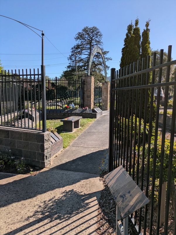
2. Ferntree Gully Cemetery Marker at the Cemetery entrance
Also see . . .
1. Ferntree Gully Cemetery marks 150th anniversary. Ferntree Gully News
The Ferntree Gully Cemetery was established in 1873, after John Buckley, whose grave lies just inside the main gate, spearheaded a community campaign petitioning the government to set aside five acres of land for this important place.(Submitted on November 16, 2026, by Dean Barton-Ancliffe of Rowville, Victoria.)
Operating by community trustees until 1982, Knox Council took over responsibility as trustee and takes great pride in providing this service not only for families and their loved ones but also for the wider community. Council is dedicated to preserving the cemetery’s historical and cultural importance, ensuring it remains a cherished space for generations to come.
Whilst it may be the burial place of pioneers, convicts, Gallipoli soldiers, cold case victims and prominent figures, including renowned artist Sir Arthur Streeton, it is the stories behind the names on the plaques that have most intrigued local historians.
2. Upper Ferntree Gully heritage. Walking Maps Australia
The modern neighborhood house incorporates the former 1870s homestead built by Charles H Dawson, which was one of the few stone buildings in the area(Submitted on November 16, 2026, by Dean Barton-Ancliffe of Rowville, Victoria.)
Credits. This page was last revised on November 18, 2026. It was originally submitted on November 16, 2026, by Dean Barton-Ancliffe of Rowville, Victoria. This page has been viewed 5 times since then. Photos: 1, 2. submitted on November 16, 2026, by Dean Barton-Ancliffe of Rowville, Victoria. • Andrew Ruppenstein was the editor who published this page.
