East Vincent Township near Spring City in Chester County, Pennsylvania — The American Northeast (Mid-Atlantic)
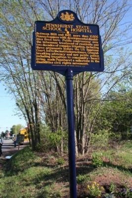
Pennhurst State School & Hospital
Erected 2010 by Pennsylvania Historical & Museum Commission.
Topics and series. This historical marker is listed in these topic lists: Civil Rights • Education • Science & Medicine. In addition, it is included in the Pennsylvania Historical and Museum Commission series list. A significant historical year for this entry is 1908.
Location. 40° 11.206′ N, 75° 34.33′ W. Marker is near Spring City, Pennsylvania, in Chester County. It is in East Vincent Township. Marker is on Schuylkill Road (State Highway 724). Touch for map. Marker is at or near this postal address: 3301 Schuylkill Rd, Spring City PA 19475, United States of America. Touch for directions.
Other nearby markers. At least 8 other markers are within 5 miles of this marker, measured as the crow flies. Canal Construction (approx. 3.4 miles away); Schuylkill Navigation Company (approx. 3½ miles away); Life on the Canal (approx. 3½ miles away); Towpath Park Historical Trail (approx. 3.6 miles away); Graceanna Lewis (approx. 3.9 miles away); 1871 Phoenix Column Bridge (approx. 4.6 miles away); Foundry Building (approx. 4.6 miles away); Symbols of Steel Sculpture Garden (approx. 4.6 miles away).
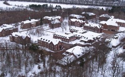
More about this marker. The marker's location off of the Spring Hollow Golf Course was historically part of the Pennhurst campus.
Also see . . . Pennhurst Memorial and Preservation Alliance. More about the school and hospital. "Through preservation and adaptive re-use of the historic Pennhurst campus, the Pennhurst Memorial and Preservation Alliance seeks to ensure that those achievements won at Pennhurst are neither lost nor forgotten." (Submitted on June 30, 2010.)
Credits. This page was last revised on February 7, 2023. It was originally submitted on June 23, 2010. This page has been viewed 1,985 times since then and 7 times this year. Photos: 1, 2, 3. submitted on June 23, 2010. • Craig Swain was the editor who published this page.


