Near Frederick in Frederick County, Maryland — The American Northeast (Mid-Atlantic)
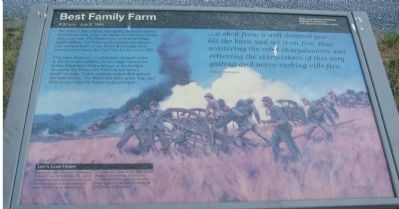
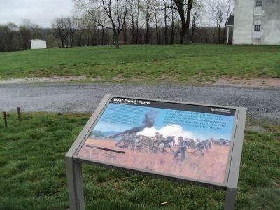
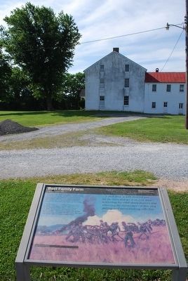
Best Family Farm
8:30 a.m. July 9, 1864
— Monocacy National Battlefield, National Park Service, U.S. Department of the Interior —
This time, however, Confederate sharpshooters in the barn and artillery on the ridge behind the house hammered Union troops at the bridges spanning the Monocacy River on the farm's southern edge. Union artillery responded and set the barn ablaze. The Bests lost their grain, hay and farm tools - and the battle had just begun.
...a shell from a well directed gun...hit the barn and set it on fire, thus scattering the rebel sharpshooters and relieving the skirmishers of this very galling and nerve-racking rifle fire.
Glenn H. Worthington
(Lower Sidebar): Lee's Lost Order
During the 1862 Maryland Campaign, Robert E. Lee's Order No. 191, which outlined his army's movements, was found wrapped around cigars in a grove of trees at an abandoned Confederate camp on the Best family farm. Ever cautious, Union Gen. George McClellan did not use the information to his full advantage at the Battle of Antietam.
Erected by National Park Service, U.S. Department of the Interior .
Topics. This historical marker is listed in this topic list: War, US Civil. A significant historical month for this entry is July 1730.
Location. This marker has been replaced by another marker nearby. It was located near 39° 22.235′ N, 77° 23.917′ W. Marker was near Frederick, Maryland, in Frederick County. Marker could be reached from Urbana Pike (State Highway 355), on the right when traveling south. Located at on the Best Farm Lane, in the parking lot for for stop number one for the driving tour of Monocacy Battlefield. Touch for map. Marker was in this post office area: Frederick MD 21704, United States of America. Touch for directions.
Other nearby markers. At least 8 other markers are within walking distance of this location. L'Hermitage (here, next to this marker); Caught in the Crossfire (here, next to this marker); The Lost Order (here, next to this marker); 1862 Antietam Campaign (here, next to this marker); 14th New Jersey Infantry Regiment (approx. 0.3 miles away); Commemoration (approx. 0.3 miles away); Federals Take a Stand (approx. 0.3 miles away); Nick of Time (approx. 0.4 miles away). Touch for a list and map of all markers in Frederick.
More about this marker. The background on the marker is Confederate Battery at the Best Farm Monocacy, Maryland, 1864, a painting by Keith Rocco.
This marker
was replaced by a new one named Caught in the Crossfire (see nearby markers).
Also see . . . Monocacy National Battlefield. (Submitted on October 30, 2007, by Craig Swain of Leesburg, Virginia.)
Additional commentary.
1. History of the Best Family Farm
An interpretive pamphlet is available at the park which details the history of the farm. It was first established by the Vincendiere family, French planters who relocated from Haiti in the 1790s. The farm was known as L'Hermitage, and included some 90 slaves (the largest holding recorded in Frederick County). At least seven times between 1796 and 1806, legal action was taken against the Vincendiere family regarding cruel treatment of the slaves. Much of what we know of this early period of the farm is from the observations of a Polish exile traveling through - Julian Ursyn Niemcewicz - who recorded his visit to the farm in 1798.
The Vincendiere family declined somewhat, and by 1827 the farm was sold. Eventually it came into the possession of the Trail Family. During this time the Best Family began tenant farming, and continued to farm there until the early 20th century. The farm was noted as among the most prosperous in the County during that span. Eventually the National
Park Service would acquire the farm from the Trail family in 1993, forming a major portion of the Monocacy National Battlefield.
— Submitted October 30, 2007, by Craig Swain of Leesburg, Virginia.
2. The Best Farm and the Civil War
Standing near the National Road, the railroad junction, and the Georgetown Pike, the Best Farm frequently saw the passing of the armies during the Civil War. In September 1862, practically the entire Confederate Army of Northern Virginia concentrated around the Best Farm. General Robert E. Lee and staff camped in the Best Grove (see the nearby Maryland state historical marker). As noted on the marker, the famous "Lost Order" was found by Union soldiers on the Best Farm, near the railroad junction. The following year, while pursuing the Confederates towards Gettysburg, Union troops camped on the Best Farm.
The most notable Civil War action was of course the battle on July 9, 1864. But following Confederate Gen. Jubal Early's retreat from Washington, D.C., Federal forces once again occupied the ground before moving westward in pursuit.
— Submitted October 30, 2007, by Craig Swain of Leesburg, Virginia.
Photographed By Craig Swain, January 29, 2007
5. Markers at Their Old Location
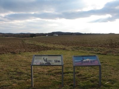
The markers were next to the UDC and Maryland Monuments along Urbana Pike (MD 355), but were moved in the summer of 2007. The Best Farm could be seen in the distance, looking across the fields once tended by the family. Much of the ground between this point and the farm was covered by a grove of trees at the time of the battle.
Photographed By Craig Swain, July 7, 2007
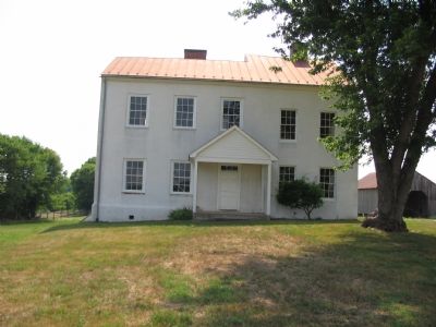
6. Main House of the Best Family Farm
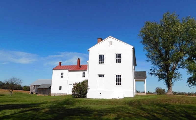
Constructed in at least four phases starting in the late 18th century, at the time of the battle it actually had a detached kitchen. It is described as having a mixed "French Colonial" and "Caribbean" architectural theme.
Photographed By Craig Swain, July 7, 2007
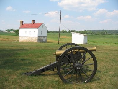
7. Secondary Dwelling
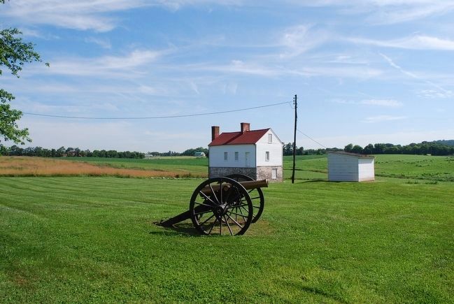
Built sometime in the 1790s, this building originally featured an elevated porch. It continued with the "Caribbean" architectural style used on the main house. The lower story is stone, while the second story is log with wooden siding. The 12-pdr Napoleon in the foreground is a reproduction. The other outer building is the old well house, dating to the 20th century.
Photographed By Craig Swain, July 7, 2007
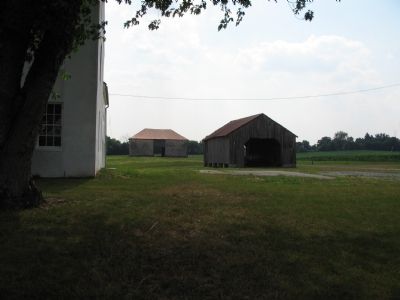
8. Corn Crib and Stone Barn
In the foreground is a corn crib, now used as a wagon shed, probably constructed in the 1870s. The open bay construction allowed corn to be stored in the sides, but allow circulation.
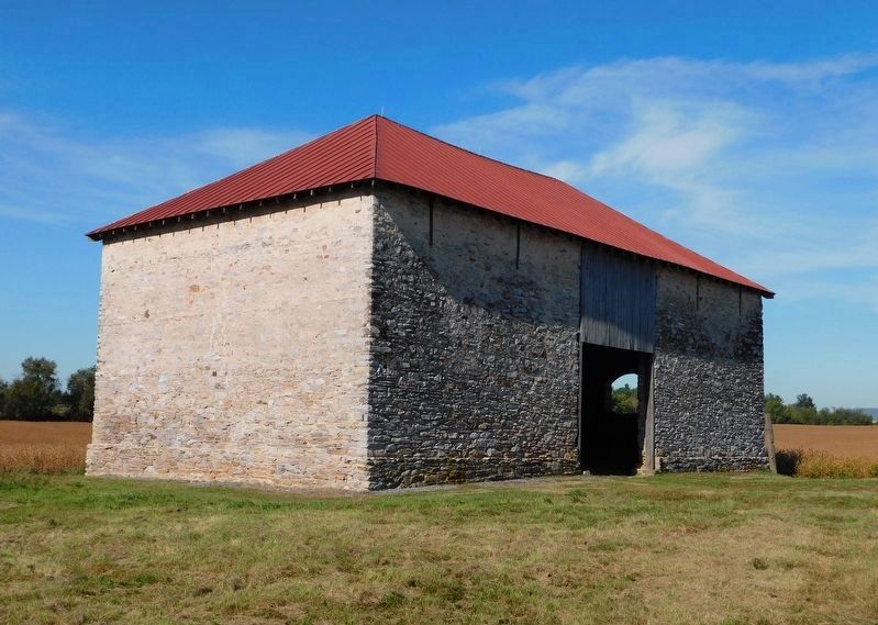
In the background is a stone barn built in the 1790s. Remarkable in appearance, somewhat more European than other barns in the area.
In the background is a stone barn built in the 1790s. Remarkable in appearance, somewhat more European than other barns in the area.
Photographed By Craig Swain, July 7, 2007
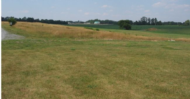
9. Looking From the Farm Back towards the Visitors Center
Confederate Gen. Ramseur's Division advanced down what was then the Georgetown Pike (Modern Urbana Pike, MD 355), skirmishing first with Federal cavalry pickets (two companies of the 8th Illinois Cavalry). This initial action occurred around where the Visitors Center now stands. After pressing the cavalry back, Ramseur's Division deployed across the Best Farm and drove towards the Monocacy Bridges, marching directly towards the point this photograph was taken from.
Photographed By Craig Swain, July 7, 2007
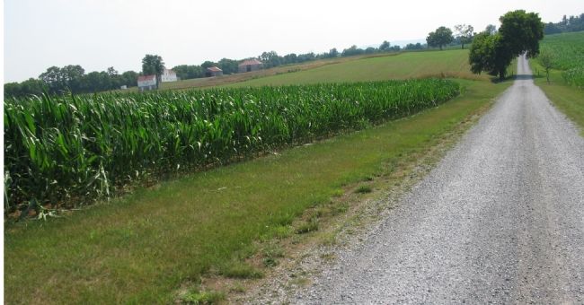
12. Best Farm Seen from the Farm Lane
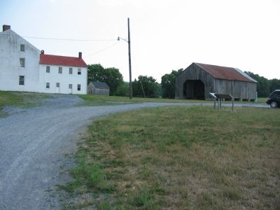
On the morning of July 9, 1864, Confederate General Stephen Ramseur's Division advanced across this lane to press the Federal forces deployed along the railroad line. The Federal positions were to the south of the farm (far right), where the woodline conceals the railroad grade. At least two Confederate cannon were deployed on the high ground around the farm.
Credits. This page was last revised on May 24, 2022. It was originally submitted on October 30, 2007, by Craig Swain of Leesburg, Virginia. This page has been viewed 2,654 times since then and 44 times this year. Last updated on March 28, 2022, by Connor Olson of Kewaskum, Wisconsin. Photos: 1. submitted on October 30, 2007, by Craig Swain of Leesburg, Virginia. 2. submitted on April 23, 2011, by Bill Coughlin of Woodland Park, New Jersey. 3. submitted on October 30, 2007, by Craig Swain of Leesburg, Virginia. 4. submitted on August 9, 2015, by Brandon Fletcher of Chattanooga, Tennessee. 5, 6, 7, 8, 9. submitted on October 30, 2007, by Craig Swain of Leesburg, Virginia. 10. submitted on August 9, 2015, by Brandon Fletcher of Chattanooga, Tennessee. 11. submitted on April 10, 2021, by Bradley Owen of Morgantown, West Virginia. 12. submitted on October 30, 2007, by Craig Swain of Leesburg, Virginia. 13. submitted on April 10, 2021, by Bradley Owen of Morgantown, West Virginia. • Bill Pfingsten was the editor who published this page.
