Shockoe Bottom in Richmond, Virginia — The American South (Mid-Atlantic)
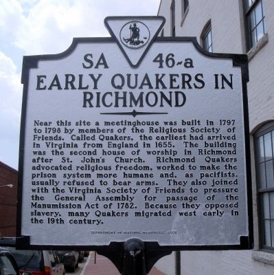
Early Quakers in Richmond
Erected 2008 by Department of Historic Resources. (Marker Number SA 46-a.)
Topics and series. This historical marker is listed in these topic lists: Abolition & Underground RR • Churches & Religion • Peace • Settlements & Settlers. In addition, it is included in the Quakerism, and the Virginia Department of Historic Resources (DHR) series lists. A significant historical year for this entry is 1797.
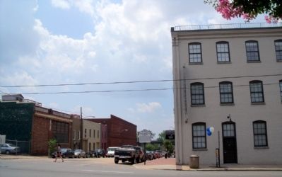
Location. 37° 31.906′ N, 77° 25.558′ W. Marker is in Richmond, Virginia. It is in Shockoe Bottom. Marker is at the intersection of South 20th Street and East Main Street, on the right when traveling south on South 20th Street. Touch for map. Marker is in this post office area: Richmond VA 23223, United States of America. Touch for directions.
Other nearby markers. At least 8 other markers are within walking distance of this marker. The Oldest House (within shouting distance of this marker); Edgar Allan Poe Pedestal (within shouting distance of this marker); I Can/t Breathe (about 400 feet away, measured in a direct line); Libby Prison (about 400 feet away); Libby Prison CSA (about 400 feet away); Franklin Street Burying Grounds (about 500 feet away); a different marker also named Libby Prison (about 500 feet away); Confederate General Hospital No. 12 (about 500 feet away). Touch for a list and map of all markers in Richmond.
Credits. This page was last revised on February 1, 2023. It was originally submitted on June 26, 2010, by Bernard Fisher of Richmond, Virginia. This page has been viewed 1,502 times since then and 98 times this year. Photos: 1, 2. submitted on June 26, 2010, by Bernard Fisher of Richmond, Virginia.

