Rome in Oneida County, New York — The American Northeast (Mid-Atlantic)
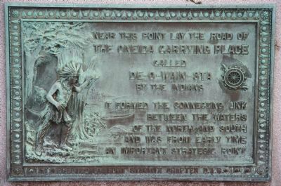
The Oneida Carrying Place
The Oneida Carrying Place
called
De-O-Wain-Sta
By the Indians
It formed the connecting link
between the waters
of the north and south
and was from early time
an important strategic point
Erected by Fort Stanwix Chapter D.A.R.
Topics and series. This historical marker is listed in these topic lists: Colonial Era • Landmarks • Military • Native Americans • Notable Places • War, French and Indian • War, US Revolutionary. In addition, it is included in the Daughters of the American Revolution series list.
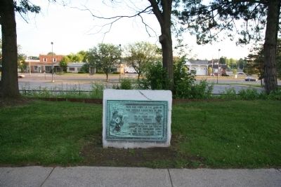
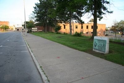
Location. 43° 12.79′ N, 75° 27.759′ W. Marker is in Rome, New York, in Oneida County. Marker is on West Dominick Street west of George Street, on the right when traveling east. This historical marker is situated at ground level, affixed to a large, cut stone slab, and is located on the south side of the street, in the middle of the block of the street. Touch for map. Marker is at or near this postal address: 339 West Dominick Street, Rome NY 13440, United States of America. Touch for directions.
Other nearby markers. At least 8 other markers are within walking distance of this marker. U.S. Arsenal (approx. ¼ mile away); Stars & Stripes First Flew in Battle (approx. 0.3 miles away); Christopher P. Destito (approx. 0.3 miles away); The Empire State Trail at Rome (approx. 0.3 miles away); Unknown Soldiers (approx. 0.3 miles away); Discover how courage, survival, and success against the odds shaped history... (approx. 0.3 miles away); The Gateway between East and West.... (approx. 0.3 miles away); Rome (approx. 0.3 miles away). Touch for a list and map of all markers in Rome.
Also see . . .
1. Oneida Carry Forts. This link provides access to information regarding the Oneida Carrying forts, that is provided by the New York State Military Museum. (Submitted on June 29, 2010, by Dale K. Benington of Toledo, Ohio.)
2. Oneida Carry. From Wikipedia, the free encyclopedia (Submitted on June 29, 2010, by Dale K. Benington of Toledo, Ohio.)
Credits. This page was last revised on June 16, 2016. It was originally submitted on June 29, 2010, by Dale K. Benington of Toledo, Ohio. This page has been viewed 1,480 times since then and 35 times this year. Photos: 1, 2, 3. submitted on June 29, 2010, by Dale K. Benington of Toledo, Ohio.


