Royal Oak in Oakland County, Michigan — The American Midwest (Great Lakes)
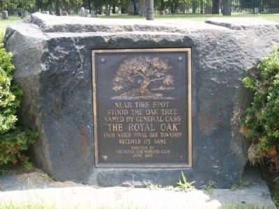
The Royal Oak
Erected 1917 by The Royal Oak Woman's Club.
Topics. This historical marker is listed in these topic lists: Landmarks • Natural Features • Women.
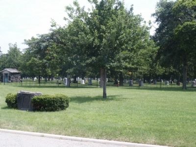
Location. 42° 29.968′ N, 83° 8.653′ W. Marker is in Royal Oak, Michigan, in Oakland County. Marker is at the intersection of North Rochester Road and Crooks Road and North Main Street, on the right when traveling north on North Rochester Road. This marker just north of the entrance to Oakview Cemetery. Touch for map. Marker is in this post office area: Royal Oak MI 48067, United States of America. Touch for directions.
Other nearby markers. At least 8 other markers are within one mile of this marker, measured as the crow flies. Royal Oak Township Cemetery / Saint Mary Catholic Cemetery (about 600 feet away, measured in a direct line); First Baptist Church of Royal Oak (approx. half a mile away); Royal Oak Post Office Tragedy (approx. ¾ mile away); Royal Oak Volunteer Fire Department (approx. 0.8 miles away); How Royal Oak Got Its Name (approx. 0.8 miles away); Howard & Howard (approx. 0.9 miles away); Royal Oak Woman's Club (approx. 0.9 miles away); Royal Oak Methodist Episcopal Church (approx. one mile away). Touch for a list and map of all markers in Royal Oak.
Credits. This page was last revised on June 16, 2016. It was originally submitted on June 30, 2010, by Joel Seewald of Madison Heights, Michigan. This page has been viewed 1,233 times since then and 40 times this year. Photos: 1, 2. submitted on June 30, 2010, by Joel Seewald of Madison Heights, Michigan. • Bill Pfingsten was the editor who published this page.

