Near Otto in Macon County, North Carolina — The American South (South Atlantic)
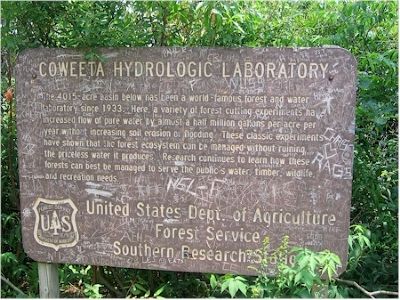
Coweeta Hydrologic Laboratory
Erected by Forest Service, U.S. Department of Agriculture.
Topics. This historical marker is listed in these topic lists: Agriculture • Horticulture & Forestry • Waterways & Vessels. A significant historical year for this entry is 1933.
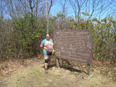
Location. 35° 3.154′ N, 83° 28.649′ W. Marker is near Otto, North Carolina, in Macon County. Marker can be reached from National Forest Road (at milepost 1,110). Sign is on the top of Albert Mountain (elev. 5200), near the firetower along the Appalachian Trail. Touch for map. Marker is in this post office area: Otto NC 28763, United States of America. Touch for directions.
Other nearby markers. At least 8 other markers are within 10 miles of this marker, measured as the crow flies. Cherokee Victory (approx. 5.3 miles away); Cherokee Defeat (approx. 5.8 miles away); Rabun Gap – Nacoochee School (approx. 8 miles away in Georgia); Brig·Gen·Francis·S·Bartow·C·S·A· (approx. 8.3 miles away in Georgia); Memorial Lands and Cottages (approx. 8.6 miles away in Georgia); York House Inn (approx. 9.6 miles away in Georgia); Wilson Lick Ranger Station (approx. 9.8 miles away); The Appalachian & Bartram Trails (approx. 10 miles away). Touch for a list and map of all markers in Otto.
Additional keywords. Albert Mountain, firetower, Appalachain Trail
Credits. This page was last revised on June 30, 2021. It was originally submitted on November 1, 2007, by Julie Szabo of Oldsmar, Florida. This page has been viewed 1,527 times since then and 25 times this year. Photos: 1, 2. submitted on November 1, 2007, by Julie Szabo of Oldsmar, Florida. • J. J. Prats was the editor who published this page.

