Newtown in Bucks County, Pennsylvania — The American Northeast (Mid-Atlantic)
Newtown Common & Creek
| — | Newtown Heritage Walk | — |
Photographed by William Fischer, Jr., October 15, 2009
1. Newtown Common & Creek Marker
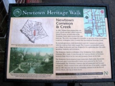
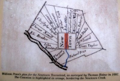
In 1684, William Penn planned his new town, which was later called Newtown. About 30 acres, on both sides of Newtown Creek, were reserved for common use. The town was designed to resemble an open fan of lots surrounding a narrow, rectangular town common that ran along the Newtown Creek.
By mutual agreement, early landowners used the Common as a pasture, with the creek as their water supply. The Common was intended to serve as a village focal point, and was designed to be a gathering place for public speaking, business, and recreation.
The Newtown Creek is a tributary of the Neshaminy Creek, within the Delaware River basin. It runs through the business district of Newtown between State Street on the east and Sycamore Street on the west.
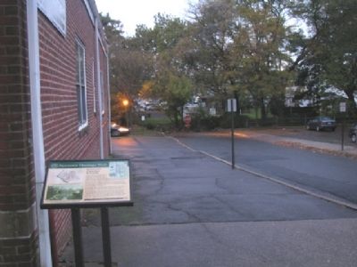
The Newtown Creek attracted many businesses. Early mills, blacksmith shops and other water-dependent trades were powered by the Creek. Unfortunately, the Newtown Common was left unattended and became overgrown, which resulted in the sale of all but one of the public common lots in 1796. You can visit the one remaining common lot at the foot of Greene Street, directly in front of you.
Erected 2007
this page online
Topics and series. This historical marker is listed in these topic lists: Colonial Era • Industry & Commerce • Settlements & Settlers • Waterways & Vessels. In addition, it is included in the Pennsylvania, Newtown Heritage Walk series list. A significant historical year for this entry is 1684.
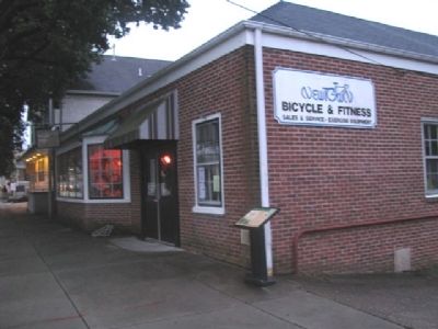
Location. 40° 13.823′ N, 74° 56.203′ W. Marker is in Newtown, Pennsylvania, in Bucks County. It is at the intersection of State Street and Greene Street, on the left when traveling north on State Street. Touch for map. Marker is at or near this postal address: 30 N State Street, Newtown PA 18940, United States of America. Touch for directions.

Regionally, this marker is in Southeast Pennsylvania and in Greater Philadelphia. It is also in the American Northeast and in the Mid-Atlantic. Globally, it is in North America, the Western Hemisphere, the Western World, and the Anglosphere. Historically, it finds itself in what was once the Haudenosaunee (Iroquois) Confederacy, New Netherland, and one of the original Thirteen Colonies.
Other nearby markers. At
Photographed by William Fischer, Jr., October 15, 2009
2. Newtown Common & Creek Marker
Also see . . .
1. Newtown Heritage Walk. (Submitted on July 3, 2010, by William Fischer, Jr. of Reynoldsburg, Ohio.)
2. Newtown Borough. (Submitted on July 3, 2010, by William Fischer, Jr. of Reynoldsburg, Ohio.)
Photographed by William Fischer, Jr., October 15, 2009
3. Newtown Common & Creek Marker
Looking west toward the last remaining common lot at end of street.
Photographed by William Fischer, Jr., October 15, 2009
4. Photo on Newtown Common & Creek Marker
[Caption reads] William Penn's plan for Newtown Townstead, as surveyed by Thomas Holme in 1687. The Common is highlighted in orange, bordering the Newtown Creek.
Photographed by William Fischer, Jr., October 15, 2009
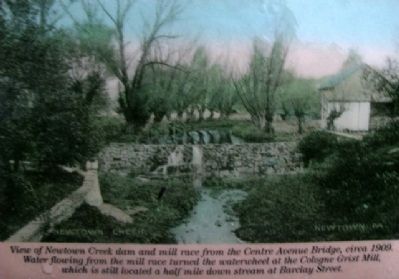
5. Photo on Newtown Common & Creek Marker
[Caption reads] View of Newtown Creek dam and mill race from the Centre Avenue Bridge, circa 1909. Water flowing from the mill race turned the waterwheel at the Cologne Grist Mill, which is still located a half mile down street at Barclay Street.
Credits. This page was last revised on December 4, 2025. It was originally submitted on July 3, 2010, by William Fischer, Jr. of Reynoldsburg, Ohio. This page has been viewed 1,099 times since then and 52 times this year. Photos: 1, 2, 3, 4, 5. submitted on July 3, 2010, by William Fischer, Jr. of Reynoldsburg, Ohio.
