Marquette in Madison in Dane County, Wisconsin — The American Midwest (Great Lakes)
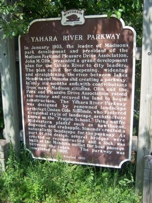
Yahara River Parkway
Photographed by Gordon Govier, June 13, 2009
1. Yahara River Parkway Marker
Erected 1996 by the Wisconsin State Historical Society. (Marker Number 340.)
Topics and series. This historical marker
this page online
Location. Marker is missing. It was located near 43° 5.289′ N, 89° 21.515′ W. Marker was in Madison, Wisconsin, in Dane County. It was in Marquette. It was at the intersection of South Thornton Avenue and Williamson Street, on the right when traveling north on South Thornton Avenue. Touch for map. Marker was in this post office area: Madison WI 53703, United States of America. Touch for directions.

Regionally, this marker was in Southeast Wisconsin. It was also in the American Midwest and in the Corn Belt. Globally, it was in North America, the Western Hemisphere, the Western World, and the Anglosphere. Historically, it found itself in what was once the territory of the Mississippian Culture and also the Northwest Territory.
Other nearby markers. At least 8 other markers are within walking distance of this location: John A. Johnson made Madison's Factory District Flourish (approx. 0.2 miles away); Steensland Bridge (approx.
Photographed by Gordon Govier, June 13, 2009
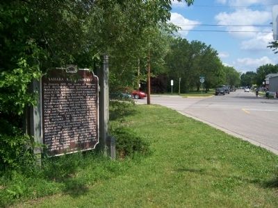
2. Yahara River Parkway
The photo shows the area around the marker, looking south.
Regarding Yahara River Parkway. According to the Madison Landmarks Commission, which designated the Yahara River Parkway a landmark (no. 126) in 1995, "The Yahara River Parkway was designed by noted landscape architect O. C. Simonds of Chicago. At the time it was at the eastern edge of the City. When European-Americans first settled here, the Yahara River meandered through marshland between Lakes Mendota and Monona. It had been canalized for use by the mills at the northern end of the river, and was used as an informal trash dump for decades.
"The parkway was developed by the Madison Parks and Pleasure Drive Association, a group of private citizens who worked tirelessly at the turn of the
Photographed by Gordon Govier, June 13, 2009
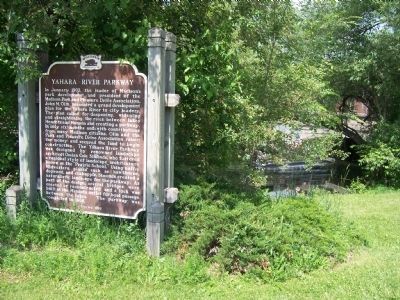
3. Yahara River
The photo shows the Yahara River running in back of the location of the marker.
Related markers. Click here for a list of markers that are related to this marker. This is a list of markers that mention John Olin.
Also see . . . Movers & Shapers. Article names Olin one of the ten most influential people in Madison history. (Submitted on July 12, 2010, by William J. Toman of Green Lake, Wisconsin.)
Additional commentary.
1. Yahara River Parkway marker
This marker is currently missing. Sign on the marker says it has been removed for cleaning.
— Submitted June 28, 2026, by Michael Allen Wilde of Madison, Wisconsin.
Additional keywords. Prairie School of Architecture
Credits. This page was last revised on August 4, 2026. It was originally submitted on June 14, 2009, by Gordon Govier of Fitchburg, Wisconsin. This page has been viewed 2,253 times since then and 106 times this year. Last updated on July 4, 2010, by William J. Toman of Green Lake, Wisconsin. Photos: 1, 2, 3. submitted on June 14, 2009, by Gordon Govier of Fitchburg, Wisconsin. • Kevin W. was the editor who published this page.
