Near Coshocton in Coshocton County, Ohio — The American Midwest (Great Lakes)
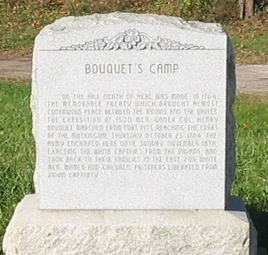
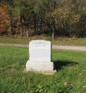
Bouquet’s Camp
Topics. This historical marker is listed in these topic lists: Colonial Era • Heroes • Native Americans. A significant historical date for this entry is October 25, 1764.
Location. 40° 18.054′ N, 81° 52.629′ W. Marker is near Coshocton, Ohio, in Coshocton County. Marker is at the intersection of County Road 24 and Local Road 26, on the right when traveling north on County Road 24. Touch for map. Marker is in this post office area: Coshocton OH 43812, United States of America. Touch for directions.
Other nearby markers. At least 8 other markers are within 2 miles of this marker, measured as the crow flies. Bouquet’s Expedition (approx. ¾ mile away); Ohio-Erie Canal and Walhonding Canal (approx. 1.2 miles away); Visitor Center - 1992 (approx. 1.3 miles away); Underground Railroad Agents in Coshocton County / Muskingum River Underground Railroad Corridor (approx. 1.4 miles away); Nicholas Schott (approx. 1.4 miles away); Capt. Bill Smart (approx. 1.4 miles away); This Building (approx. 1.4 miles away); Village Smithy - c.1890 (approx. 1.4 miles away). Touch for a list and map of all markers in Coshocton.
Credits. This page was last revised on June 16, 2016. It was originally submitted on November 4, 2007, by Carl Breth of Willoughby Hills, Ohio. This page has been viewed 2,745 times since then and 85 times this year. Photos: 1, 2. submitted on November 4, 2007, by Carl Breth of Willoughby Hills, Ohio. • J. J. Prats was the editor who published this page.

