Near Frederick in Frederick County, Maryland — The American Northeast (Mid-Atlantic)
The Battle That Saved Washington
The Battle of Monocacy took place on July 9, 1864, in the valley before you. The battle pitted North against South, and Washington, D.C., was the prize.
Richmond and Petersburg were endangered, but the Southern leader, General Robert E. Lee had sent General Early north to threaten Washington, D.C., at least to force the Union commander at Richmond, Lieutenant General Ulysses S. Grant, to send soldiers back to defend the Capital.
The Battle of Monocacy was fought on Saturday, July 9, 1864. The Union forces were heavily outnumbered, about 18,000 to 6,000. Union General Lew Wallace gave battle to delay the Southern forces until Northern reinforcements could reach Washington, D.C.
The fighting started in mid-morning and continued throughout the day. In the late afternoon when Southern troops in battle line streamed out of the woods on Brooks Hill, broke the Northern lines and forced Wallace's small force back towards Baltimore.
The way to Washington was open, but it was too late. General Grant summed up the importance of the valiant effort by outnumbered Northerners.
"They met the enemy, and, as might have been expected, were defeated; but they succeeded in stopping him for the day on which the battle took place... If Early had been put one day earlier he might have entered the capital before the arrival of the reinforcements I had sent."
Topics and series. This historical marker is listed in this topic list: War, US Civil. In addition, it is included in the Former U.S. Presidents: #18 Ulysses S. Grant series list. A significant historical month for this entry is July 1764.
Location. 39° 20.97′ N, 77° 23.391′ W. Marker is near Frederick, Maryland, in Frederick County. Marker can be reached from Interstate 270, on the right when traveling west. Located at a rest stop/scenic overlook loop reached from west bound I-270. Touch for map. Marker is in this post office area: Frederick MD 21704, United States of America. Touch for directions.
Other nearby markers. At least 8 other markers are within walking distance of this marker. History of the Monocacy River Valley (here, next to this marker); Clustered Spires of Frederick (a few steps from this marker); Civilians Under Siege (approx. half a mile away); Final Attack (approx. half a mile away); 10th Vermont Monument (approx. ¾ mile away); State of Pennsylvania Monument (approx. 0.8 miles away); Final Stand (approx. 0.8 miles away); Dennis Memorial (approx. 0.9 miles away). Touch for a list and map of all markers in Frederick.
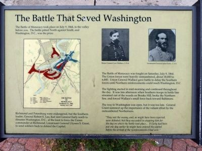
More about this marker. On the left is a map of the battle. On the upper right are portraits of Gens. Lew Wallace and Jubal Early.
Related markers. Click

Photographed By Devry Becker Jones (CC0), November 6, 2020
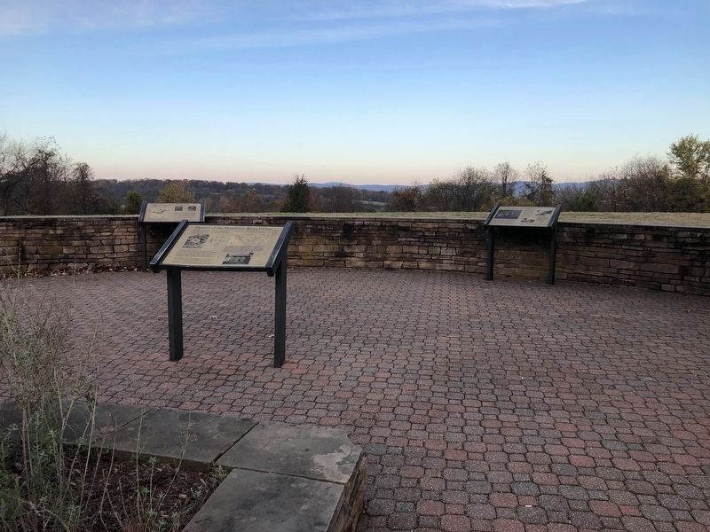
2. Markers at the Rest Stop / Overlook
The Battle that Saved Washington marker is in the left of the observation walkway.
Also see . . . Battle of Monocacy. National Park Service site. (Submitted on November 4, 2007, by Craig Swain of Leesburg, Virginia.)

Photographed By Craig Swain, September 9, 2007
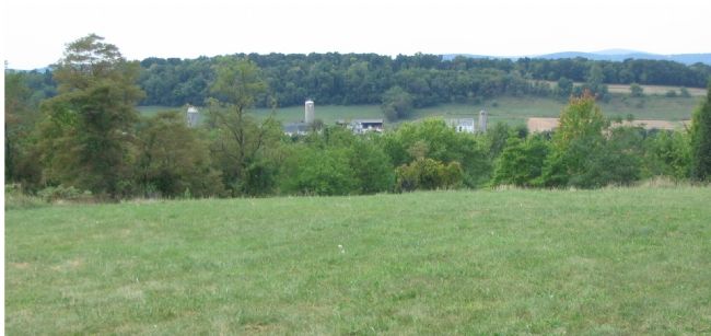
3. The Battlefield from the Overlook Loop
Brooks Hill and the Baker Farm are clearly visible from the overlook. In the afternoon of July 9, 1864, General John B. Gordon's division used the cover of Brooks Hill to assemble and then attacked the Federal left flank where Union General James Rickets' Division held.
Credits. This page was last revised on April 27, 2022. It was originally submitted on November 4, 2007, by Craig Swain of Leesburg, Virginia. This page has been viewed 2,087 times since then and 28 times this year. Photos: 1. submitted on February 1, 2013, by Allen C. Browne of Silver Spring, Maryland. 2. submitted on November 6, 2020, by Devry Becker Jones of Washington, District of Columbia. 3. submitted on November 4, 2007, by Craig Swain of Leesburg, Virginia.
