Marquette in Madison in Dane County, Wisconsin — The American Midwest (Great Lakes)
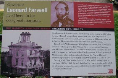
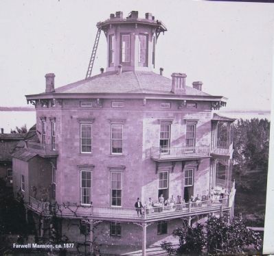
Governor Leonard Farwell lived here, in his octagonal mansion
The Madison Heritage Series
Inscription.
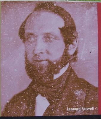
Madison was little more than a few buildings and a swamp in 1847 when Leonard Farwell bought large amounts of land here. Orphaned at 11, Farwell built a very successful hardware business in Milwaukee while still in his 20s. He would soon transform Madison and Wisconsin.
Farwell built Williamson and Winnebago streets and East Washington Avenue, and straightened the Yahara River between lakes Mendota and Monona. He dammed Lake Mendota to harness power for the first mill. He supported and created local businesses and tirelessly promoted Madison as a place to live and work. During the “Farwell Boom,” Madison’s population skyrocketed, from 600 in 1846 to 11,000 in 1857.
Serving a brief but productive term as Wisconsin’s youngest governor, from 1852 to 1854, Farwell abolished the death penalty and created an influential immigration agency that attracted Europeans, especially Germans, to Wisconsin.
Sidebar:
Leonard Farwell’s elegant 1854 mansion occupied a lakefront block bounded by Spaight and Brearly streets. Measuring almost 9,000 square feet, its opening was a grand social event in Madison. But Farwell lost the house and most of his investments in the 1857 depression. Appointed to a federal post in 1863, Farwell was present at Abraham Lincoln’s assassination and warned the vice president to protect himself from the conspirators.
The mansion became a Civil War soldiers’ hospital, a soldiers’ orphans’ home and a Lutheran seminary. The house was demolished in 1895 to make room for a subdivision.
Erected 2001 by City of Madison.
Topics. This historical marker is listed in these topic lists: Charity & Public Work • Industry & Commerce • War, US Civil • Waterways & Vessels. A significant historical year for this entry is 1847.
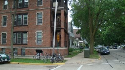
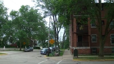
Location. 43° 4.759′ N, 89° 21.971′ W. Marker is in Madison, Wisconsin, in Dane County. It is in Marquette. Marker is at the intersection of South Brearly Street and Spaight Street, on the right when traveling south on South Brearly Street. Touch for map. Marker is in this post office area: Madison WI 53703, United States of America. Touch for directions.
Other nearby markers. At least 8 other markers are within walking distance of this marker. Harvey Hospital (here, next to this marker); Shipley-Shuttleworth House (within shouting distance of this marker); Cutter House (about 600 feet away, measured in a direct line); Lougee House (about 700 feet away); Orton Park (about 700 feet away); Curtis-Kittleson House (about 700 feet away); Hyer - Jaquish Hotel (approx. 0.2 miles away); B.B. Clarke (approx. 0.2 miles away). Touch for a list and map of all markers in Madison.
More about this marker. This marker is part of the The Madison Heritage Series, Sharing Our Legacy, created for Madison's sesquicentennial. The marker was sponsored by the Madison Community Foundation.
Also see . . . Leonard J. Farwell. Wikipedia entry (Submitted on July 31, 2022, by Larry Gertner of New York, New York.)
Credits. This page was last revised on February 16, 2023. It was originally submitted on July 12, 2010, by William J. Toman of Green Lake, Wisconsin. This page has been viewed 1,613 times since then and 52 times this year. Photos: 1, 2, 3, 4, 5. submitted on July 12, 2010, by William J. Toman of Green Lake, Wisconsin. • Bill Pfingsten was the editor who published this page.
